| Memorials | : | 5 |
| Location | : | Locust Grove, Orange County, USA |
| Coordinate | : | 38.3440710, -77.7981470 |
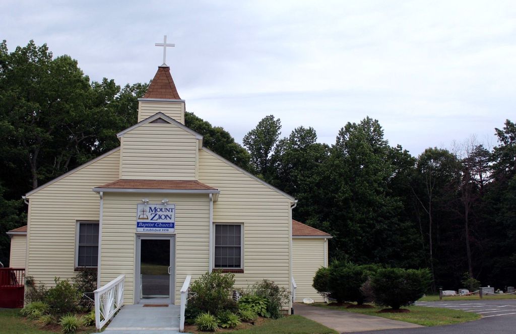
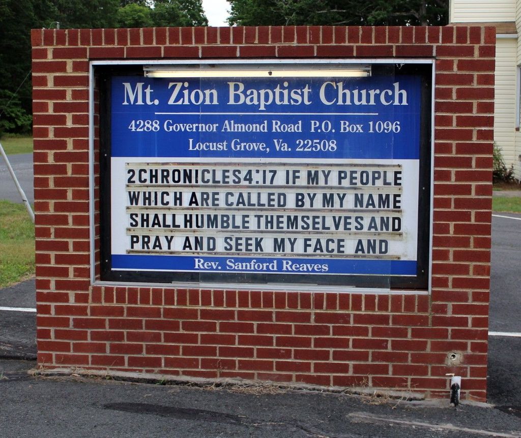
| Description | : | The Church at this location is about 150 years old, although the small cemetery on the property appears to be more recent. The building and property are well kept and maintained. A pastor from Culpeper currently comes in on Sundays for services. A sign on the property says "Incorporated 2002". Mailing address is: PO Box 1096, Locust Grove, VA 22508. |
frequently asked questions (FAQ):
-
Where is Mount Zion Baptist Church Cemetery?
Mount Zion Baptist Church Cemetery is located at 4288 Governor Almond Road (Rt. 614) Locust Grove, Orange County ,Virginia , 22508USA.
-
Mount Zion Baptist Church Cemetery cemetery's updated grave count on graveviews.com?
5 memorials
-
Where are the coordinates of the Mount Zion Baptist Church Cemetery?
Latitude: 38.3440710
Longitude: -77.7981470
Nearby Cemetories:
1. Willis Cemetery
Locust Grove, Orange County, USA
Coordinate: 38.3493040, -77.7769730
2. Zoar Cemetery
Burr Hill, Orange County, USA
Coordinate: 38.3319016, -77.8296967
3. Lewistown Cemetery
Locust Grove, Orange County, USA
Coordinate: 38.3602040, -77.8273730
4. Dempsey Family Cemetery
Flat Run, Orange County, USA
Coordinate: 38.3452910, -77.7595140
5. Urquhart Family Cemetery
Locust Grove, Orange County, USA
Coordinate: 38.3766670, -77.7844440
6. Germanna Memorial Garden
Locust Grove, Orange County, USA
Coordinate: 38.3773640, -77.7838230
7. Fort Germanna Burying Ground
Madison County, USA
Coordinate: 38.3773660, -77.7838220
8. Spotswood Family Cemetery
Locust Grove, Orange County, USA
Coordinate: 38.3448200, -77.7468110
9. Pilgrim Baptist Church Cemetery
Locust Grove, Orange County, USA
Coordinate: 38.3455560, -77.7419600
10. Rhoades Family Farm Cemetery
Burr Hill, Orange County, USA
Coordinate: 38.3380400, -77.8616560
11. Coleman Cemetery
Rhoadesville, Orange County, USA
Coordinate: 38.3371450, -77.8692970
12. Quann-Chambers Cemetery
Rhoadesville, Orange County, USA
Coordinate: 38.3074493, -77.8535843
13. Wilderness Chapel Cemetery
Locust Grove, Orange County, USA
Coordinate: 38.3228930, -77.7303960
14. Jones Family Cemetery
Orange County, USA
Coordinate: 38.3438110, -77.7248383
15. Kube Family Cemetery
Rhoadesville, Orange County, USA
Coordinate: 38.3067640, -77.8576390
16. Mount Pisgah Baptist Church Cemetery
True Blue, Orange County, USA
Coordinate: 38.3480988, -77.8886032
17. Hopewell United Methodist Church Cemetery
Lignum, Culpeper County, USA
Coordinate: 38.4128110, -77.8235200
18. Lael Cemetery
Lignum, Culpeper County, USA
Coordinate: 38.4153960, -77.8289080
19. Oakland Baptist Church Cemetery
Richardsville, Culpeper County, USA
Coordinate: 38.4045370, -77.7404100
20. Richardsville United Methodist Church Cemetery
Richardsville, Culpeper County, USA
Coordinate: 38.4006820, -77.7267770
21. New Hope Cemetery
Locust Grove, Orange County, USA
Coordinate: 38.2635020, -77.8118950
22. James William Brown Family Cemetery
Lignum, Culpeper County, USA
Coordinate: 38.4163100, -77.8571940
23. Ebenezer Baptist Church Cemetery
Lignum, Culpeper County, USA
Coordinate: 38.4350310, -77.8257590
24. Salem Cemetery
Rhoadesville, Orange County, USA
Coordinate: 38.2769012, -77.8871994


