
| Memorials | : | 0 |
| Location | : | Vinton County, USA |
| Coordinate | : | 39.3231010, -82.4927979 |
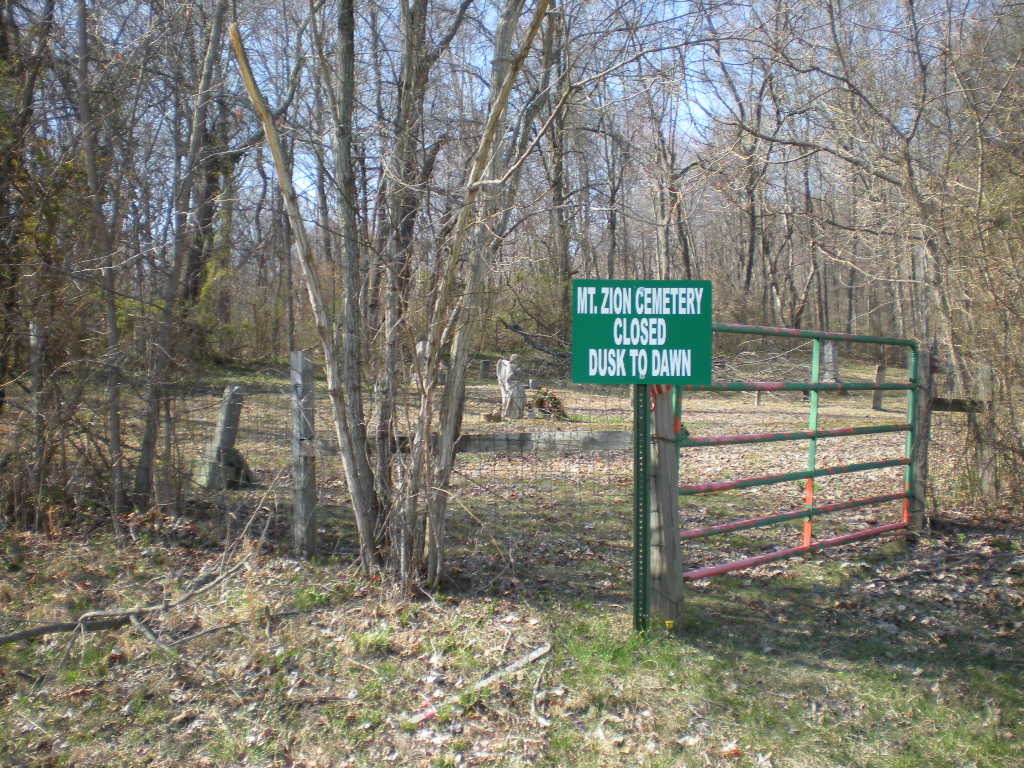
| Description | : | The cemetery is located on the north side of Dunkle Creek Road (County Road 34) about 0.9 miles southeast of its intersection with Mash Hill Road (County Road 14). The cemetery is 1 acre in size. The cemetery is located in Swan Township, Vinton County, Ohio, and is # 12169 (Mount Zion Cemetery) in “Ohio Cemeteries 1803-2003”, compiled by the Ohio Genealogical Society. The U.S. Geological Survey (USGS) Geographic Names Information System (GNIS) feature ID for the cemetery is 1076463 (Mount Zion Cemetery). |
frequently asked questions (FAQ):
-
Where is Mount Zion Cemetery?
Mount Zion Cemetery is located at Dunkle Creek Road (County Road 34) Vinton County ,Ohio , 45622USA.
-
Mount Zion Cemetery cemetery's updated grave count on graveviews.com?
0 memorials
-
Where are the coordinates of the Mount Zion Cemetery?
Latitude: 39.3231010
Longitude: -82.4927979
Nearby Cemetories:
1. Conley Family Cemetery
Creola, Vinton County, USA
Coordinate: 39.3185390, -82.4709010
2. Creola Cemetery
Creola, Vinton County, USA
Coordinate: 39.3182983, -82.4702988
3. Susannah Byerly Grave
Creola, Vinton County, USA
Coordinate: 39.3330000, -82.4710000
4. Stevens-Robb Cemetery
Zaleski, Vinton County, USA
Coordinate: 39.3002700, -82.5050580
5. Fri Cemetery
Creola, Vinton County, USA
Coordinate: 39.3051200, -82.4665800
6. Bethel Cemetery
Creola, Vinton County, USA
Coordinate: 39.3423610, -82.4667500
7. Mitchell Family Cemetery
Vinton County, USA
Coordinate: 39.3427810, -82.4668280
8. Thaddeus Fuller Cemetery
Vinton County, USA
Coordinate: 39.2925090, -82.4538760
9. Centenary Cemetery
Vinton County, USA
Coordinate: 39.3135986, -82.5522003
10. Curry Hill Cemetery
Allensville, Vinton County, USA
Coordinate: 39.2977982, -82.5438995
11. Prose Cemetery
Vinton County, USA
Coordinate: 39.3616982, -82.4571991
12. Ankrum Cemetery
McArthur, Vinton County, USA
Coordinate: 39.2839040, -82.5377190
13. Locust Grove Cemetery
Vinton County, USA
Coordinate: 39.3489070, -82.5520210
14. Wesley Chapel Cemetery
Vinton County, USA
Coordinate: 39.3456001, -82.4274979
15. Pawpaw Cemetery
Allensville, Vinton County, USA
Coordinate: 39.2769012, -82.5374985
16. Elk Fork Cemetery
McArthur, Vinton County, USA
Coordinate: 39.2663994, -82.4741974
17. Ebenezer Cemetery
McArthur, Vinton County, USA
Coordinate: 39.3811792, -82.5051573
18. Johnson Cemetery
Mount Pleasant, Vinton County, USA
Coordinate: 39.3809400, -82.4561000
19. Elk Cemetery
McArthur, Vinton County, USA
Coordinate: 39.2556000, -82.4794006
20. Fee Cemetery
Zaleski, Vinton County, USA
Coordinate: 39.3302100, -82.3981900
21. Fee-Frantz Cemetery
New Plymouth, Vinton County, USA
Coordinate: 39.3302100, -82.3979800
22. Mount Pleasant Methodist Church Cemetery
Mount Pleasant, Vinton County, USA
Coordinate: 39.3928200, -82.4600370
23. Otterbein Chapel Cemetery
Allensville, Vinton County, USA
Coordinate: 39.3587320, -82.5804440
24. Colvin Cemetery
McArthur, Vinton County, USA
Coordinate: 39.2460570, -82.4936720