
| Memorials | : | 7 |
| Location | : | Mayfield, Westmoreland County, USA |
| Website | : | www.usgwarchives.org/pa/westmoreland/tsimages/oldzionluth-easthuntingdon.htm |
| Coordinate | : | 40.1423035, -79.6093979 |
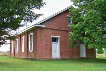
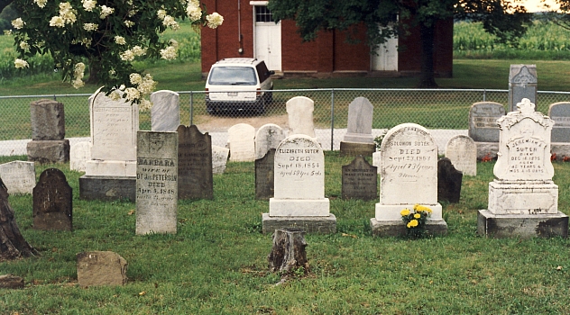
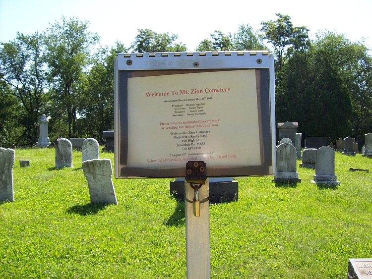
| Description | : | The Mt. Zion Schwabs Church was a Union Church of Lutheran and German Reformed congregations. It was originally "Schwabs"; afterwards called "Swopes", the name of a nearby family; and finally "Zion". The church is just north of the Reagantown road (Rt 981), on the Zion Church (Lotus) Rd, about 1.3 miles west of Alverton. The church was organized in 1789, and services were conducted in German until 1858 when English was introduced. Supposedly covered in: Fischer, Della R. "14 Cemeteries, Westmoreland County, Pennsylvania," 1972 (FHL film 924403) |
frequently asked questions (FAQ):
-
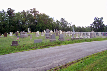
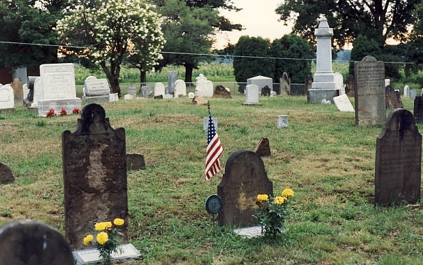
Where is Mount Zion Lutheran and Reformed Cemetery?
Mount Zion Lutheran and Reformed Cemetery is located at Mayfield, Westmoreland County ,Pennsylvania ,USA.
-
Mount Zion Lutheran and Reformed Cemetery cemetery's updated grave count on graveviews.com?
5 memorials
-
Where are the coordinates of the Mount Zion Lutheran and Reformed Cemetery?
Latitude: 40.1423035
Longitude: -79.6093979
Nearby Cemetories:
1. Zion Cemetery
Alverton, Westmoreland County, USA
Coordinate: 40.1423650, -79.6094020
2. Alverton Cemetery
Alverton, Westmoreland County, USA
Coordinate: 40.1410000, -79.5890000
3. Roman Catholic Polish Cemetery of the Transfigurat
Mount Pleasant, Westmoreland County, USA
Coordinate: 40.1558800, -79.5631700
4. Saint Pius X Cemetery
Mount Pleasant, Westmoreland County, USA
Coordinate: 40.1438200, -79.5461200
5. Visitation Parish Cemetery
Mount Pleasant, Westmoreland County, USA
Coordinate: 40.1439600, -79.5447200
6. Mount Pleasant Cemetery
Mount Pleasant, Westmoreland County, USA
Coordinate: 40.1571999, -79.5475006
7. Old United Presbyterian Graveyard
Mount Pleasant, Westmoreland County, USA
Coordinate: 40.1500824, -79.5452369
8. Fairview Church Cemetery
Hammondville, Fayette County, USA
Coordinate: 40.1169014, -79.5333023
9. Saint Josef's Polish Catholic Cemetery
Everson, Fayette County, USA
Coordinate: 40.0830000, -79.5752000
10. King Cemetery
Fayette County, USA
Coordinate: 40.0764300, -79.6005800
11. Middle Presbyterian Cemetery
Mount Pleasant, Westmoreland County, USA
Coordinate: 40.1777000, -79.5309000
12. Tyrone United Presbyterian Church Cemetery
Dawson, Fayette County, USA
Coordinate: 40.0740000, -79.6306000
13. Pennsville Independent Cemetery
Connellsville, Fayette County, USA
Coordinate: 40.0844002, -79.5566711
14. Saint John's Union Cemetery
Mount Pleasant, Westmoreland County, USA
Coordinate: 40.1814000, -79.5316000
15. Greenlick Cemetery
Fayette County, USA
Coordinate: 40.1105995, -79.5194016
16. Mount Joy Church Of The Brethren Cemetery
Mount Pleasant, Westmoreland County, USA
Coordinate: 40.1439000, -79.5054000
17. Bethel Church of Christ Cemetery
Dawson, Fayette County, USA
Coordinate: 40.0667000, -79.6444016
18. Green Ridge Memorial Park
Connellsville, Fayette County, USA
Coordinate: 40.0682983, -79.5622025
19. Bryan Methodist Church Cemetery
Dawson, Fayette County, USA
Coordinate: 40.0742000, -79.6712000
20. Stone Hill Cemetery
Hempfield Township, Westmoreland County, USA
Coordinate: 40.2220000, -79.5776000
21. Brothers Cemetery
Fayette County, USA
Coordinate: 40.1360700, -79.5004300
22. Boyd Cemetery
Connellsville, Fayette County, USA
Coordinate: 40.0595000, -79.5776400
23. Cochran Cemetery
Dawson, Fayette County, USA
Coordinate: 40.0597000, -79.6444016
24. Lobingier Cemetery
Mount Pleasant Township, Westmoreland County, USA
Coordinate: 40.1439030, -79.4887870