
| Memorials | : | 4 |
| Location | : | Mount Pleasant, Westmoreland County, USA |
| Coordinate | : | 40.1558800, -79.5631700 |
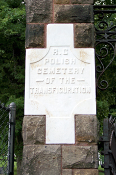
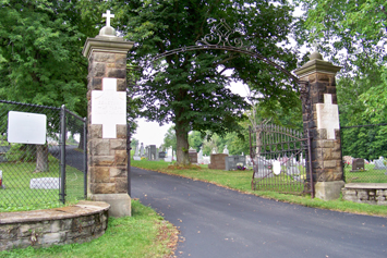
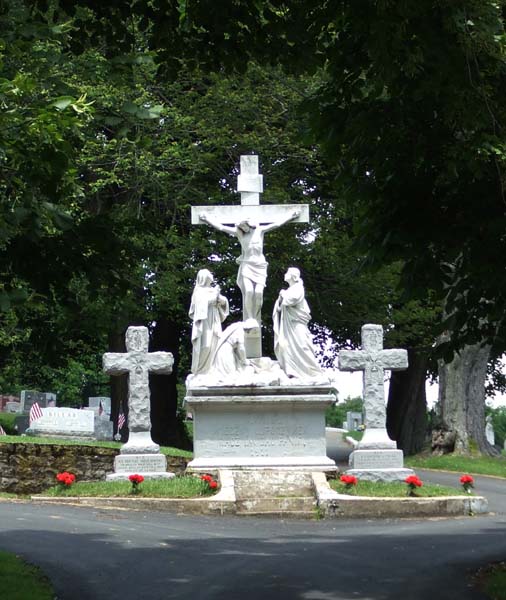
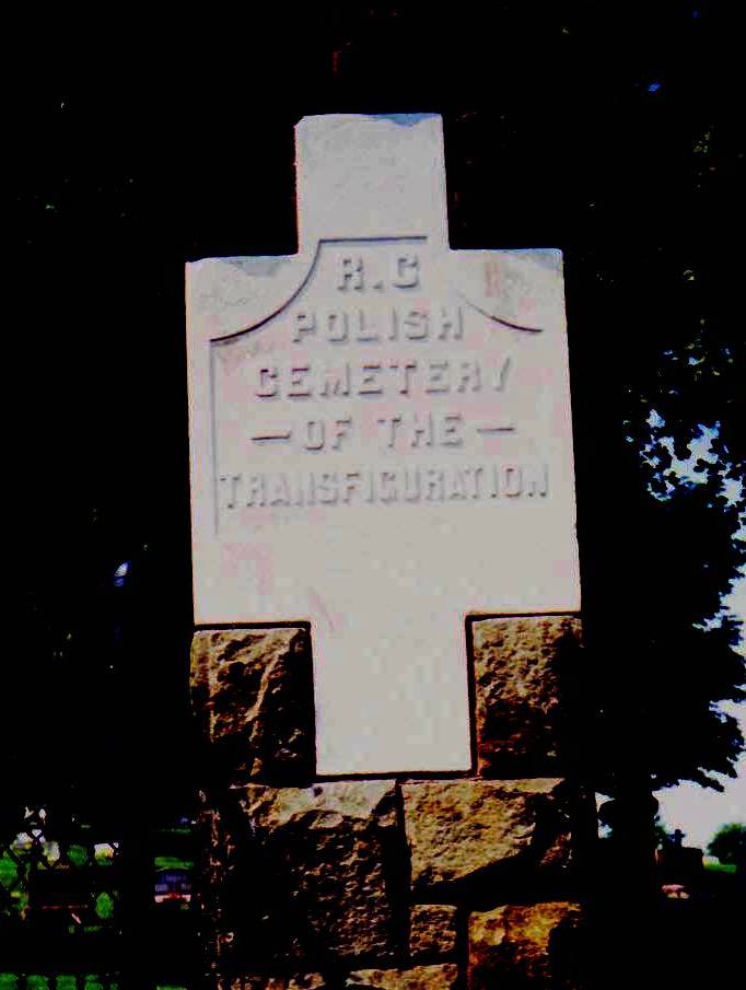
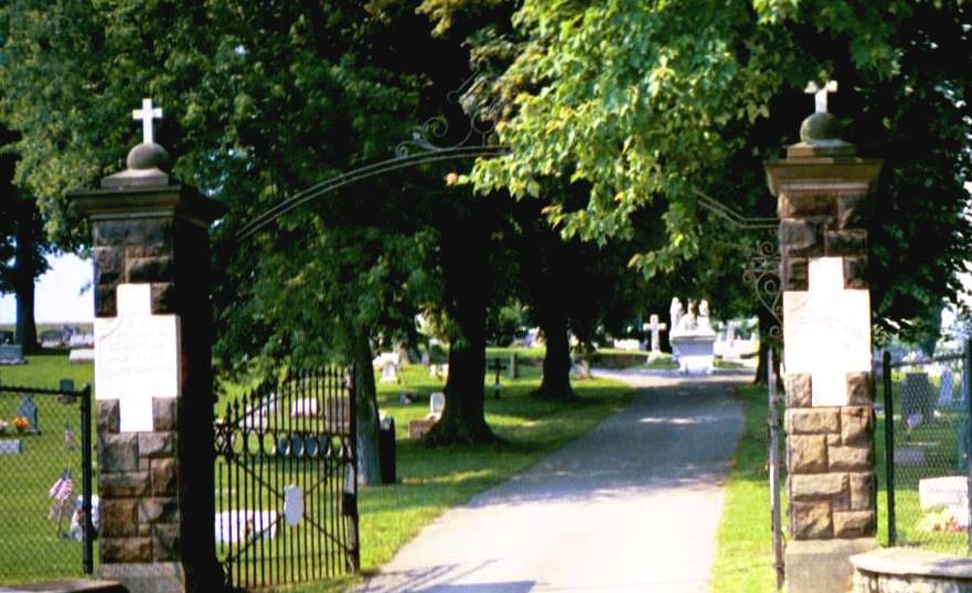
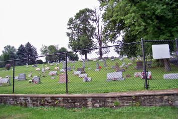
| Description | : | This cemetery is located at the foothills of the Laurel Mountains in western Pennsylvania. Enclosed by two iron gates with an inscription stone reading "R.K. POLSKI CMENTARZ PRZEMIENIENIA PANSKIEGO" on the right gate post and an inscription stone reading "R.C. POLISH CEMETERY OF THE TRANSFIGURATION" on the left gate post. Many immigrants from Poland and Czechoslovkia are interred here. At the turn of the 20th century, the coal mining industry was thriving in this area and the immigrants settled in communities surrounding Mt. Pleasant. The older section includes old tombstones worn and weathered, with inscriptions indigenous to... Read More |
frequently asked questions (FAQ):
-
Where is Roman Catholic Polish Cemetery of the Transfigurat?
Roman Catholic Polish Cemetery of the Transfigurat is located at Old Route 31 Mount Pleasant, Westmoreland County ,Pennsylvania , 15666USA.
-
Roman Catholic Polish Cemetery of the Transfigurat cemetery's updated grave count on graveviews.com?
4 memorials
-
Where are the coordinates of the Roman Catholic Polish Cemetery of the Transfigurat?
Latitude: 40.1558800
Longitude: -79.5631700
Nearby Cemetories:
1. Mount Pleasant Cemetery
Mount Pleasant, Westmoreland County, USA
Coordinate: 40.1571999, -79.5475006
2. Old United Presbyterian Graveyard
Mount Pleasant, Westmoreland County, USA
Coordinate: 40.1500824, -79.5452369
3. Saint Pius X Cemetery
Mount Pleasant, Westmoreland County, USA
Coordinate: 40.1438200, -79.5461200
4. Visitation Parish Cemetery
Mount Pleasant, Westmoreland County, USA
Coordinate: 40.1439600, -79.5447200
5. Alverton Cemetery
Alverton, Westmoreland County, USA
Coordinate: 40.1410000, -79.5890000
6. Middle Presbyterian Cemetery
Mount Pleasant, Westmoreland County, USA
Coordinate: 40.1777000, -79.5309000
7. Saint John's Union Cemetery
Mount Pleasant, Westmoreland County, USA
Coordinate: 40.1814000, -79.5316000
8. Zion Cemetery
Alverton, Westmoreland County, USA
Coordinate: 40.1423650, -79.6094020
9. Mount Zion Lutheran and Reformed Cemetery
Mayfield, Westmoreland County, USA
Coordinate: 40.1423035, -79.6093979
10. Fairview Church Cemetery
Hammondville, Fayette County, USA
Coordinate: 40.1169014, -79.5333023
11. Mount Joy Church Of The Brethren Cemetery
Mount Pleasant, Westmoreland County, USA
Coordinate: 40.1439000, -79.5054000
12. Brothers Cemetery
Fayette County, USA
Coordinate: 40.1360700, -79.5004300
13. Greenlick Cemetery
Fayette County, USA
Coordinate: 40.1105995, -79.5194016
14. Lobingier Cemetery
Mount Pleasant Township, Westmoreland County, USA
Coordinate: 40.1439030, -79.4887870
15. Mellinger Cemetery
Mellingertown, Westmoreland County, USA
Coordinate: 40.1432050, -79.4784730
16. Stone Hill Cemetery
Hempfield Township, Westmoreland County, USA
Coordinate: 40.2220000, -79.5776000
17. Pennsville Independent Cemetery
Connellsville, Fayette County, USA
Coordinate: 40.0844002, -79.5566711
18. Saint Josef's Polish Catholic Cemetery
Everson, Fayette County, USA
Coordinate: 40.0830000, -79.5752000
19. Fairview Cemetery
Kecksburg, Westmoreland County, USA
Coordinate: 40.1696000, -79.4634000
20. King Cemetery
Fayette County, USA
Coordinate: 40.0764300, -79.6005800
21. Saint Stanislaus Cemetery
Calumet, Westmoreland County, USA
Coordinate: 40.2095000, -79.4775000
22. Green Ridge Memorial Park
Connellsville, Fayette County, USA
Coordinate: 40.0682983, -79.5622025
23. Mount Olive Cemetery
Connellsville, Fayette County, USA
Coordinate: 40.0645000, -79.5445000
24. Stouffer Cemetery
Bullskin Township, Fayette County, USA
Coordinate: 40.0848990, -79.4816900