| Memorials | : | 0 |
| Location | : | Emery, Emery County, USA |
| Coordinate | : | 38.9725000, -111.2145600 |
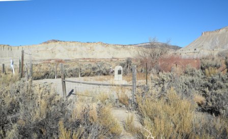
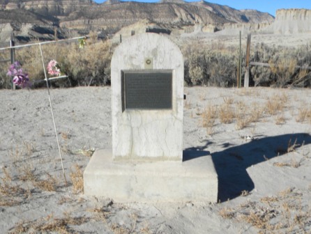
| Description | : | Travel North out of the town of Emery on Highway 10. Just as you get to the turn-off to the right to Moore, take the dirt road to the left. Go about 2 miles until you come to a field on the right with a center pivot irrigation system. Follow the road around this field to the right. Just as you start to leave the field, there is a faint dirt road to the right, through a barbed wire fence and around the hill to the left. The cemetery is located on the far side of the hill. 1/13: It is... Read More |
frequently asked questions (FAQ):
-
Where is Muddy Creek Cemetery?
Muddy Creek Cemetery is located at Emery, Emery County ,Utah , 84513USA.
-
Muddy Creek Cemetery cemetery's updated grave count on graveviews.com?
0 memorials
-
Where are the coordinates of the Muddy Creek Cemetery?
Latitude: 38.9725000
Longitude: -111.2145600
Nearby Cemetories:
1. Johnson Ranch Cemetery
Sevier County, USA
Coordinate: 38.9414200, -111.2014400
2. Old Emery Cemetery
Emery, Emery County, USA
Coordinate: 38.9243622, -111.2390594
3. Emery Cemetery
Emery, Emery County, USA
Coordinate: 38.9310989, -111.2546997
4. Ridge Cemetery
Emery County, USA
Coordinate: 38.9177017, -111.2138138
5. Ferron City Cemetery
Ferron, Emery County, USA
Coordinate: 39.0936012, -111.1224976
6. Clawson Cemetery
Emery County, USA
Coordinate: 39.1259308, -111.1104431
7. Molen Cemetery
Ferron, Emery County, USA
Coordinate: 39.0978012, -111.0543976
8. Orangeville City Cemetery
Orangeville, Emery County, USA
Coordinate: 39.2317009, -111.0686035
9. Wilsonville Cemetery
Castle Dale, Emery County, USA
Coordinate: 39.1758000, -110.9492030
10. Castle Dale City Cemetery
Castle Dale, Emery County, USA
Coordinate: 39.2214012, -111.0196991
11. Lawrence Cemetery
Lawrence, Emery County, USA
Coordinate: 39.2983017, -110.9235992
12. Huntington City Cemetery
Huntington, Emery County, USA
Coordinate: 39.3375015, -110.9749985
13. Mayfield Cemetery
Mayfield, Sanpete County, USA
Coordinate: 39.1128006, -111.7177963
14. Sterling Cemetery
Sterling, Sanpete County, USA
Coordinate: 39.1962000, -111.6997000
15. Manti Cemetery
Manti, Sanpete County, USA
Coordinate: 39.2764015, -111.6327972
16. Tucker Family Cemetery
Cleveland, Emery County, USA
Coordinate: 39.3610000, -110.8881000
17. Cleveland Cemetery
Cleveland, Emery County, USA
Coordinate: 39.3525009, -110.8431015
18. Axtell Cemetery
Axtell, Sanpete County, USA
Coordinate: 39.0468000, -111.8273000
19. Pioneer Cemetery
Salina, Sevier County, USA
Coordinate: 38.9700012, -111.8427963
20. Crandall Canyon Mine
Huntington, Emery County, USA
Coordinate: 39.4599991, -111.1676407
21. Centerfield Cemetery
Centerfield, Sanpete County, USA
Coordinate: 39.1185989, -111.8171997
22. East Side Cemetery
Salina, Sevier County, USA
Coordinate: 38.9581660, -111.8468980
23. Ephraim Park Cemetery
Ephraim, Sanpete County, USA
Coordinate: 39.3715500, -111.5874000
24. Gunnison Cemetery
Gunnison, Sanpete County, USA
Coordinate: 39.1671982, -111.8043976


