| Memorials | : | 0 |
| Location | : | Pickensville, Pickens County, USA |
| Coordinate | : | 33.2540200, -88.2567000 |
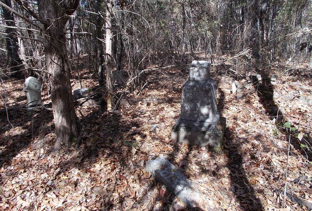
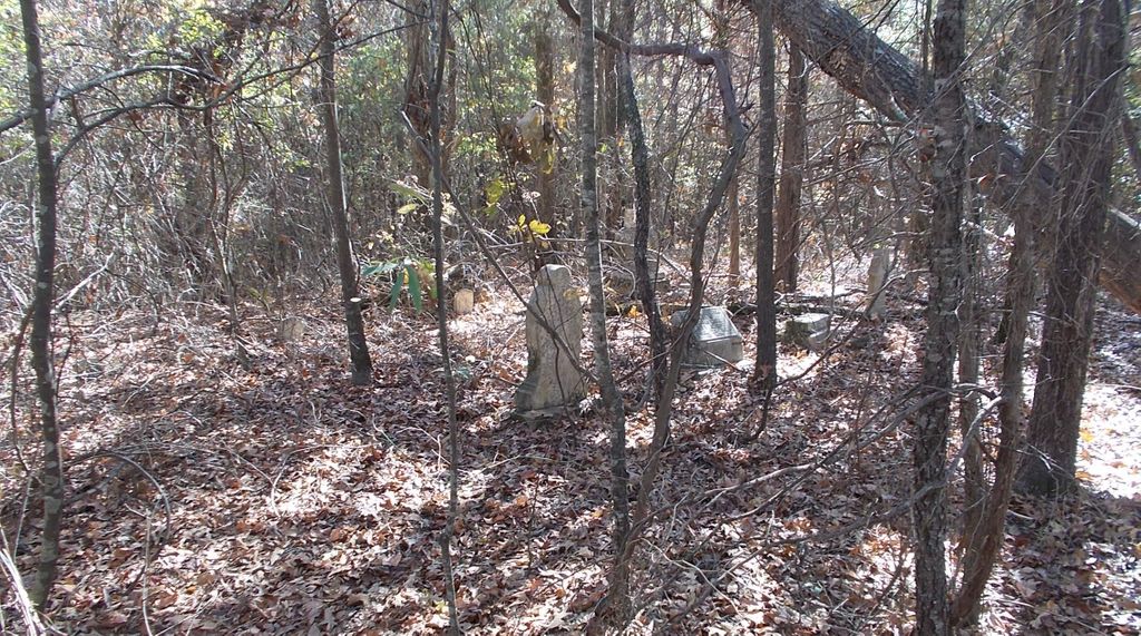
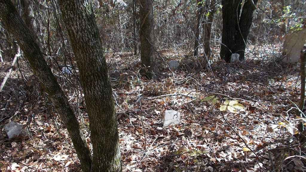
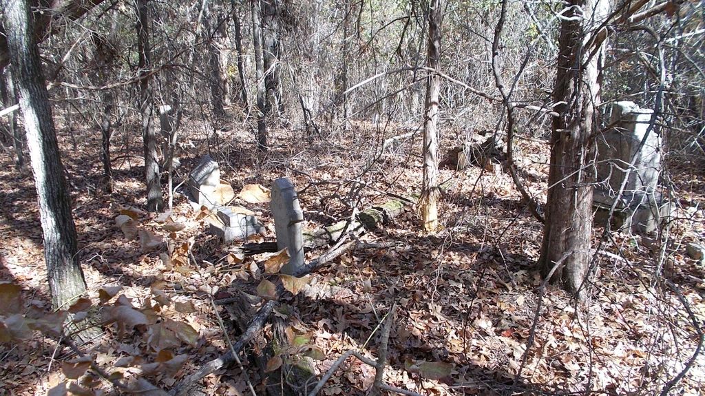
| Description | : | 2 miles north of Pickensville, Pickens Co., Alabama (Nance Ferry was just west of Pickensville) Nance Cemetery is the family cemetery of James Nance, his wife and descendants. There are some individual headstones, but there is one large marker with names on four sides. Other than James Nance, there are numbers with each name. It appears this large marker marks the burial site of James Nance and the numbers correspond with small marble markers with an engraved number that mark the actual burial sites of the relatives. This cemetery is located on private property... Read More |
frequently asked questions (FAQ):
-
Where is Nance Cemetery?
Nance Cemetery is located at Pickensville, Pickens County ,Alabama ,USA.
-
Nance Cemetery cemetery's updated grave count on graveviews.com?
0 memorials
-
Where are the coordinates of the Nance Cemetery?
Latitude: 33.2540200
Longitude: -88.2567000
Nearby Cemetories:
1. Doss Cemetery
Pickensville, Pickens County, USA
Coordinate: 33.2619019, -88.2600021
2. Beebe Chapel Cemetery
Pickensville, Pickens County, USA
Coordinate: 33.2344700, -88.2625400
3. Upper Cemetery
Pickensville, Pickens County, USA
Coordinate: 33.2345500, -88.2640400
4. Hanks Cemetery
Archer, Pickens County, USA
Coordinate: 33.2635000, -88.2322000
5. New Cumberland Cemetery
Pickensville, Pickens County, USA
Coordinate: 33.2402992, -88.2319031
6. Cook-Temple Memorial Cemetery
Pickensville, Pickens County, USA
Coordinate: 33.2844000, -88.2606000
7. Springhill Baptist Church Cemetery
Pickensville, Pickens County, USA
Coordinate: 33.2847000, -88.2394000
8. Spring Hill Church Cemetery
Archer, Pickens County, USA
Coordinate: 33.2867012, -88.2397003
9. Lower Cemetery
Pickensville, Pickens County, USA
Coordinate: 33.2192001, -88.2664032
10. Saint John Cemetery
Pickensville, Pickens County, USA
Coordinate: 33.2188988, -88.2664032
11. Bain Cemetery
Carrollton, Pickens County, USA
Coordinate: 33.2740000, -88.1995000
12. Shady Grove Cemetery
Carrollton, Pickens County, USA
Coordinate: 33.3037120, -88.2084670
13. Bigbee Valley Cemetery
Noxubee County, USA
Coordinate: 33.2433014, -88.3375015
14. Christian Hill Cemetery
Brooksville, Noxubee County, USA
Coordinate: 33.2440300, -88.3402700
15. Roberson Cemetery
Noxubee County, USA
Coordinate: 33.2421989, -88.3407974
16. Brooks Cemetery
Pickens County, USA
Coordinate: 33.2490300, -88.1711200
17. Oak Ridge Cemetery
Pickens County, USA
Coordinate: 33.3235400, -88.2800000
18. Leslie Britt Family Cemetery
Pine Grove, Pickens County, USA
Coordinate: 33.3256000, -88.2443000
19. Brewer Cemetery
Noxubee County, USA
Coordinate: 33.2083015, -88.3274994
20. Pilgrim Rest Cemetery
Sapps, Pickens County, USA
Coordinate: 33.2247009, -88.1707993
21. Spiller Cemetery
Sapps, Pickens County, USA
Coordinate: 33.2355995, -88.1647034
22. Springhill Cemetery
Noxubee County, USA
Coordinate: 33.2055900, -88.3315900
23. Fleming Cemetery
Sapps, Pickens County, USA
Coordinate: 33.2026000, -88.1812000
24. Taylor Hinton Cemetery
Pickens County, USA
Coordinate: 33.1812400, -88.2112400


