
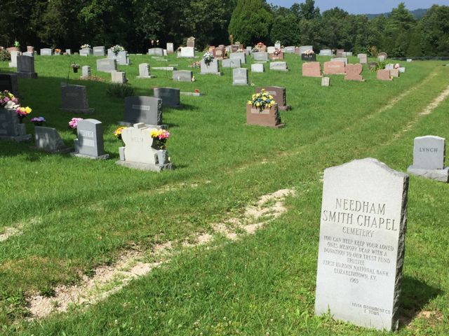
| Memorials | : | 24 |
| Location | : | Hardin County, USA |
| Coordinate | : | 37.6260986, -86.1485977 |
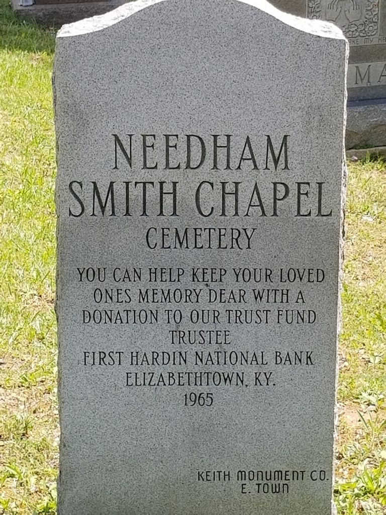
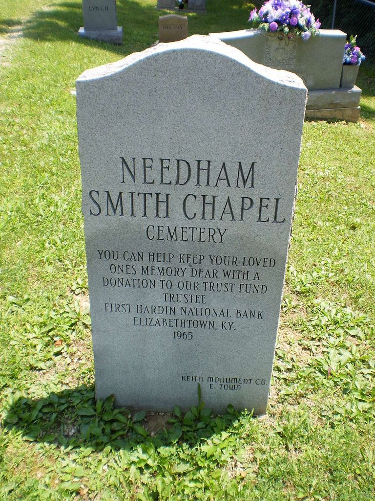
| Description | : | Land for the Needham Smith Chapel Cemetery was donated by the Cundiff family. The earliest burials are believed to date to the 1850s. According to early session records of the Needham Cumberland Presbyterian Church, it was organized May 28, 1859, with 43 members. The original members were: Rutha Needham, A. B. Needham, S. E. Needham, A. Kelly, G. W. Hilton, Rachel Ann Hilton, Sally Cundiff, Sally Ann Cundiff, R. W. Cundiff, Margaret Cundiff, John McDonald, Cynthia McDonald, Margaret Kinny, G. W. Moore, Thomas Noe, Martha Noe, Margaret Miller, Martha V. Cundiff, Rebeca J. Shawler, Presley C. Clater, B.... Read More |
frequently asked questions (FAQ):
-
Where is Needham Smith Chapel Cemetery?
Needham Smith Chapel Cemetery is located at Hardin County ,Kentucky ,USA.
-
Needham Smith Chapel Cemetery cemetery's updated grave count on graveviews.com?
24 memorials
-
Where are the coordinates of the Needham Smith Chapel Cemetery?
Latitude: 37.6260986
Longitude: -86.1485977
Nearby Cemetories:
1. Needham Family Cemetery
Hardin County, USA
Coordinate: 37.6338900, -86.1556000
2. Jacobs Graveyard
Hardin County, USA
Coordinate: 37.6047270, -86.1348970
3. Givan Family Graveyard
Hardin County, USA
Coordinate: 37.6422690, -86.1772520
4. Sutzer Creek Cemetery
Hardin County, USA
Coordinate: 37.6278000, -86.1093979
5. Meeting Creek Baptist Church Cemetery
Eastview, Hardin County, USA
Coordinate: 37.6081740, -86.1138750
6. Pole Bridge Baptist Church Cemetery
Hardin County, USA
Coordinate: 37.6487030, -86.1820580
7. Holbert Cemetery
Hardin County, USA
Coordinate: 37.6692009, -86.1635971
8. Moore Cemetery #1
Hardin County, USA
Coordinate: 37.5881700, -86.1810200
9. Moore Cemetery #2
Eastview, Hardin County, USA
Coordinate: 37.5881160, -86.1810570
10. Fairfield Baptist Church Cemetery
Eastview, Hardin County, USA
Coordinate: 37.6131140, -86.0883410
11. Pleasant Grove Methodist Church Cemetery
Hardin County, USA
Coordinate: 37.6116982, -86.2117004
12. Dellview Cemetery
Hardin County, USA
Coordinate: 37.5793991, -86.1141968
13. Richardson Home Cemetery
Hardin County, USA
Coordinate: 37.6618230, -86.0859510
14. Horn Cemetery
Hardin County, USA
Coordinate: 37.6800003, -86.1905975
15. Aubrey Cemetery
Eastview, Hardin County, USA
Coordinate: 37.6413780, -86.2273090
16. Akers Family Cemetery
Summit, Hardin County, USA
Coordinate: 37.5673190, -86.1124840
17. Mount Olive Cemetery
Eastview, Hardin County, USA
Coordinate: 37.6308800, -86.2430300
18. Petty Cemetery
Grayson County, USA
Coordinate: 37.5505981, -86.1444016
19. Petty Cemetery
Big Clifty, Grayson County, USA
Coordinate: 37.5503360, -86.1469590
20. Cedar Hill Cemetery
Big Clifty, Grayson County, USA
Coordinate: 37.5497017, -86.1453018
21. Saint Mary Cemetery
Big Clifty, Grayson County, USA
Coordinate: 37.5493460, -86.1456600
22. Old Brick Cemetery
Eastview, Hardin County, USA
Coordinate: 37.5780000, -86.0725000
23. Richardson-Woolridge Cemetery
Summit, Hardin County, USA
Coordinate: 37.5695220, -86.0790150
24. Eastview Baptist Church Cemetery
Eastview, Hardin County, USA
Coordinate: 37.5877880, -86.0613540