
| Memorials | : | 4 |
| Location | : | Clymer, Indiana County, USA |
| Coordinate | : | 40.7256317, -79.0229416 |
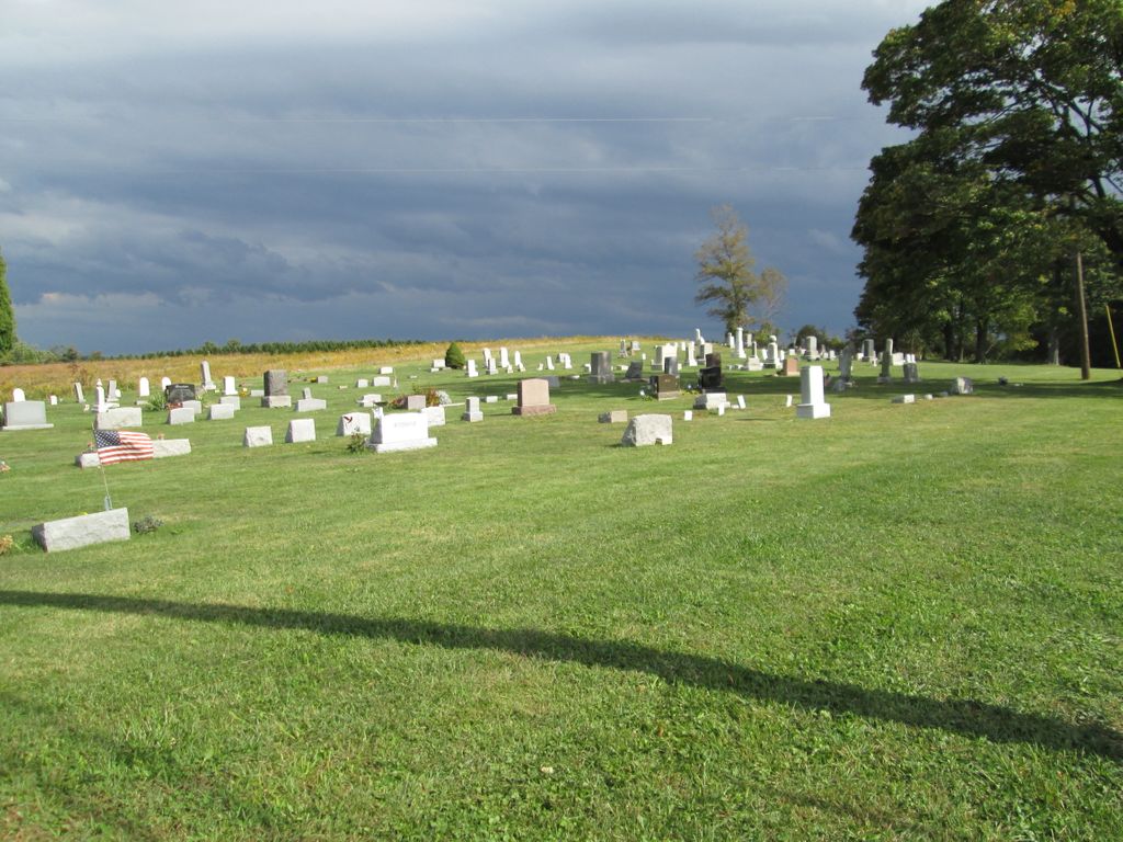
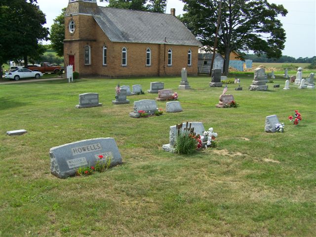
| Description | : | Directions: From the middle of "downtown" Marion Center, Indiana County, PA, take Pennsylvania Route 403 south for 3.46 miles to the intersection of Bethel Church Road. Turn right onto Bethel Church Road and drive 0.5 miles to the intersection of Leroy Road. The Church and cemetery are at this intersection. From Clymer, PA, at the intersection of PA Routes 286 and 403, take PA Route 403 north for 4.61 miles, to the intersection of Bethel Church Road...(You will pass through Dixonville to get to this point.) Turn Left onto Bethel Church Rd. and drive 0.5 miles to the intersection... Read More |
frequently asked questions (FAQ):
-
Where is New Life Evangelical Lutheran Church Cemetery?
New Life Evangelical Lutheran Church Cemetery is located at 1209 Leroy Road Clymer, Indiana County ,Pennsylvania , 15728USA.
-
New Life Evangelical Lutheran Church Cemetery cemetery's updated grave count on graveviews.com?
4 memorials
-
Where are the coordinates of the New Life Evangelical Lutheran Church Cemetery?
Latitude: 40.7256317
Longitude: -79.0229416

Nearby Cemetories:
1. Dixonville Wesleyan Methodist Church Cemetery
Indiana County, USA
Coordinate: 40.7195000, -79.0049000
2. Church of the Resurrection Cemetery
Dixonville, Indiana County, USA
Coordinate: 40.7322498, -78.9996384
3. German Baptist Church Cemetery
Clymer, Indiana County, USA
Coordinate: 40.6987534, -79.0461960
4. Shilo Cemetery
Deckers Point, Indiana County, USA
Coordinate: 40.7620000, -78.9825000
5. Rayne Presbyterian Church Cemetery
Indiana, Indiana County, USA
Coordinate: 40.6909050, -79.0695580
6. Ruffner Cemetery
Rayne Township, Indiana County, USA
Coordinate: 40.6784980, -79.0468130
7. Oakland Cemetery
Deckers Point, Indiana County, USA
Coordinate: 40.7656000, -78.9812000
8. Marion Center Memorial Cemetery
Marion Center, Indiana County, USA
Coordinate: 40.7744000, -79.0530000
9. Best Cemetery
Marion Center, Indiana County, USA
Coordinate: 40.7627000, -78.9684000
10. Sample Run Cemetery
Cherryhill Township, Indiana County, USA
Coordinate: 40.6666985, -79.0307999
11. Saint Michael's Orthodox Greek Catholic Cemetery
Clymer, Indiana County, USA
Coordinate: 40.6666630, -79.0305760
12. Church of the Resurrection Cemetery
Clymer, Indiana County, USA
Coordinate: 40.6655000, -79.0305100
13. Grove Chapel Lutheran Church Cemetery
Indiana, Indiana County, USA
Coordinate: 40.6974945, -79.1025085
14. Nicewonger Cemetery
Clymer, Indiana County, USA
Coordinate: 40.6624230, -78.9909660
15. Christ Our Savior Orthodox Church Cemetery
Indiana, Indiana County, USA
Coordinate: 40.6635380, -79.0622810
16. Pine Vale Cemetery
Marion Center, Indiana County, USA
Coordinate: 40.7743000, -78.9553000
17. Rich Hill Cemetery
Indiana County, USA
Coordinate: 40.6497002, -79.0077972
18. East Mahoning Cemetery
Purchase Line, Indiana County, USA
Coordinate: 40.7441000, -78.9227000
19. Diamondville Cemetery
Indiana County, USA
Coordinate: 40.6603012, -78.9597015
20. Cookport Methodist Cemetery
Cookport, Indiana County, USA
Coordinate: 40.6925011, -78.9238968
21. Old Washington Church Cemetery
Home, Indiana County, USA
Coordinate: 40.7318993, -79.1346970
22. Cookport Lutheran Cemetery
Cookport, Indiana County, USA
Coordinate: 40.6960000, -78.9170000
23. Washington Church Cemetery
Home, Indiana County, USA
Coordinate: 40.7366730, -79.1355620
24. Cherry Hill Progressive Brethren Cemetery
Penn Run, Indiana County, USA
Coordinate: 40.6397018, -79.0650024