
| Memorials | : | 114 |
| Location | : | North Bloomfield, Nevada County, USA |
| Coordinate | : | 39.3678150, -120.9038890 |
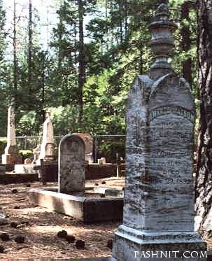
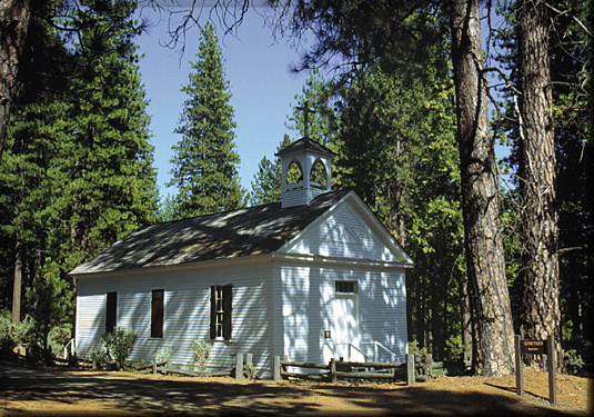
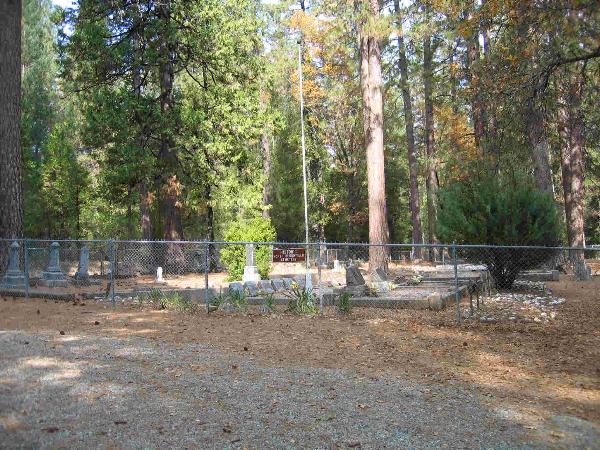
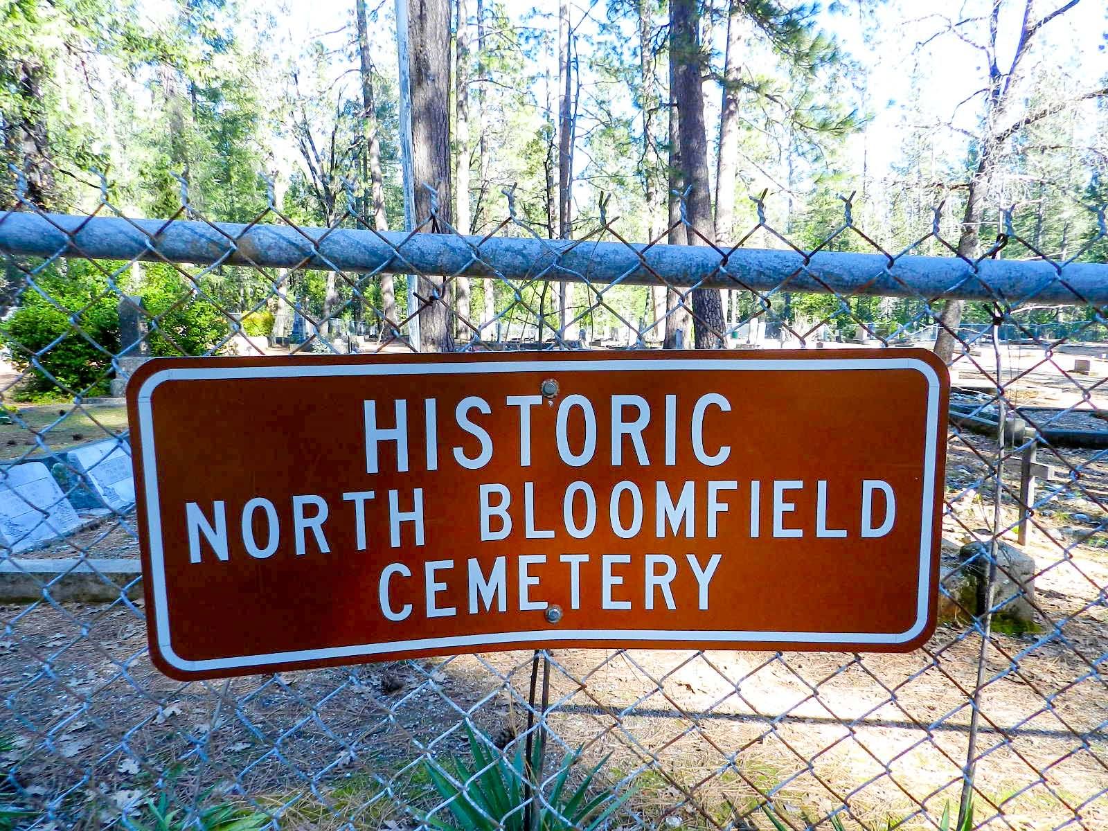
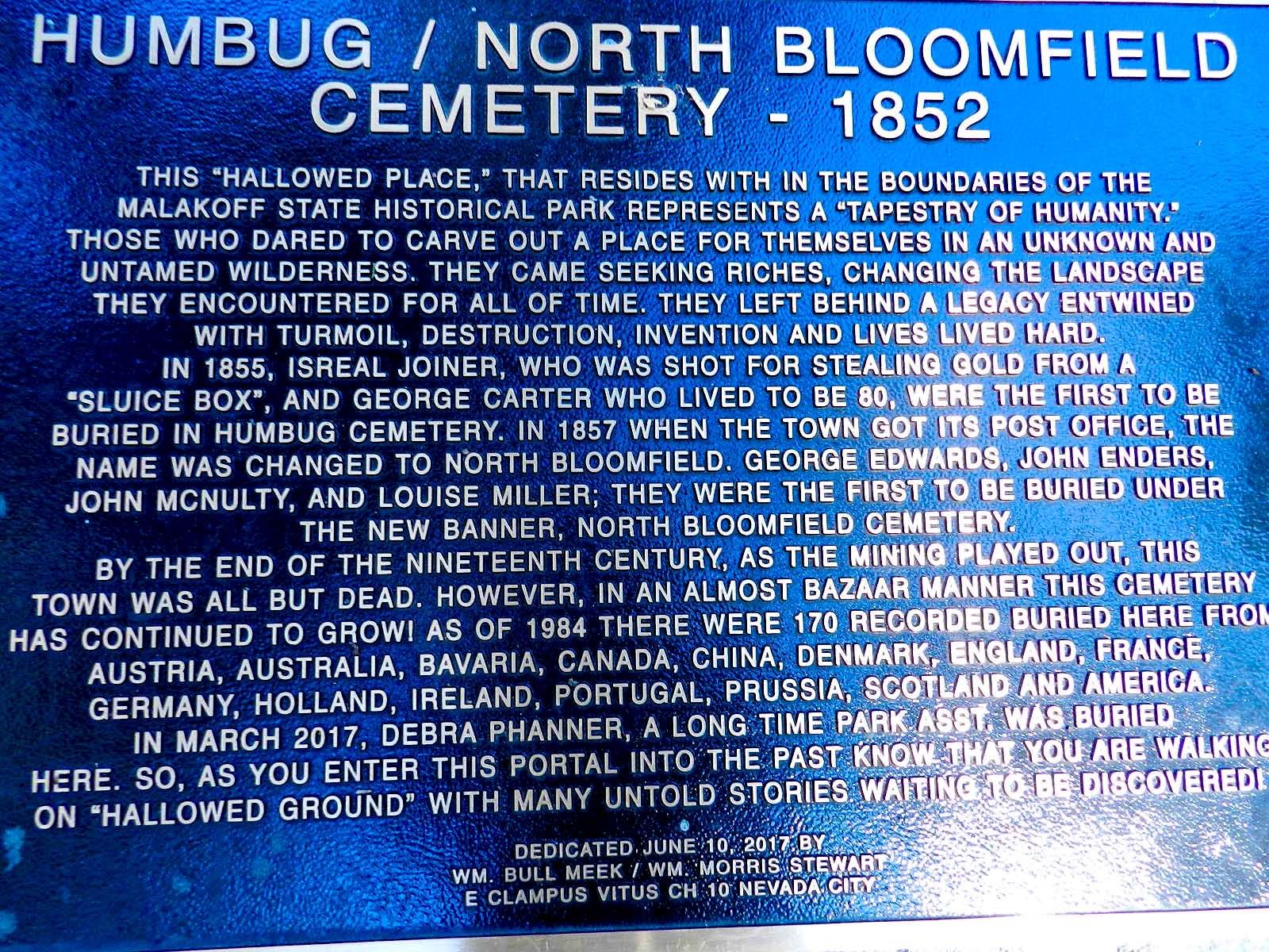
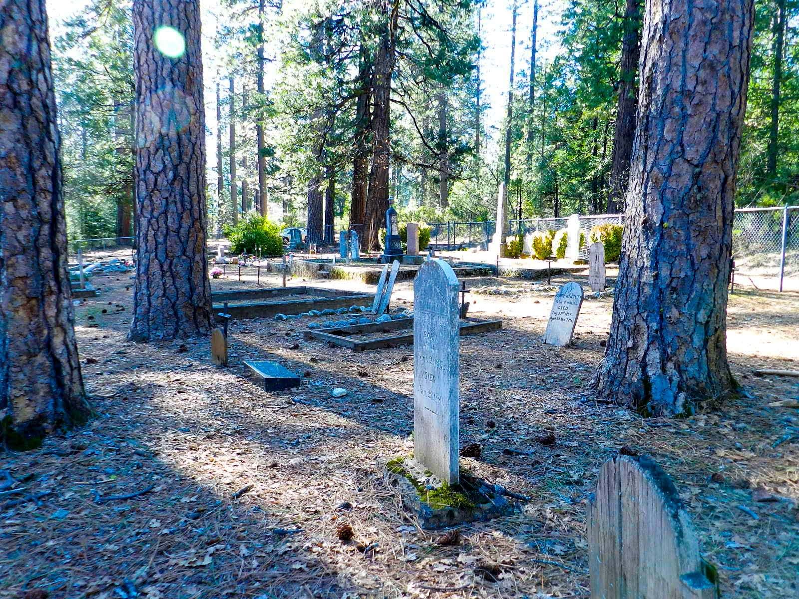
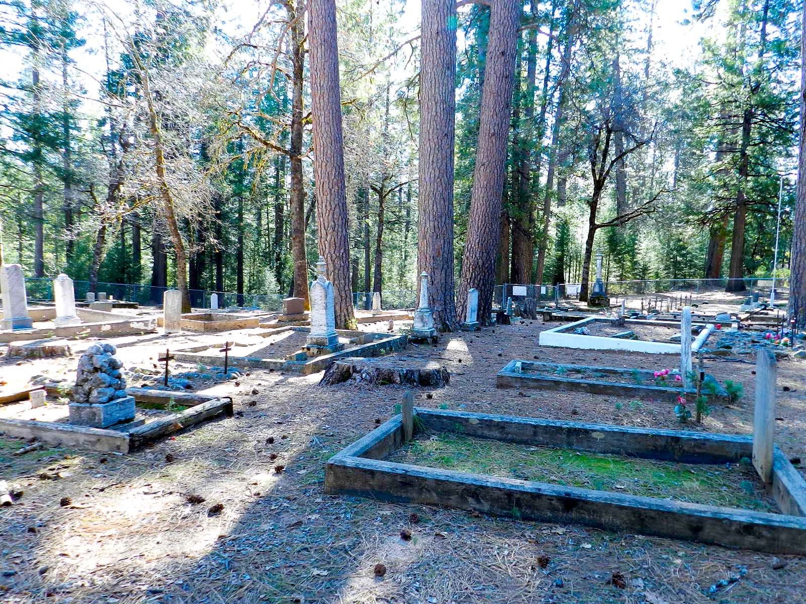
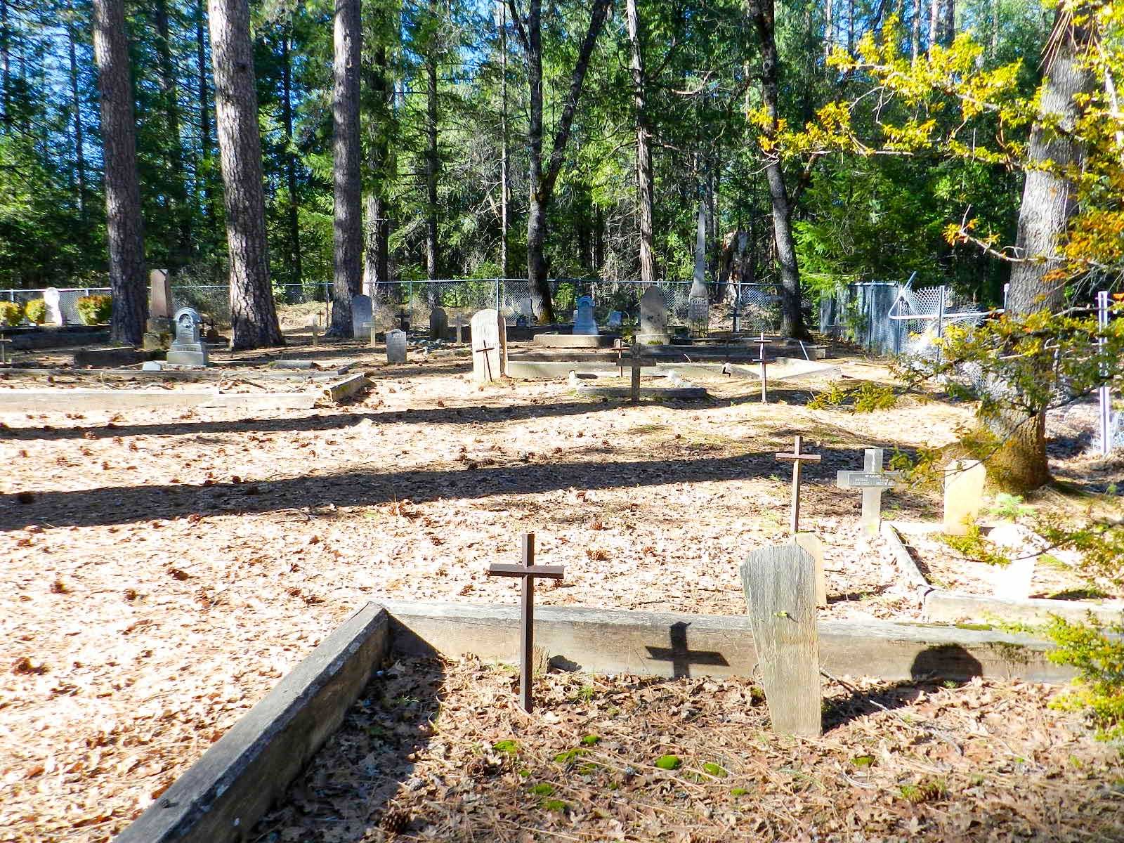
| Description | : | North Bloomfield Cemetery, North Bloomfield (formerly Humbug to 1857), Nevada County, CA. The cemetery and town are found nearest Malakoff Diggins State Historic Park which is located at 23579 North Bloomfield Road (Park). A short path over a creek (Humbug) at the west edge of North Bloomfield town leads over to the town church (St. Columncille's Catholic Church dating back to 1860), the cemetery is located a little way behind the church building, and the massive one room school house. The cemetery is rather large, well preserved and lies underneath massive trees. Pine cones dot the ground amongst... Read More |
frequently asked questions (FAQ):
-
Where is North Bloomfield Cemetery?
North Bloomfield Cemetery is located at North Bloomfield, Nevada County ,California ,USA.
-
North Bloomfield Cemetery cemetery's updated grave count on graveviews.com?
114 memorials
-
Where are the coordinates of the North Bloomfield Cemetery?
Latitude: 39.3678150
Longitude: -120.9038890
Nearby Cemetories:
1. Relief Hill Cemetery
North Bloomfield, Nevada County, USA
Coordinate: 39.3552140, -120.8610870
2. Julius Apperson Gravesite
Nevada City, Nevada County, USA
Coordinate: 39.3058660, -120.9134940
3. Moores Flat Cemetery
Moores Flat, Nevada County, USA
Coordinate: 39.4275170, -120.8556670
4. Washington Cemetery
Washington, Nevada County, USA
Coordinate: 39.3573220, -120.8010220
5. Round Mountain Gravesite
Nevada City, Nevada County, USA
Coordinate: 39.3157700, -120.9940000
6. Pike City Cemetery
Pike, Sierra County, USA
Coordinate: 39.4358400, -121.0002400
7. Cherokee Township Cemetery
Cherokee, Nevada County, USA
Coordinate: 39.3700870, -121.0463440
8. Alleghany Cemetery
Alleghany, Sierra County, USA
Coordinate: 39.4696900, -120.8429100
9. Crystal Hermitage Moksha Mandir
Nevada City, Nevada County, USA
Coordinate: 39.3850646, -121.0488795
10. Omega Cemetery
Omega, Nevada County, USA
Coordinate: 39.3310100, -120.7498500
11. Historic Nevada County Cemetery
Nevada City, Nevada County, USA
Coordinate: 39.2697220, -121.0055560
12. Forest City Cemetery
Forest, Sierra County, USA
Coordinate: 39.4883100, -120.8553100
13. Nevada City County Hospital Cemetery
Nevada City, Nevada County, USA
Coordinate: 39.2669440, -121.0058330
14. Forest View Cemetery
Nevada City, Nevada County, USA
Coordinate: 39.2631100, -121.0054000
15. Pine Grove Cemetery
Nevada City, Nevada County, USA
Coordinate: 39.2627780, -121.0052780
16. Deer Creek Cemetery
Nevada City, Nevada County, USA
Coordinate: 39.2625000, -121.0055560
17. Sleighville House Cemetery
Alleghany, Sierra County, USA
Coordinate: 39.4711100, -121.0091700
18. Forest Old Pioneer Cemetery
Forest, Sierra County, USA
Coordinate: 39.4939410, -120.8515940
19. Saint Canice Cemetery
Nevada City, Nevada County, USA
Coordinate: 39.2669400, -121.0236110
20. Pioneer Cemetery
Nevada City, Nevada County, USA
Coordinate: 39.2655560, -121.0241670
21. Camptonville Cemetery
Camptonville, Yuba County, USA
Coordinate: 39.4508018, -121.0472031
22. Graniteville Cemetery
Graniteville, Nevada County, USA
Coordinate: 39.4395860, -120.7462590
23. Maidu Tribal Burial Grounds
Nevada City, Nevada County, USA
Coordinate: 39.2821350, -121.0512190
24. Nevada City Jewish Cemetery
Nevada City, Nevada County, USA
Coordinate: 39.2545590, -121.0233320