
| Memorials | : | 413 |
| Location | : | Northbranch, Jewell County, USA |
| Coordinate | : | 39.9728300, -98.3708300 |
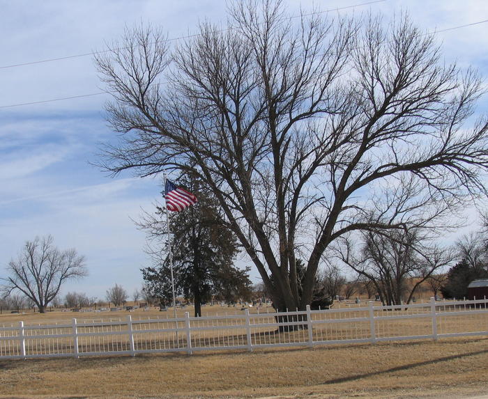
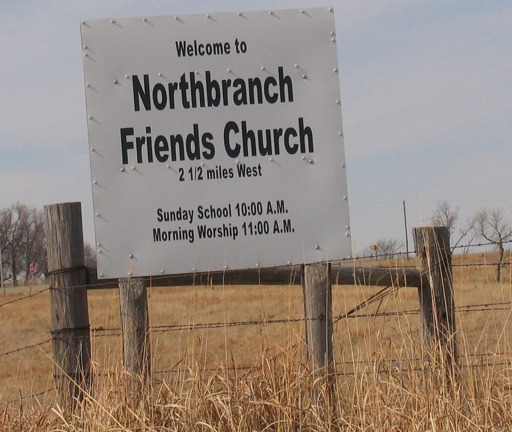
| Description | : | The North Branch (later Northbranch) Preparative Meeting was organized in 1875/1876, part of the Walnut Creek Friends Monthly Meeting which had been formed in 1873. Property was given by D. H. and Emma Dillon for a meeting house and cemetery, in the northwest corner of the northeast quarter of section 18 of Walnut Township (Cedar Road at 78th Road). The first meeting house was a dugout, replaced by a frame meeting house in 1882. Both the church and cemetery remain active, after more than 140 years. |
frequently asked questions (FAQ):
-
Where is Northbranch Friends Cemetery?
Northbranch Friends Cemetery is located at Northbranch, Jewell County ,Kansas ,USA.
-
Northbranch Friends Cemetery cemetery's updated grave count on graveviews.com?
27 memorials
-
Where are the coordinates of the Northbranch Friends Cemetery?
Latitude: 39.9728300
Longitude: -98.3708300
Nearby Cemetories:
1. Conservative Friends Cemetery
Jewell County, USA
Coordinate: 39.9448800, -98.3527500
2. Maple Grove Cemetery
Guide Rock, Webster County, USA
Coordinate: 40.0106010, -98.3482971
3. Highland Cemetery
Jewell County, USA
Coordinate: 39.9660988, -98.4300003
4. Walnut Creek Friends Cemetery
Northbranch, Jewell County, USA
Coordinate: 39.9298800, -98.3436400
5. Old Highland Township Cemetery
Jewell County, USA
Coordinate: 39.9430600, -98.4458900
6. Oak Creek Cemetery
Jewell County, USA
Coordinate: 39.9014015, -98.3918991
7. Wagoner Cemetery
Red Cloud, Webster County, USA
Coordinate: 40.0307999, -98.4488983
8. Providence Cemetery
Jewell County, USA
Coordinate: 39.8866997, -98.4008026
9. Amity Cemetery
Jewell County, USA
Coordinate: 39.9153170, -98.4673780
10. Columbia Cemetery
Guide Rock, Webster County, USA
Coordinate: 40.0499992, -98.2932968
11. Webb Hill Cemetery
Lebanon, Smith County, USA
Coordinate: 39.9520200, -98.5045200
12. Martin Cemetery
Webster County, USA
Coordinate: 40.0606003, -98.4518967
13. German Baptist Brethren Cemetery I
Burr Oak, Jewell County, USA
Coordinate: 39.8787900, -98.2955400
14. Baker Cemetery
Jewell County, USA
Coordinate: 39.8581009, -98.3617020
15. Guide Rock Cemetery
Guide Rock, Webster County, USA
Coordinate: 40.0811005, -98.3125000
16. German Baptist Brethren Cemetery II
Burr Oak, Jewell County, USA
Coordinate: 39.8720860, -98.2786470
17. Shaffer Cemetery
Mankato, Jewell County, USA
Coordinate: 39.9514008, -98.2118988
18. German Kellner Cemetery
Webber, Jewell County, USA
Coordinate: 39.9437828, -98.2119141
19. Burr Oak Cemetery
Burr Oak, Jewell County, USA
Coordinate: 39.8652992, -98.2846985
20. Amboy Cemetery
Amboy, Webster County, USA
Coordinate: 40.1003150, -98.4297540
21. Gust Cemetery
Webster County, USA
Coordinate: 40.0172005, -98.5421982
22. Salem Cemetery
Esbon, Jewell County, USA
Coordinate: 39.8755989, -98.5006027
23. Cleveland Cemetery
Webber, Jewell County, USA
Coordinate: 39.9305992, -98.1939011
24. Pleasant Hill Cemetery
Webster County, USA
Coordinate: 40.1178017, -98.4250031