
| Memorials | : | 8 |
| Location | : | Dorchester, Clark County, USA |
| Coordinate | : | 45.0059000, -90.3293000 |
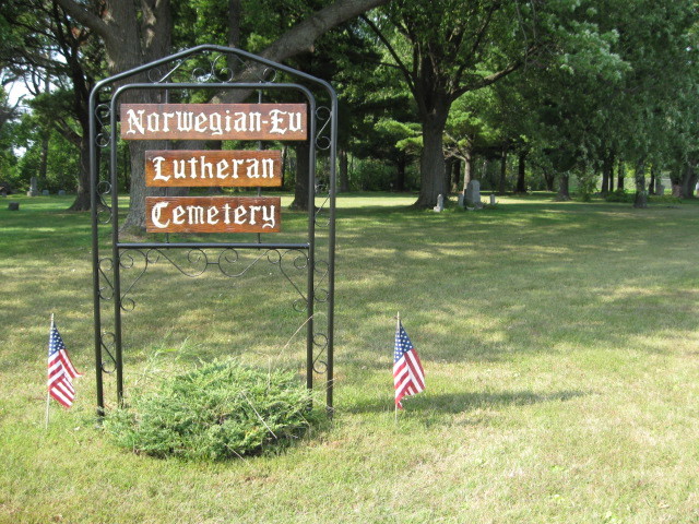
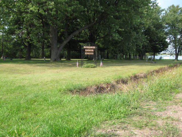
| Description | : | Cemetery is no longer in use. On the west side of Factory Street, 0.2 miles north of Center Avenue (County Highway A). Norwegian Evangelical Lutheran Cemetery, Dorchester, Mayville Township, Clark County Wisconsin, USA: Latitude 45.005791° N, Longitude 90.329307° W |
frequently asked questions (FAQ):
-
Where is Norwegian Evangelical Lutheran Cemetery?
Norwegian Evangelical Lutheran Cemetery is located at Dorchester, Clark County ,Wisconsin ,USA.
-
Norwegian Evangelical Lutheran Cemetery cemetery's updated grave count on graveviews.com?
8 memorials
-
Where are the coordinates of the Norwegian Evangelical Lutheran Cemetery?
Latitude: 45.0059000
Longitude: -90.3293000
Nearby Cemetories:
1. North Dorchester Memorial Cemetery
Dorchester, Clark County, USA
Coordinate: 45.0099983, -90.3352966
2. Dorchester Memorial Cemetery
Dorchester, Clark County, USA
Coordinate: 44.9962000, -90.3366000
3. Popple Ridge Mennonite Church Cemetery
Dorchester, Clark County, USA
Coordinate: 44.9860940, -90.3369020
4. Abbotsford Cemetery
Abbotsford, Clark County, USA
Coordinate: 44.9562000, -90.3173000
5. Lindeman Cemetery
Dorchester, Clark County, USA
Coordinate: 45.0018600, -90.4015200
6. Stetsonville Public Cemetery
Stetsonville, Taylor County, USA
Coordinate: 45.0600000, -90.3151000
7. Zion Cemetery
Stetsonville, Taylor County, USA
Coordinate: 45.0621986, -90.3153000
8. Christ Lutheran Cemetery
Holton, Marathon County, USA
Coordinate: 44.9600910, -90.2801080
9. Sacred Heart Cemetery
Stetsonville, Taylor County, USA
Coordinate: 45.0766983, -90.3296967
10. Pine Hill Cemetery
Curtiss, Clark County, USA
Coordinate: 44.9735985, -90.4332962
11. Saint Paul Lutheran Cemetery
Curtiss, Clark County, USA
Coordinate: 44.9580000, -90.4489000
12. Saint Marys Cemetery
Stetsonville, Taylor County, USA
Coordinate: 45.0936000, -90.3967000
13. Colby Cemetery
Colby, Clark County, USA
Coordinate: 44.9033012, -90.3360977
14. Pilgrim Rest Cemetery
Milan, Marathon County, USA
Coordinate: 44.9744100, -90.1901400
15. Saint Marys Catholic Cemetery
Colby, Clark County, USA
Coordinate: 44.9023000, -90.3361000
16. Bethlehem Lutheran Cemetery
Milan, Marathon County, USA
Coordinate: 44.9878006, -90.1791992
17. Saint Thomas Catholic Cemetery
Milan, Marathon County, USA
Coordinate: 44.9883003, -90.1789017
18. Sunny Ridge Mennonite Cemetery
Curtiss, Clark County, USA
Coordinate: 44.9624700, -90.4739400
19. Colby Mennonite Cemetery
Colby, Clark County, USA
Coordinate: 44.9158000, -90.4258300
20. Saint Paul Lutheran Cemetery
Colby, Clark County, USA
Coordinate: 44.9089000, -90.4337000
21. Our Saviours Lutheran Church Cemetery
Medford, Taylor County, USA
Coordinate: 45.1033000, -90.4448600
22. Amish Cemetery
Little Black, Taylor County, USA
Coordinate: 45.0993996, -90.4542007
23. Evergreen Cemetery I
Medford, Taylor County, USA
Coordinate: 45.1411018, -90.3225021
24. Holy Rosary Cemetery
Medford, Taylor County, USA
Coordinate: 45.1413000, -90.3216000