
| Memorials | : | 651 |
| Location | : | New Bedford, Bristol County, USA |
| Coordinate | : | 41.6432100, -70.9416000 |
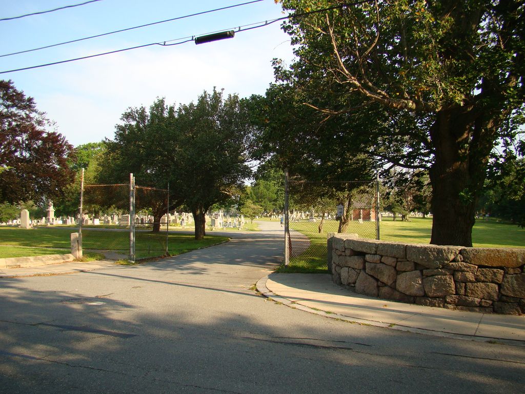
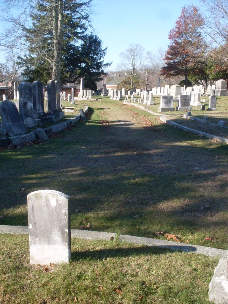
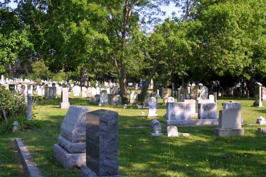
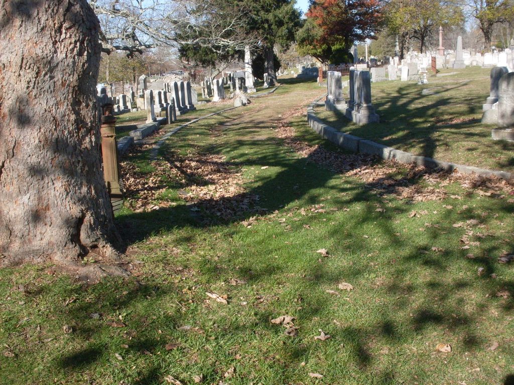
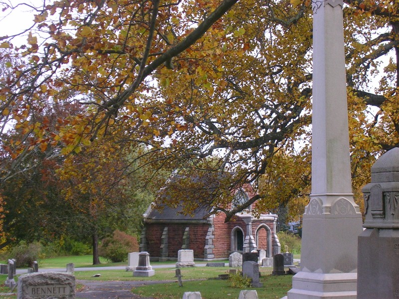
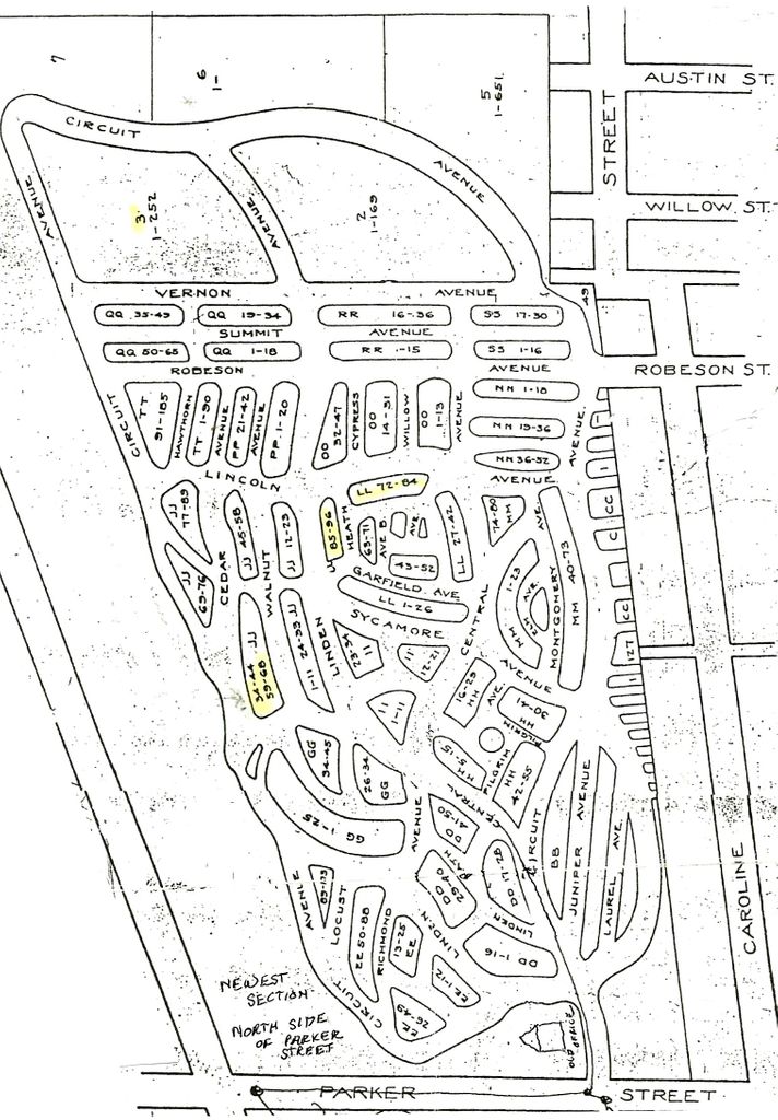
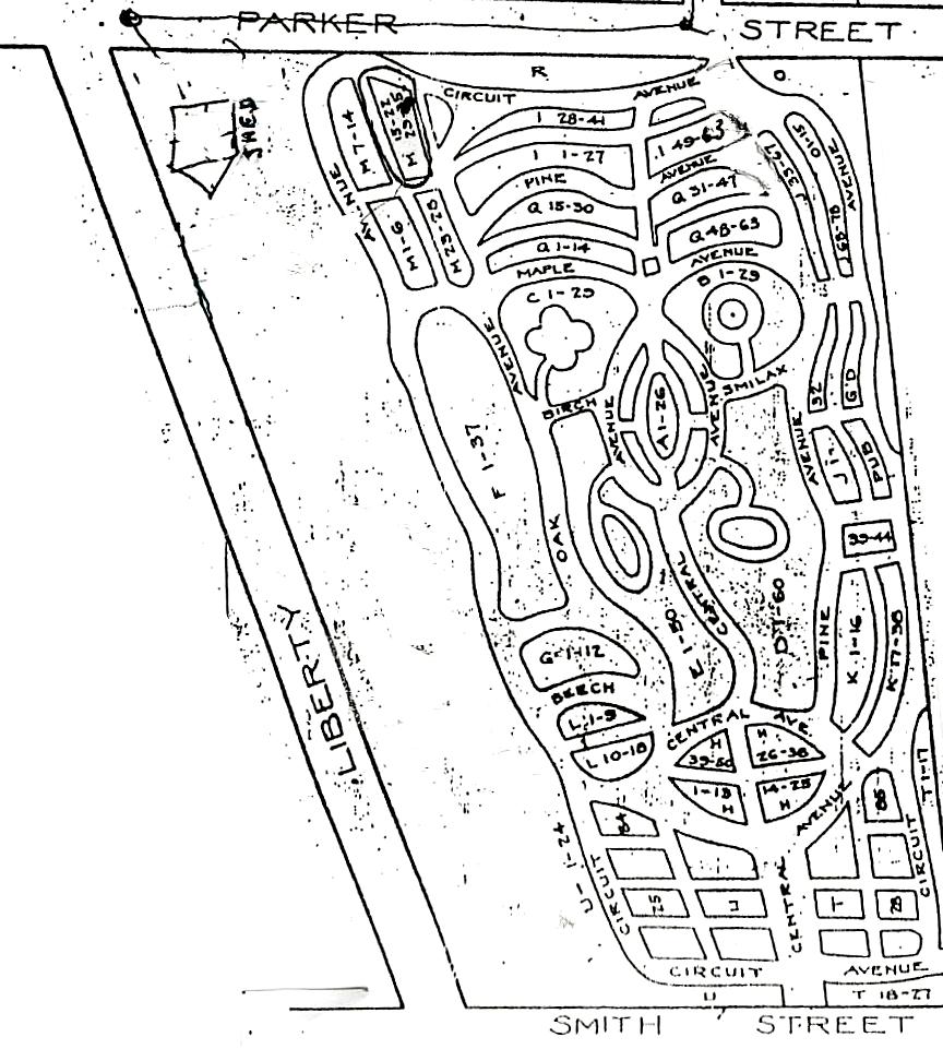
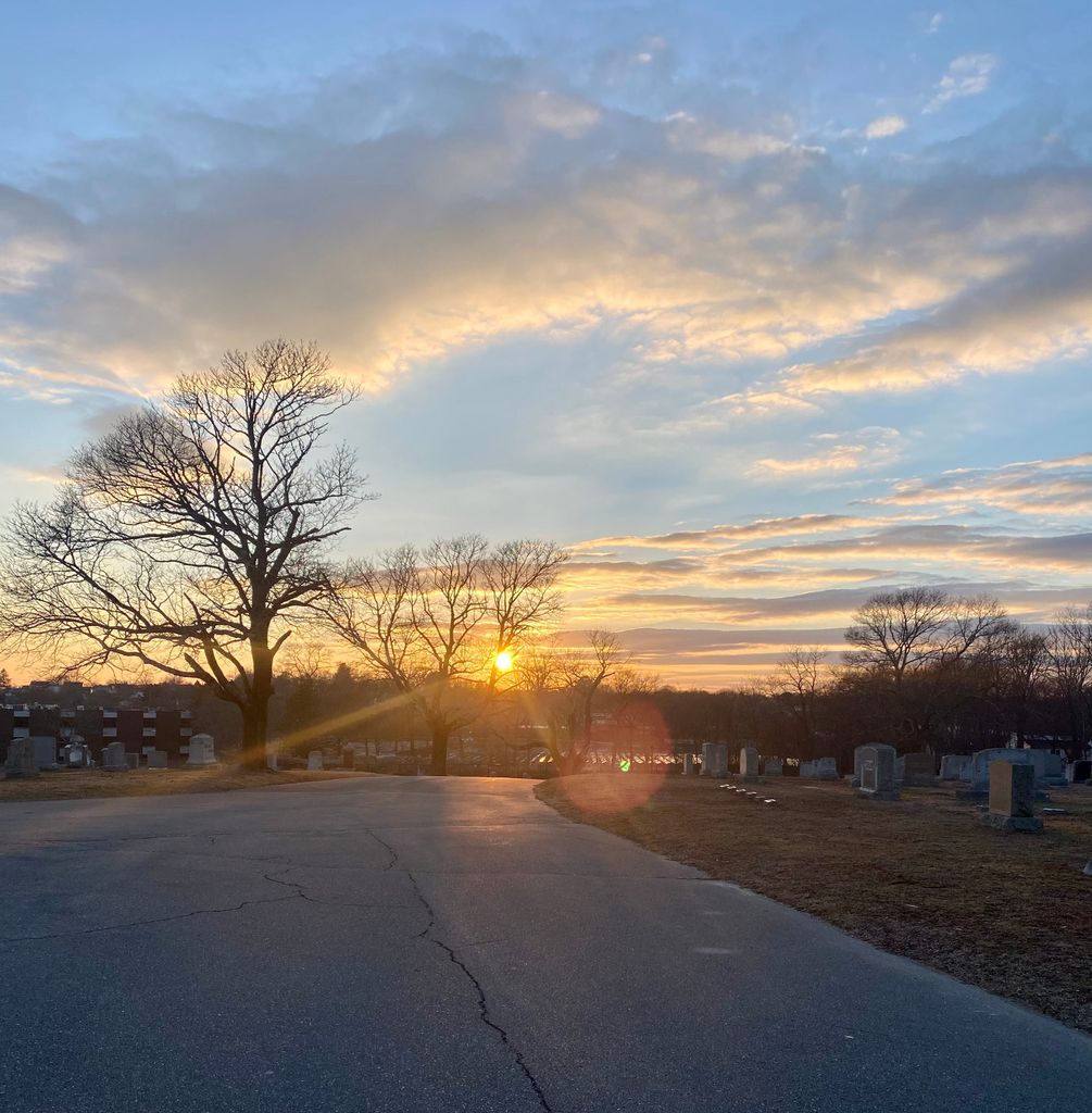
| Description | : | The land for Oak Grove Cemetery was purchased from Dr. Alexander Read (6 acres) and Bethel Pennyman (2 acres) for $1300. Additional funds were allocated, which included $770 for the construction of a stonewall surrounding the cemetery and $330 was spent laying out the making of carriage way and paths. The original entrance was on Smith Street, which has formal granite pillars. The cemetery was opened on October 6, 1843. In 1868 an additional 14 acres were purchased and laid out. In 1887 another large tract of land was purchased across Parker Street and developed into additional burial space.... Read More |
frequently asked questions (FAQ):
-
Where is Oak Grove Cemetery?
Oak Grove Cemetery is located at 185 Parker Street New Bedford, Bristol County ,Massachusetts , 02740USA.
-
Oak Grove Cemetery cemetery's updated grave count on graveviews.com?
560 memorials
-
Where are the coordinates of the Oak Grove Cemetery?
Latitude: 41.6432100
Longitude: -70.9416000
Nearby Cemetories:
1. Noel Taber Cemetery
New Bedford, Bristol County, USA
Coordinate: 41.6446500, -70.9541000
2. Hathaway Family Cemetery
New Bedford, Bristol County, USA
Coordinate: 41.6543700, -70.9479600
3. Saint Marys Cemetery
New Bedford, Bristol County, USA
Coordinate: 41.6391983, -70.9602966
4. Sacred Heart Old Cemetery
New Bedford, Bristol County, USA
Coordinate: 41.6586200, -70.9408200
5. Seamans Bethel Church Memorial
New Bedford, Bristol County, USA
Coordinate: 41.6350630, -70.9236090
6. Peckham West Cemetery
New Bedford, Bristol County, USA
Coordinate: 41.6594009, -70.9421997
7. Saint Anthony of Padua Churchyard
New Bedford, Bristol County, USA
Coordinate: 41.6599120, -70.9279700
8. Rural Cemetery
New Bedford, Bristol County, USA
Coordinate: 41.6236229, -70.9397964
9. Griffin Street Cemetery
New Bedford, Bristol County, USA
Coordinate: 41.6282300, -70.9226800
10. Saint Johns Cemetery
New Bedford, Bristol County, USA
Coordinate: 41.6226273, -70.9497070
11. Friends Burying Ground
New Bedford, Bristol County, USA
Coordinate: 41.6215800, -70.9366800
12. Almshouse Cemetery (Defunct)
Dartmouth, Bristol County, USA
Coordinate: 41.6286400, -70.9659300
13. Cooke Memorial Park
Fairhaven, Bristol County, USA
Coordinate: 41.6465200, -70.9104600
14. Hathaway Family Cemetery
Dartmouth, Bristol County, USA
Coordinate: 41.6494200, -70.9719600
15. Riverside Cemetery
Fairhaven, Bristol County, USA
Coordinate: 41.6521988, -70.9124985
16. Barker Family Cemetery
Dartmouth, Bristol County, USA
Coordinate: 41.6319300, -70.9697400
17. Sacred Heart New Cemetery
New Bedford, Bristol County, USA
Coordinate: 41.6682968, -70.9464417
18. Woodside Cemetery
Fairhaven, Bristol County, USA
Coordinate: 41.6589012, -70.9085999
19. Wilbur Family Cemetery
Dartmouth, Bristol County, USA
Coordinate: 41.6273300, -70.9794700
20. Sacred Hearts of Jesus and Mary Community Cemetery
Fairhaven, Bristol County, USA
Coordinate: 41.6420000, -70.8978000
21. Newtown Burial Ground
Dartmouth, Bristol County, USA
Coordinate: 41.6474100, -70.9871900
22. DAR844 Cemetery
Dartmouth, Bristol County, USA
Coordinate: 41.6475800, -70.9882100
23. Joseph Davis Burial Ground
Dartmouth, Bristol County, USA
Coordinate: 41.6502760, -70.9882340
24. Friends Burial Ground
Dartmouth, Bristol County, USA
Coordinate: 41.6336600, -70.9908700