
| Memorials | : | 0 |
| Location | : | Holland, Hunterdon County, USA |
| Coordinate | : | 40.6061170, -75.1085940 |
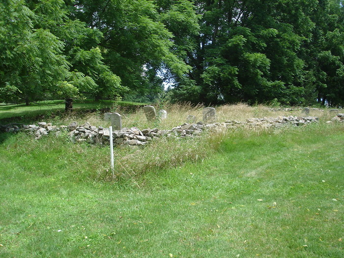
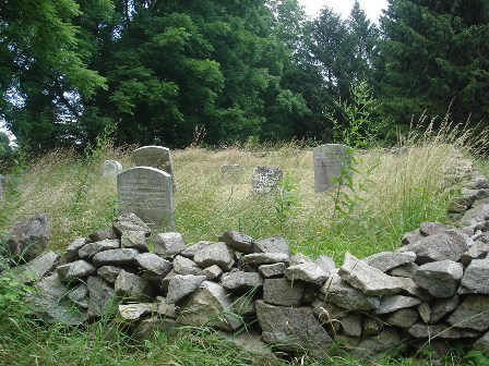
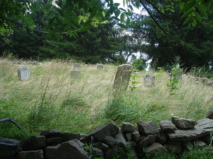
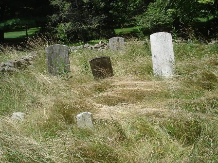
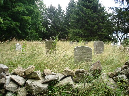
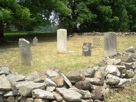
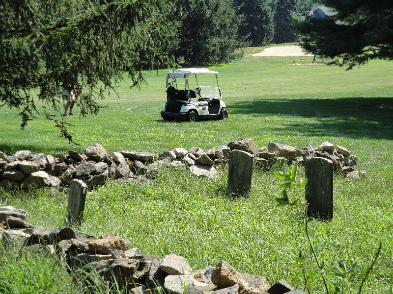
| Description | : | This cemetery is located on the farm of Jacob and Catharine Sidders Cole. Their son, Henry Cole, later took over the farm. The present location of the farm is on the Oak Hill Golf Course. The farm was located in Alexandria Township until 1874 when Holland Township was created. |
frequently asked questions (FAQ):
-
Where is Oak Hill Golf Course Burial Ground?
Oak Hill Golf Course Burial Ground is located at 15 Fernwood Road Holland, Hunterdon County ,New Jersey , 08848USA.
-
Oak Hill Golf Course Burial Ground cemetery's updated grave count on graveviews.com?
0 memorials
-
Where are the coordinates of the Oak Hill Golf Course Burial Ground?
Latitude: 40.6061170
Longitude: -75.1085940
Nearby Cemetories:
1. Milford Christian Churchyard
Milford, Hunterdon County, USA
Coordinate: 40.5685425, -75.0972214
2. Milford Union Cemetery
Milford, Hunterdon County, USA
Coordinate: 40.5667000, -75.0922012
3. Hughesville Cemetery
Warren Glen, Warren County, USA
Coordinate: 40.6269455, -75.1559296
4. Mount Pleasant Cemetery
Mount Pleasant, Hunterdon County, USA
Coordinate: 40.5835267, -75.0536867
5. Pursell Burying Ground
Upper Black Eddy, Bucks County, USA
Coordinate: 40.5584410, -75.0933950
6. Bloomsbury Cemetery
Greenwich Township, Warren County, USA
Coordinate: 40.6552500, -75.0972200
7. Bloomsbury Presbyterian Cemetery
Bloomsbury, Hunterdon County, USA
Coordinate: 40.6539497, -75.0865173
8. Bloomsbury Methodist Churchyard
Bloomsbury, Hunterdon County, USA
Coordinate: 40.6536522, -75.0852127
9. Finesville Union Cemetery
Finesville, Warren County, USA
Coordinate: 40.6010300, -75.1773900
10. Garrison-Tharp Cemetery
Pattenburg, Hunterdon County, USA
Coordinate: 40.6340294, -75.0494461
11. Robins Family Burying Ground
Pattenburg, Hunterdon County, USA
Coordinate: 40.6284027, -75.0432663
12. Greenwich Cemetery
Greenwich Township, Warren County, USA
Coordinate: 40.6644440, -75.1168060
13. Holland Presbyterian Church Cemetery
Holland, Hunterdon County, USA
Coordinate: 40.5748700, -75.1861600
14. Riegelsville Union Cemetery
Riegelsville, Bucks County, USA
Coordinate: 40.5957920, -75.1965020
15. Raubsville Cemetery
Raubsville, Northampton County, USA
Coordinate: 40.6267014, -75.1947021
16. Saint Marys Cemetery
Alpha, Warren County, USA
Coordinate: 40.6666700, -75.1554100
17. Saint Johns Russian Orthodox Cemetery
Alpha, Warren County, USA
Coordinate: 40.6670300, -75.1557700
18. Saints Peter and Paul Byzantine Catholic Cemetery
Alpha, Warren County, USA
Coordinate: 40.6671982, -75.1556015
19. United Presbyterian Church Cemetery
Alpha, Warren County, USA
Coordinate: 40.6681200, -75.1562800
20. Everittstown Methodist Cemetery
Everittstown, Hunterdon County, USA
Coordinate: 40.5655823, -75.0279922
21. Vliet Family Burial Ground
Bloomsbury, Hunterdon County, USA
Coordinate: 40.6700310, -75.0557040
22. Creveling Family Burying Ground
West Portal, Hunterdon County, USA
Coordinate: 40.6642600, -75.0420000
23. Pattenburg United Methodist Church Cemetery
Pattenburg, Hunterdon County, USA
Coordinate: 40.6355800, -75.0126900
24. Upper Tinicum Cemetery
Upper Black Eddy, Bucks County, USA
Coordinate: 40.5292650, -75.0822933