
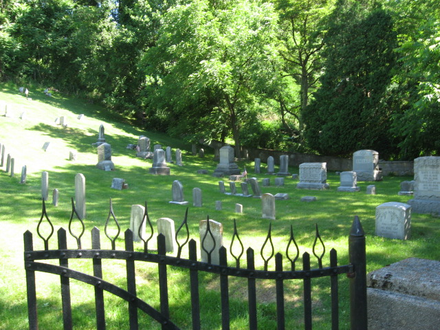
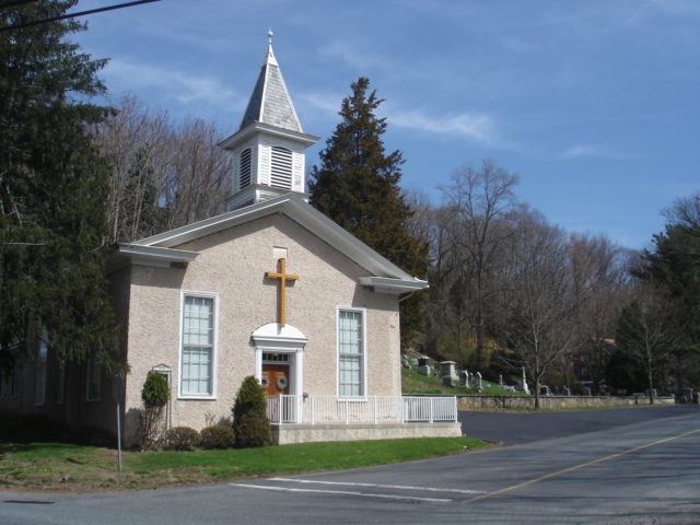
| Memorials | : | 1 |
| Location | : | Holland, Hunterdon County, USA |
| Website | : | www.hollandpresbychurch.org/ |
| Coordinate | : | 40.5748700, -75.1861600 |
frequently asked questions (FAQ):
-
Where is Holland Presbyterian Church Cemetery?
Holland Presbyterian Church Cemetery is located at Riegelsville Road [Route 627] Holland, Hunterdon County ,New Jersey ,USA.
-
Holland Presbyterian Church Cemetery cemetery's updated grave count on graveviews.com?
1 memorials
-
Where are the coordinates of the Holland Presbyterian Church Cemetery?
Latitude: 40.5748700
Longitude: -75.1861600
Nearby Cemetories:
1. Riegelsville Union Cemetery
Riegelsville, Bucks County, USA
Coordinate: 40.5957920, -75.1965020
2. Finesville Union Cemetery
Finesville, Warren County, USA
Coordinate: 40.6010300, -75.1773900
3. Durham Cemetery
Durham, Bucks County, USA
Coordinate: 40.5837517, -75.2259521
4. Nockamixon Union Cemetery
Ferndale, Bucks County, USA
Coordinate: 40.5314903, -75.1812820
5. Saint Luke's Evangelical Lutheran Church Cemetery
Ferndale, Bucks County, USA
Coordinate: 40.5290000, -75.1835000
6. Gallows Hill Graveyard
Gallows Hill, Bucks County, USA
Coordinate: 40.5362000, -75.2239000
7. Raubsville Cemetery
Raubsville, Northampton County, USA
Coordinate: 40.6267014, -75.1947021
8. Hughesville Cemetery
Warren Glen, Warren County, USA
Coordinate: 40.6269455, -75.1559296
9. Saint Lukes Old Williams Cemetery
Williams Township, Northampton County, USA
Coordinate: 40.6017685, -75.2637253
10. Oak Hill Golf Course Burial Ground
Holland, Hunterdon County, USA
Coordinate: 40.6061170, -75.1085940
11. Milford Christian Churchyard
Milford, Hunterdon County, USA
Coordinate: 40.5685425, -75.0972214
12. Stewart Cemetery
Tinicum, Bucks County, USA
Coordinate: 40.5148430, -75.1368700
13. Milford Union Cemetery
Milford, Hunterdon County, USA
Coordinate: 40.5667000, -75.0922012
14. Pursell Burying Ground
Upper Black Eddy, Bucks County, USA
Coordinate: 40.5584410, -75.0933950
15. Salem Evangelical Cemetery
Springtown, Bucks County, USA
Coordinate: 40.5580000, -75.2800170
16. Saint Johns Lutheran Cemetery
Williams Township, Northampton County, USA
Coordinate: 40.6380600, -75.2354500
17. Saint John the Baptist Roman Catholic Cemetery
Haycock Township, Bucks County, USA
Coordinate: 40.4996986, -75.2055969
18. Trinity Cemetery
Hellertown, Northampton County, USA
Coordinate: 40.5839400, -75.2914330
19. Christ United Evangelical Church Cemetery
Williams Township, Northampton County, USA
Coordinate: 40.6497700, -75.2259000
20. Springtown Cemetery
Springtown, Bucks County, USA
Coordinate: 40.5533000, -75.2896000
21. Rock Ridge Chapel Cemetery
Upper Black Eddy, Bucks County, USA
Coordinate: 40.5010986, -75.1181030
22. Upper Tinicum Cemetery
Upper Black Eddy, Bucks County, USA
Coordinate: 40.5292650, -75.0822933
23. Pleasant Hill Cemetery
Pleasant Valley, Bucks County, USA
Coordinate: 40.5295150, -75.2951970
24. Saint Marys Cemetery
Alpha, Warren County, USA
Coordinate: 40.6666700, -75.1554100