
| Memorials | : | 9 |
| Location | : | Livermore, Alameda County, USA |
| Coordinate | : | 37.6770660, -121.7896590 |
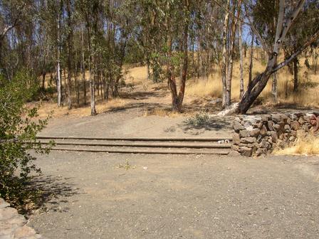
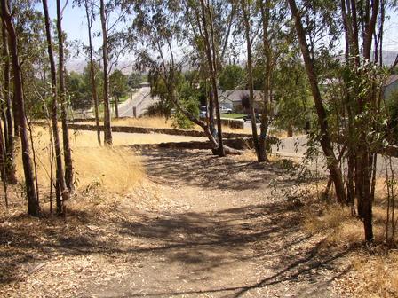
| Description | : | "Around the turn of the century, the Catholic, Masonic and IOOF cemeteries came into existence, so burials at Oak Knoll became less common. It is not known when the last burial took place there. Oak Knoll was formally abandoned as a public cemetery in April 1963, to be dedicated as a public park. The existing gravestones were removed, and advertised as available to any descendent who wanted them. Today, Oak Knoll still holds that unique attraction for us that probably attracted the early settlers of the Valley to it." NOTE: There are no bodies or headstones. They were all moved... Read More |
frequently asked questions (FAQ):
-
Where is Oak Knoll Pioneer Memorial Park (Defunct)?
Oak Knoll Pioneer Memorial Park (Defunct) is located at Corner of East Stanley Blvd and Wall St Livermore, Alameda County ,California , 94550USA.
-
Oak Knoll Pioneer Memorial Park (Defunct) cemetery's updated grave count on graveviews.com?
8 memorials
-
Where are the coordinates of the Oak Knoll Pioneer Memorial Park (Defunct)?
Latitude: 37.6770660
Longitude: -121.7896590
Nearby Cemetories:
1. Roselawn Cemetery
Livermore, Alameda County, USA
Coordinate: 37.6947000, -121.7734800
2. IOOF Memory Gardens Cemetery
Livermore, Alameda County, USA
Coordinate: 37.6797850, -121.7526100
3. Saint Michaels Cemetery
Livermore, Alameda County, USA
Coordinate: 37.6797790, -121.7519150
4. Saint Augustines Cemetery
Pleasanton, Alameda County, USA
Coordinate: 37.6476250, -121.8811340
5. Pleasanton Memorial Gardens Cemetery
Pleasanton, Alameda County, USA
Coordinate: 37.6466179, -121.8812256
6. Five Pillars Farm Cemetery
Livermore, Alameda County, USA
Coordinate: 37.7262764, -121.7105789
7. Dublin Cemetery
Dublin, Alameda County, USA
Coordinate: 37.6996040, -121.9384384
8. Holy Cross Orthodox Monastery Burial Site
Castro Valley, Alameda County, USA
Coordinate: 37.6331890, -121.9511560
9. Dominican Sisters of Mission San Jose Cemetery
Fremont, Alameda County, USA
Coordinate: 37.5342751, -121.9184265
10. Mission San Jose Cemetery
Fremont, Alameda County, USA
Coordinate: 37.5338287, -121.9200745
11. Ohlone Indians Cemetery
Fremont, Alameda County, USA
Coordinate: 37.5317001, -121.9344025
12. Saint Josephs Cemetery
Fremont, Alameda County, USA
Coordinate: 37.5172005, -121.9175034
13. Chapel of the Chimes Memorial Park
Hayward, Alameda County, USA
Coordinate: 37.6110992, -122.0222015
14. Garin Regional Park
Hayward, Alameda County, USA
Coordinate: 37.6365760, -122.0338690
15. Irvington Memorial Cemetery
Fremont, Alameda County, USA
Coordinate: 37.5325012, -121.9653015
16. Lone Tree Cemetery
Hayward, Alameda County, USA
Coordinate: 37.6747017, -122.0483017
17. Centerville Pioneer Cemetery
Fremont, Alameda County, USA
Coordinate: 37.5596504, -122.0080643
18. Saint Timothys Episcopal Church Columbarium
Danville, Contra Costa County, USA
Coordinate: 37.8364800, -121.9708800
19. Holy Sepulchre Cemetery
Hayward, Alameda County, USA
Coordinate: 37.6486588, -122.0647125
20. Saint James Episcopal Church Columbarium
Fremont, Alameda County, USA
Coordinate: 37.5514440, -122.0171910
21. Holy Ghost Cemetery
Fremont, Alameda County, USA
Coordinate: 37.5410995, -122.0132980
22. Mount Saint Joseph Cemetery
Hayward, Alameda County, USA
Coordinate: 37.6685028, -122.0760422
23. Cedar Lawn Memorial Park
Fremont, Alameda County, USA
Coordinate: 37.4646988, -121.9131012
24. Laguna Cemetery
Milpitas, Santa Clara County, USA
Coordinate: 37.4466900, -121.8440100