| Memorials | : | 0 |
| Location | : | Iberia, Miller County, USA |
| Coordinate | : | 38.0608700, -92.3375300 |
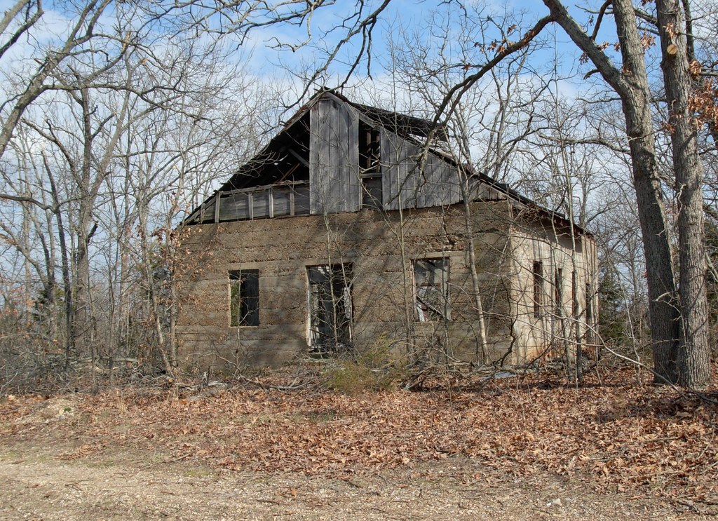
| Description | : | Richwood Township, Section 9, Township 38 North, Range 13 West, Miller County, MO. Take Hwy EE out of Iberia and go approximately 4.5 miles to Redbud Road. There is an old church on the left side of the road. The lone burial is a short distance behind the church. |
frequently asked questions (FAQ):
-
Where is Oak View Cemetery?
Oak View Cemetery is located at Iberia, Miller County ,Missouri ,USA.
-
Oak View Cemetery cemetery's updated grave count on graveviews.com?
0 memorials
-
Where are the coordinates of the Oak View Cemetery?
Latitude: 38.0608700
Longitude: -92.3375300
Nearby Cemetories:
1. Pleasant Hill Christian Church Cemetery
Iberia, Miller County, USA
Coordinate: 38.0479800, -92.3376400
2. Rankin Wright Cemetery
Iberia, Miller County, USA
Coordinate: 38.0666100, -92.3588000
3. Madden Cemetery
Miller County, USA
Coordinate: 38.0388010, -92.3073630
4. Ralph Duncan Farm Cemetery
Miller County, USA
Coordinate: 38.0249300, -92.3354300
5. Tallman Cemetery
Miller County, USA
Coordinate: 38.0644800, -92.2902700
6. Bievans Cemetery
Miller County, USA
Coordinate: 38.0654090, -92.2877100
7. Curry Cemetery
Iberia, Miller County, USA
Coordinate: 38.0464400, -92.3917400
8. Iberia Cemetery
Iberia, Miller County, USA
Coordinate: 38.0911680, -92.2839720
9. Williams Cemetery
Miller County, USA
Coordinate: 38.0791900, -92.4043800
10. Billingsley Cemetery
Iberia, Miller County, USA
Coordinate: 38.0756342, -92.2600151
11. Ralph Christeson Farm Cemetery
Crocker, Pulaski County, USA
Coordinate: 37.9998827, -92.3149395
12. Hickory Point Cemetery
Iberia, Miller County, USA
Coordinate: 38.1239200, -92.3824700
13. Hawkeye Cemetery
Hawkeye, Pulaski County, USA
Coordinate: 38.0024900, -92.3937300
14. Concord Cemetery
Crocker, Pulaski County, USA
Coordinate: 37.9871400, -92.3566100
15. Livingston Cemetery
Iberia, Miller County, USA
Coordinate: 38.1368700, -92.3401200
16. Miles Cemetery
Pulaski County, USA
Coordinate: 37.9916992, -92.3807983
17. Bethany Memorial Gardens
Crocker, Pulaski County, USA
Coordinate: 38.0091070, -92.2635760
18. Mount Union Cemetery
Brumley, Miller County, USA
Coordinate: 38.0614200, -92.4375400
19. Jarrett Cemetery
Iberia, Miller County, USA
Coordinate: 38.1475300, -92.3125300
20. Union Cemetery
Brays, Miller County, USA
Coordinate: 38.1126300, -92.2425600
21. Brays Cemetery
Brays, Miller County, USA
Coordinate: 38.1209800, -92.2419600
22. Pemberton Cemetery
Pulaski County, USA
Coordinate: 37.9763985, -92.4013977
23. Hawkins Cemetery
Brumley, Miller County, USA
Coordinate: 38.1006012, -92.4567032
24. Alder Springs Cemetery
Miller County, USA
Coordinate: 38.0748900, -92.2082200

