
| Memorials | : | 1 |
| Location | : | Ellsworth, Grafton County, USA |
| Coordinate | : | 43.8738890, -71.7430560 |
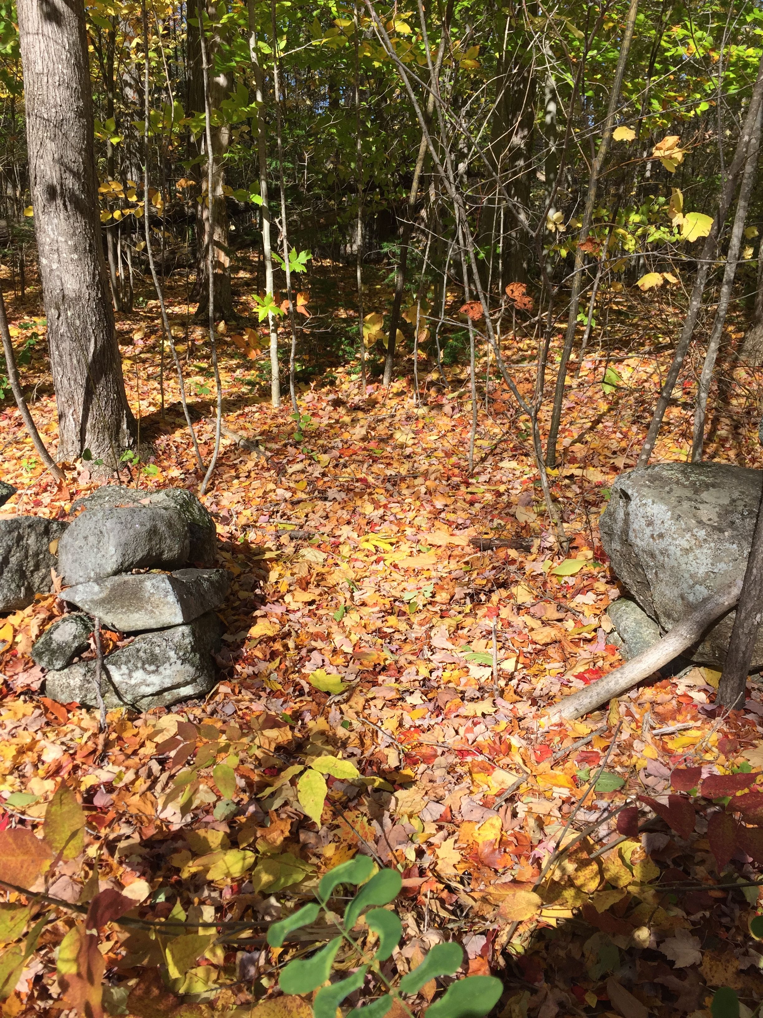
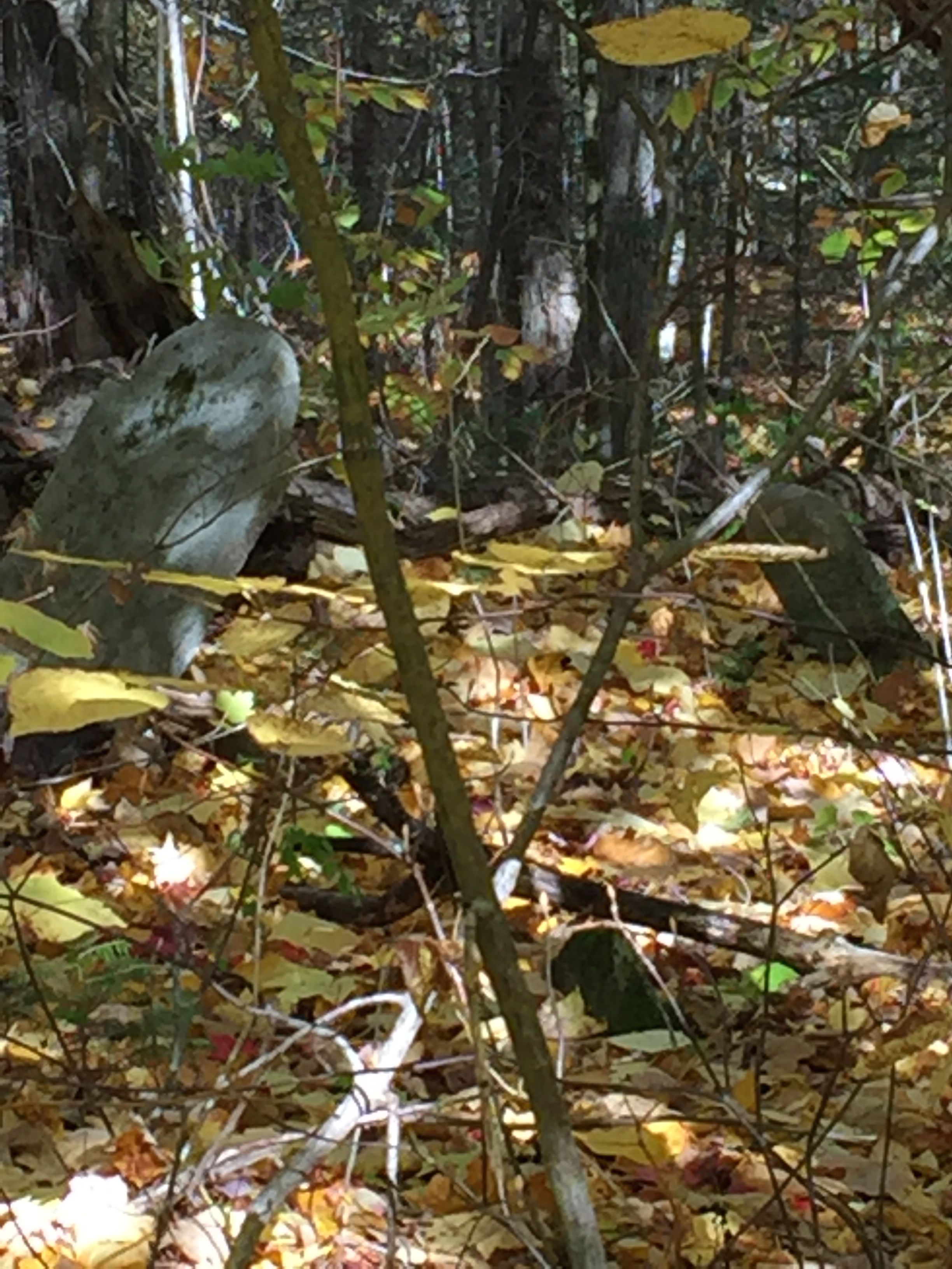
| Description | : | Ellsworth NH Old Baptist Church Cemetery , Stinson Lake Road, Ellsworth NH. [Called "Downing Cemetery" on old deeds.] Land for church given by Gideon Hill in 1824. Land for cemetery given by Gideon Hill prior to 1824. Now all grown to large timber and many plain field stone markers with no inscriptions. Many graves no markers, evident only by surface conditions. New Hampshire Old Graveyard Association database cemetery code E05-003 |
frequently asked questions (FAQ):
-
Where is Old Baptist Church Cemetery?
Old Baptist Church Cemetery is located at Ellsworth Hill Road Ellsworth, Grafton County ,New Hampshire , 03223USA.
-
Old Baptist Church Cemetery cemetery's updated grave count on graveviews.com?
1 memorials
-
Where are the coordinates of the Old Baptist Church Cemetery?
Latitude: 43.8738890
Longitude: -71.7430560
Nearby Cemetories:
1. Pease Cemetery
Ellsworth, Grafton County, USA
Coordinate: 43.8741100, -71.7382000
2. Avery Cemetery
Ellsworth, Grafton County, USA
Coordinate: 43.8805600, -71.7511200
3. West Campton Cemetery
Grafton County, USA
Coordinate: 43.8622220, -71.7052780
4. Blake Cemetery
Stinson Lake, Grafton County, USA
Coordinate: 43.8827780, -71.7975000
5. Partridge Hill Cemetery
West Campton, Grafton County, USA
Coordinate: 43.8428700, -71.7046900
6. East Rumney
Rumney, Grafton County, USA
Coordinate: 43.8236110, -71.7483330
7. Yeaton Cemetery
Thornton, Grafton County, USA
Coordinate: 43.8963800, -71.6794500
8. Blake Mountain Cemetery
Thornton, Grafton County, USA
Coordinate: 43.8963600, -71.6794200
9. West Thornton Cemetery
Thornton, Grafton County, USA
Coordinate: 43.8997200, -71.6805600
10. Town Line Cemetery
Campton, Grafton County, USA
Coordinate: 43.8614570, -71.6678870
11. Pine Grove Cemetery
Thornton, Grafton County, USA
Coordinate: 43.9060100, -71.6689000
12. Beech Hill Burying Ground
Campton, Grafton County, USA
Coordinate: 43.8000620, -71.7119690
13. Campton Village Cemetery
Campton, Grafton County, USA
Coordinate: 43.8654440, -71.6364380
14. Bog Road Cemetery
Campton, Grafton County, USA
Coordinate: 43.8152149, -71.6666793
15. Rumney Cemetery
Rumney, Grafton County, USA
Coordinate: 43.8026100, -71.8037800
16. Highland Cemetery
Rumney, Grafton County, USA
Coordinate: 43.8020400, -71.8041500
17. Blaisdell Cemetery
Campton, Grafton County, USA
Coordinate: 43.8169440, -71.6555560
18. Blair Cemetery
Campton, Grafton County, USA
Coordinate: 43.8111000, -71.6603012
19. Immanuel Memorial Cemetery
Rumney, Grafton County, USA
Coordinate: 43.7991670, -71.8077780
20. Campton Hollow Cemetery
Campton Hollow, Grafton County, USA
Coordinate: 43.8238150, -71.6409440
21. Rumney Depot Cemetery
Rumney, Grafton County, USA
Coordinate: 43.7957800, -71.8201500
22. Mad River Cemetery
Thornton, Grafton County, USA
Coordinate: 43.8833670, -71.6077500
23. Pleasant Valley Cemetery
Plymouth, Grafton County, USA
Coordinate: 43.7741300, -71.7364600
24. Spencer Cemetery
Grafton County, USA
Coordinate: 43.7720080, -71.7455500