
| Memorials | : | 61 |
| Location | : | Campton Hollow, Grafton County, USA |
| Coordinate | : | 43.8238150, -71.6409440 |
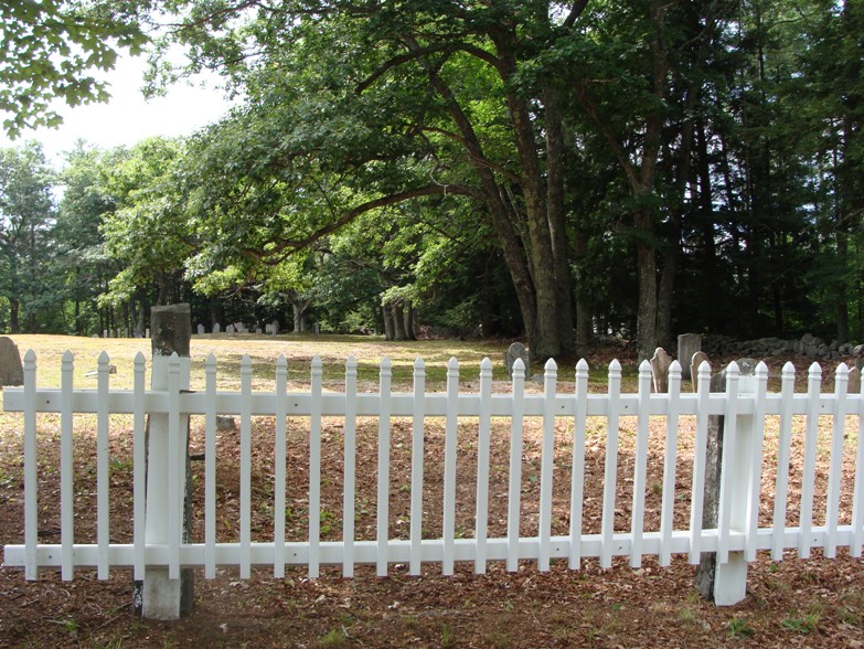
| Description | : | This cemetery is on the west side of 175 at a 90 degree turn near Perch Pond Road. There are two areas of burials, one to the east (near the road) and one that used to be fenced separately to the west. |
frequently asked questions (FAQ):
-
Where is Campton Hollow Cemetery?
Campton Hollow Cemetery is located at Campton Hollow, Grafton County ,New Hampshire ,USA.
-
Campton Hollow Cemetery cemetery's updated grave count on graveviews.com?
61 memorials
-
Where are the coordinates of the Campton Hollow Cemetery?
Latitude: 43.8238150
Longitude: -71.6409440
Nearby Cemetories:
1. Blaisdell Cemetery
Campton, Grafton County, USA
Coordinate: 43.8169440, -71.6555560
2. Blair Cemetery
Campton, Grafton County, USA
Coordinate: 43.8111000, -71.6603012
3. Bog Road Cemetery
Campton, Grafton County, USA
Coordinate: 43.8152149, -71.6666793
4. Eastern Corner Road Cemetery
Campton, Grafton County, USA
Coordinate: 43.8177540, -71.6045920
5. Campton Village Cemetery
Campton, Grafton County, USA
Coordinate: 43.8654440, -71.6364380
6. Town Line Cemetery
Campton, Grafton County, USA
Coordinate: 43.8614570, -71.6678870
7. Partridge Hill Cemetery
West Campton, Grafton County, USA
Coordinate: 43.8428700, -71.7046900
8. Beech Hill Burying Ground
Campton, Grafton County, USA
Coordinate: 43.8000620, -71.7119690
9. West Campton Cemetery
Grafton County, USA
Coordinate: 43.8622220, -71.7052780
10. Riverside Cemetery
Plymouth, Grafton County, USA
Coordinate: 43.7736000, -71.6908100
11. Mad River Cemetery
Thornton, Grafton County, USA
Coordinate: 43.8833670, -71.6077500
12. Sanborn Cemetery
Holderness, Grafton County, USA
Coordinate: 43.7612800, -71.6050600
13. Trinity Churchyard Cemetery
Holderness, Grafton County, USA
Coordinate: 43.7566000, -71.6696700
14. Ladd Cemetery
Holderness, Grafton County, USA
Coordinate: 43.7873700, -71.5506400
15. True Cemetery
Holderness, Grafton County, USA
Coordinate: 43.7819440, -71.5538890
16. East Rumney
Rumney, Grafton County, USA
Coordinate: 43.8236110, -71.7483330
17. Blake Mountain Cemetery
Thornton, Grafton County, USA
Coordinate: 43.8963600, -71.6794200
18. Yeaton Cemetery
Thornton, Grafton County, USA
Coordinate: 43.8963800, -71.6794500
19. Church Hill Cemetery
Ashland, Grafton County, USA
Coordinate: 43.7455560, -71.6522220
20. West Thornton Cemetery
Thornton, Grafton County, USA
Coordinate: 43.8997200, -71.6805600
21. Shaw Cemetery
Holderness, Grafton County, USA
Coordinate: 43.7436110, -71.6225000
22. Packard Graveyard
Thornton, Grafton County, USA
Coordinate: 43.8971540, -71.5845930
23. Burleigh-Carr Cemetery
Holderness, Grafton County, USA
Coordinate: 43.7583600, -71.5675200
24. Pine Grove Cemetery
Thornton, Grafton County, USA
Coordinate: 43.9060100, -71.6689000