
| Memorials | : | 14 |
| Location | : | Norwich, City of Norwich, England |
| Coordinate | : | 52.6627000, 1.2969770 |
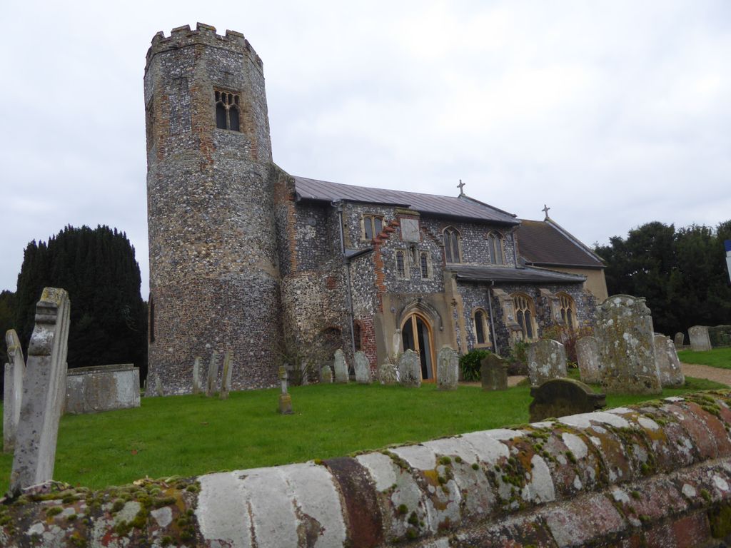
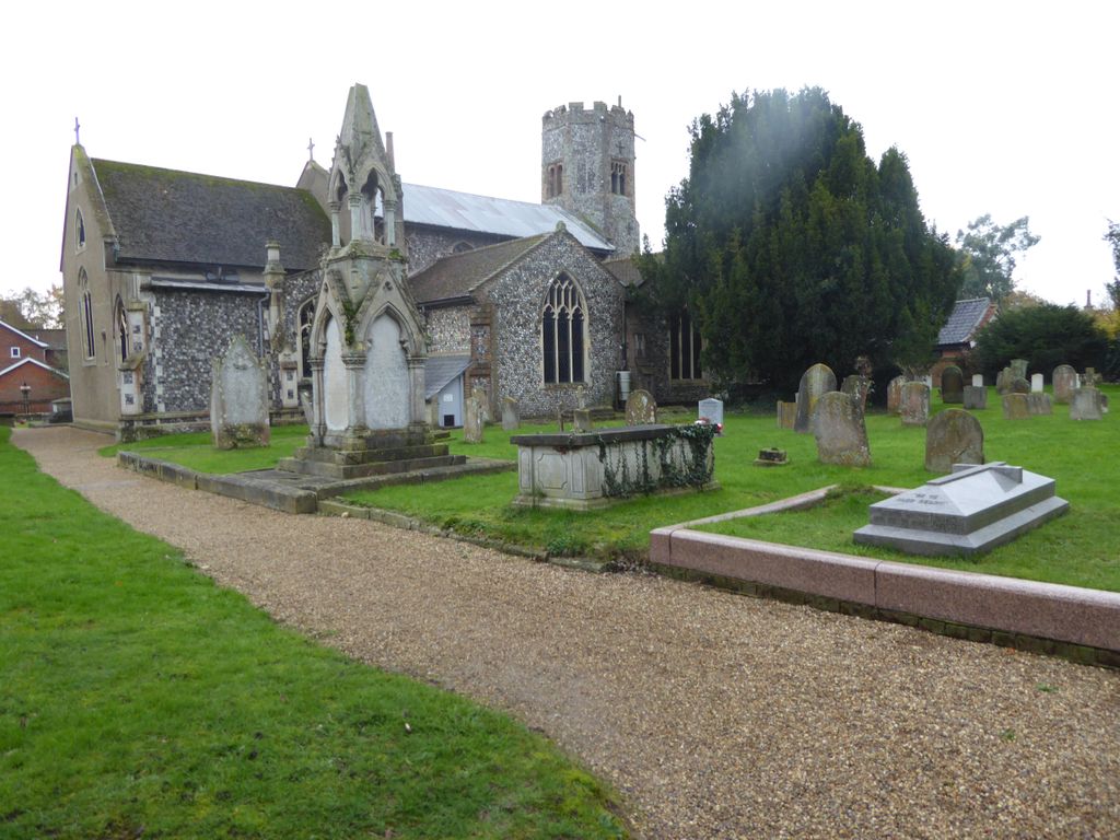
| Description | : | Old Catton is a suburban village and civil parish in the English county of Norfolk which lies 2 miles (3.2 km) to the north-east of central Norwich. The parish is bounded by the Norwich International Airport at Hellesdon to the west and Sprowston to the east. The northern boundary is with the village of Spixworth while the A1042 road forms the southern boundary. The Church of St Margaret, is a round tower flint design with extensions. The tower is built of flint with an octagonal top of brick and flint which was fashionable in the 15th century. The majority of the... Read More |
frequently asked questions (FAQ):
-
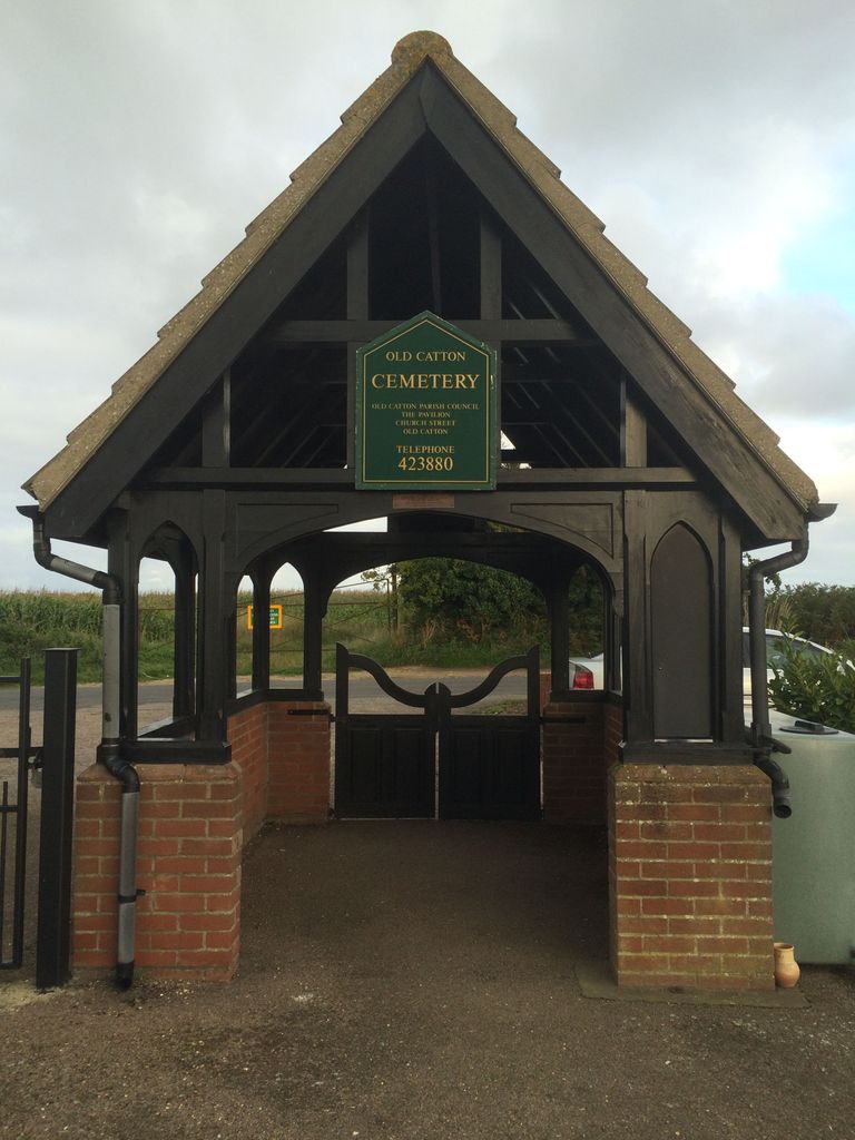
Where is Old Catton Churchyard?
Old Catton Churchyard is located at Norwich, City of Norwich ,Norfolk ,England.
-
Old Catton Churchyard cemetery's updated grave count on graveviews.com?
14 memorials
-
Where are the coordinates of the Old Catton Churchyard?
Latitude: 52.6627000
Longitude: 1.2969770
Nearby Cemetories:
1. St. Margaret's Churchyard
Catton, Broadland District, England
Coordinate: 52.6626280, 1.2970190
2. St. Mary and St. Margaret Churchyard
Sprowston, Broadland District, England
Coordinate: 52.6635430, 1.3248800
3. Sprowston Cemetery
Sprowston, Broadland District, England
Coordinate: 52.6644440, 1.3249400
4. Christ Churchyard, New Catton
Norwich, City of Norwich, England
Coordinate: 52.6438540, 1.2977320
5. St. Augustine's Churchyard
Norwich, City of Norwich, England
Coordinate: 52.6371000, 1.2925960
6. St. Bartholomew's Churchyard Heigham
Norwich, City of Norwich, England
Coordinate: 52.6401560, 1.2743680
7. Quaker Burial Ground
Norwich, City of Norwich, England
Coordinate: 52.6361120, 1.2914810
8. St James with Pockthorpe Churchyard
Norwich, City of Norwich, England
Coordinate: 52.6359070, 1.3001060
9. Horsham St. Faith cemetery
Horsham St Faith, Broadland District, England
Coordinate: 52.6870250, 1.2758110
10. St. Saviour Churchyard
Norwich, City of Norwich, England
Coordinate: 52.6351710, 1.2968890
11. Whitefriars
Norwich, City of Norwich, England
Coordinate: 52.6351750, 1.3006400
12. Norwich Prison
Norwich, City of Norwich, England
Coordinate: 52.6377840, 1.3174000
13. St. Mary and St. Andrew Churchyard
Horsham St Faith, Broadland District, England
Coordinate: 52.6880970, 1.2771330
14. St. Martin at Oak Church
Norwich, City of Norwich, England
Coordinate: 52.6348420, 1.2901930
15. St. Edmund's Churchyard
Norwich, City of Norwich, England
Coordinate: 52.6342780, 1.2989640
16. Horsham St. Faith Priory
Horsham St Faith, Broadland District, England
Coordinate: 52.6888310, 1.2783290
17. St Mary Coslany Churchyard
Norwich, City of Norwich, England
Coordinate: 52.6341180, 1.2914040
18. Old Meeting House
Norwich, City of Norwich, England
Coordinate: 52.6338830, 1.2956790
19. St. Julian Churchyard
Norwich, City of Norwich, England
Coordinate: 52.6336490, 1.3010100
20. St. Martin at Palace Church
Norwich, City of Norwich, England
Coordinate: 52.6335450, 1.3017730
21. St. Clement the Martyr Churchyard
Norwich, City of Norwich, England
Coordinate: 52.6332670, 1.2966570
22. St George Colegate Church
Norwich, City of Norwich, England
Coordinate: 52.6332060, 1.2940200
23. St. Michael of Closany Churchyard
Norwich, City of Norwich, England
Coordinate: 52.6329950, 1.2914510
24. Saint Michael Coslany Parish Churchyard
Norwich, City of Norwich, England
Coordinate: 52.6329420, 1.2914110