
| Memorials | : | 13 |
| Location | : | Harvey County, USA |
| Coordinate | : | 38.0128870, -97.1859870 |
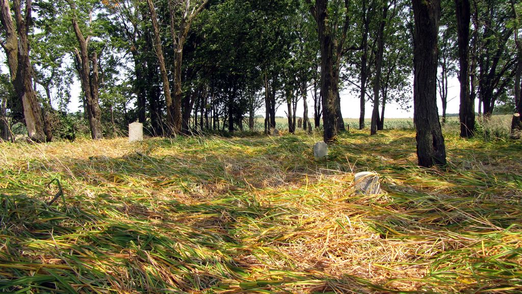
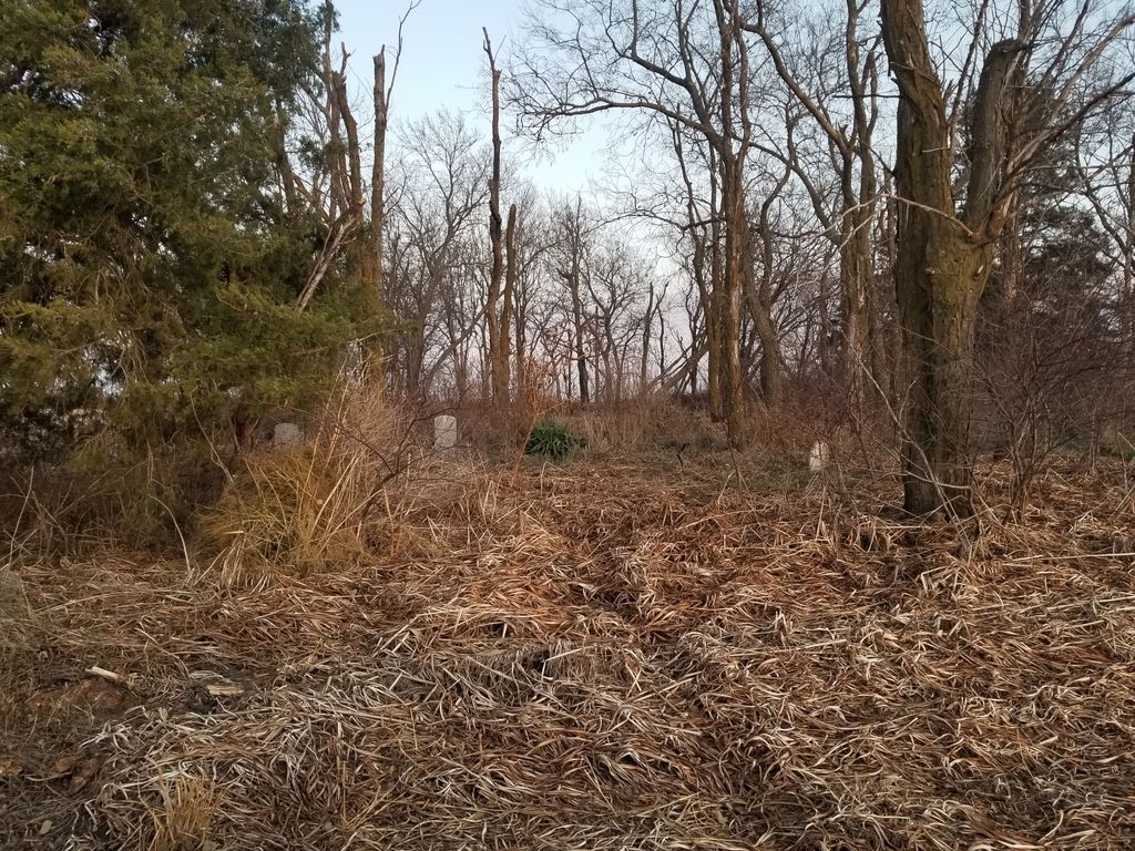
| Description | : | The Old Grace Hill Mennonite Church is about 1/4 mile west, south 1 mile, and 1/4 east of Grace Hill Mennonite Church Cemetery. There are two groves of trees back in the field to the south and this cemetery is in the larger grove. very overgrown and unkempt. Dead trees have fallen and it looks like someone planted maybe lillies years ago, and they have taken over the whole cemetery. Only 9 upright headstones were visible. You also have to walk thru a farmers field to get to the cemetery. |
frequently asked questions (FAQ):
-
Where is Old Grace Hill Mennonite Church Cemetery?
Old Grace Hill Mennonite Church Cemetery is located at Harvey County ,Kansas ,USA.
-
Old Grace Hill Mennonite Church Cemetery cemetery's updated grave count on graveviews.com?
13 memorials
-
Where are the coordinates of the Old Grace Hill Mennonite Church Cemetery?
Latitude: 38.0128870
Longitude: -97.1859870

Nearby Cemetories:
1. Grace Hill Mennonite Church Cemetery
Harvey County, USA
Coordinate: 38.0289800, -97.1803300
2. Horace Hayes Gravesite
Newton, Harvey County, USA
Coordinate: 38.0435950, -97.1757810
3. Missionary Church Cemetery
Harvey County, USA
Coordinate: 38.0581017, -97.1622009
4. Swiss Cemetery
Whitewater, Butler County, USA
Coordinate: 37.9799995, -97.1343994
5. Whitewater Cemetery
Harvey County, USA
Coordinate: 37.9550018, -97.1699982
6. Joseph Golden Gravesite
Annelly, Harvey County, USA
Coordinate: 37.9698700, -97.2456600
7. Harvey County Memorial
Newton, Harvey County, USA
Coordinate: 38.0716090, -97.2184190
8. Pleasant View Cemetery
Elbing, Butler County, USA
Coordinate: 38.0499992, -97.1153030
9. Emmaus Mennonite Church Cemetery
Whitewater, Butler County, USA
Coordinate: 37.9855200, -97.0989400
10. Harder Cemetery
Brainerd, Butler County, USA
Coordinate: 37.9593800, -97.1161600
11. Zion Cemetery
Elbing, Butler County, USA
Coordinate: 38.0783005, -97.1160965
12. Emmaus Mennonite Church South Cemetery
Brainerd, Butler County, USA
Coordinate: 37.9569000, -97.0951000
13. Brainerd Cemetery
Brainerd, Butler County, USA
Coordinate: 37.9566994, -97.0932999
14. Fairmount Lonestar Cemetery
Butler County, USA
Coordinate: 38.0285500, -97.0514200
15. Greenwood Cemetery
Newton, Harvey County, USA
Coordinate: 38.0443993, -97.3249969
16. Saint Marys Cemetery
Newton, Harvey County, USA
Coordinate: 38.0419006, -97.3277969
17. Shalom Mennonite Church Memory Garden
Newton, Harvey County, USA
Coordinate: 38.0429870, -97.3316650
18. Boot Hill
Newton, Harvey County, USA
Coordinate: 38.0426220, -97.3343410
19. Adams Family Cemetery
Butler County, USA
Coordinate: 37.9850311, -97.0330963
20. Walton Cemetery
Walton, Harvey County, USA
Coordinate: 38.1302986, -97.2533035
21. Green Valley Cemetery
Furley, Sedgwick County, USA
Coordinate: 37.8842010, -97.1694031
22. Bethel College Columbarium
North Newton, Harvey County, USA
Coordinate: 38.0730000, -97.3420000
23. Haldeman Cemetery
Butler County, USA
Coordinate: 37.9989014, -97.0132980
24. Saint Matthew's Episcopal Church Columbarium
Newton, Harvey County, USA
Coordinate: 38.0663870, -97.3486940