
| Memorials | : | 0 |
| Location | : | Harlan, Smith County, USA |
| Coordinate | : | 39.6153520, -98.7632390 |
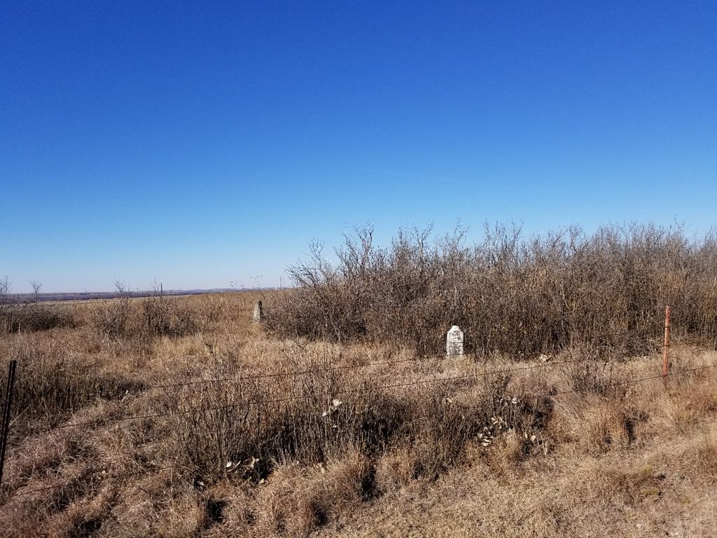
| Description | : | From Harlan, Kansas, go north on Q Road thru Harlan and the curves; go approx. 1/4 mile and the cemetery is at the top of the hill towards the north in the pasture. Permission must be gotten before going into the pasture. The site is underlain with solid rock, which made digging very difficult, so the cemetery was gradually abandoned. As common for these old cemeteries that have not been cared for, many stones are broken and many graves have no markers left. |
frequently asked questions (FAQ):
-
Where is Old Harlan Cemetery?
Old Harlan Cemetery is located at Harlan, Smith County ,Kansas ,USA.
-
Old Harlan Cemetery cemetery's updated grave count on graveviews.com?
0 memorials
-
Where are the coordinates of the Old Harlan Cemetery?
Latitude: 39.6153520
Longitude: -98.7632390
Nearby Cemetories:
1. Hammond Cemetery
Harlan, Smith County, USA
Coordinate: 39.5896500, -98.7479700
2. Garrett Cemetery
Harlan, Smith County, USA
Coordinate: 39.5873500, -98.7290900
3. Bell Cemetery
Smith Center, Smith County, USA
Coordinate: 39.6477700, -98.7102200
4. Lawrence Creek Cemetery
Portis, Osborne County, USA
Coordinate: 39.5541440, -98.8148290
5. Gaylord Cemetery
Gaylord, Smith County, USA
Coordinate: 39.6598300, -98.8416700
6. Fairview Cemetery
Portis, Osborne County, USA
Coordinate: 39.5388985, -98.7193985
7. Twelvemile Cemetery
Gaylord, Smith County, USA
Coordinate: 39.6293800, -98.6361800
8. Butler Cemetery
Osborne County, USA
Coordinate: 39.5400009, -98.8494034
9. Crystal Plains Cemetery
Smith Center, Smith County, USA
Coordinate: 39.6909714, -98.6730270
10. Christ Cemetery
Gaylord, Smith County, USA
Coordinate: 39.6988100, -98.8556700
11. Farnsworth Family Burial Ground
Portis, Osborne County, USA
Coordinate: 39.5486100, -98.6486100
12. Cedar Cemetery
Cedar, Smith County, USA
Coordinate: 39.6685982, -98.9310989
13. Custer Cemetery
Bellaire, Smith County, USA
Coordinate: 39.7350115, -98.6545141
14. Rose Valley Cemetery
Gaylord, Smith County, USA
Coordinate: 39.5748997, -98.5799270
15. Rose Valley Cemetery
Downs, Osborne County, USA
Coordinate: 39.5456009, -98.5905991
16. Saint John Lutheran Cemetery
Athol, Smith County, USA
Coordinate: 39.7269900, -98.8971600
17. Bloomington Cemetery
Bloomington, Osborne County, USA
Coordinate: 39.4669800, -98.8120800
18. Parse Homestead Cemetery
Bellaire, Smith County, USA
Coordinate: 39.7269800, -98.6245300
19. Bethany Center Cemetery
Portis, Osborne County, USA
Coordinate: 39.4947014, -98.6374969
20. Leasburg Cemetery
Cedar, Smith County, USA
Coordinate: 39.5819016, -98.9728012
21. Osborne Cemetery
Osborne, Osborne County, USA
Coordinate: 39.4514008, -98.7138977
22. Saint Francis Catholic Cemetery
Cedar, Smith County, USA
Coordinate: 39.6328011, -98.9816971
23. Saint Aloysius Cemetery
Osborne, Osborne County, USA
Coordinate: 39.4536018, -98.6903000
24. South Oak Creek Cemetery
Lebanon, Smith County, USA
Coordinate: 39.6439018, -98.5410995