
| Memorials | : | 4 |
| Location | : | Loose Creek, Osage County, USA |
| Coordinate | : | 38.5100520, -91.9497730 |
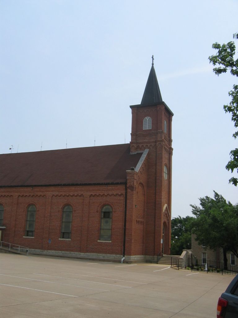
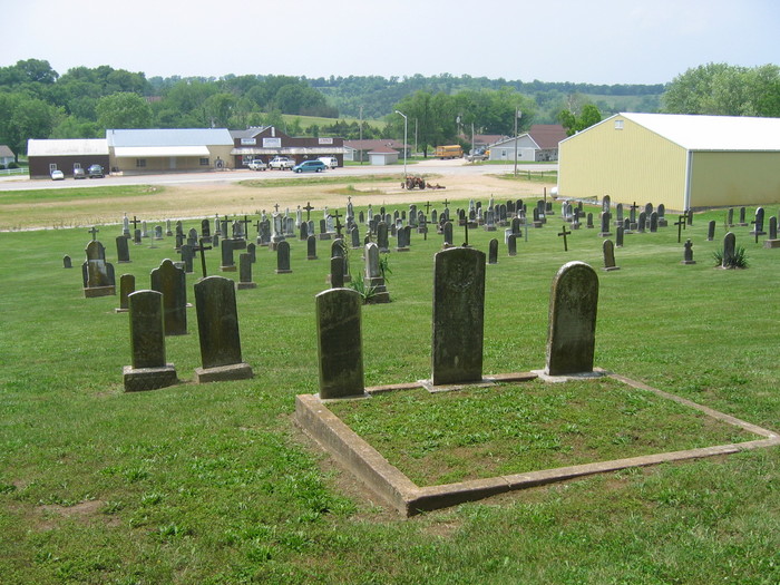
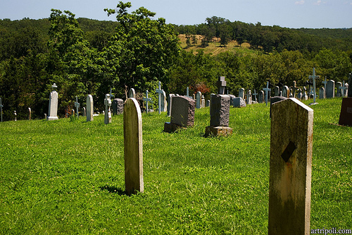
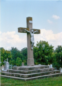
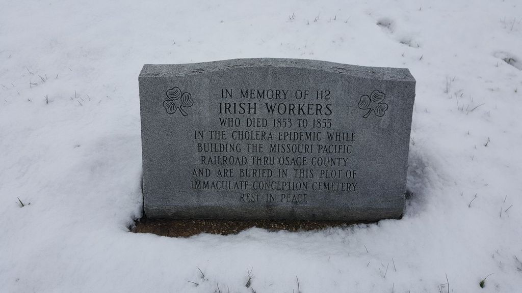
| Description | : | "Hubert Bescheinen, the owner of Bescheinen Furniture and Loose Creek Historian states that the Old Cemetery received burials from about 1850 until 1938 at which time all burials switched to the New Cemetery. Both cemeteries are known as Immaculate Conception Catholic Cemetery. The Old Cemetery next to the Church has no sign. The New Cemetery with burial from 1938 to the present has a large gate and is located about a mile from the old cemetery outside town. Information from Michael Stephen Jackson Contributor number 46629610 Population for Loose Creek, Missouri in 2010 was 835." |
frequently asked questions (FAQ):
-
Where is Old Immaculate Conception Catholic Cemetery?
Old Immaculate Conception Catholic Cemetery is located at Highway 402 Loose Creek, Osage County ,Missouri ,USA.
-
Old Immaculate Conception Catholic Cemetery cemetery's updated grave count on graveviews.com?
4 memorials
-
Where are the coordinates of the Old Immaculate Conception Catholic Cemetery?
Latitude: 38.5100520
Longitude: -91.9497730
Nearby Cemetories:
1. Immaculate Conception Cemetery
Loose Creek, Osage County, USA
Coordinate: 38.5189018, -91.9533005
2. Cadet Creek Cemetery
Loose Creek, Osage County, USA
Coordinate: 38.5367012, -91.9828033
3. Voshall Cemetery
Linn, Osage County, USA
Coordinate: 38.5216900, -91.8877390
4. Stony Ridge Cemetery
Bonnots Mill, Osage County, USA
Coordinate: 38.5700850, -91.9706080
5. Verdot Cemetery
Bonnots Mill, Osage County, USA
Coordinate: 38.5764008, -91.9546967
6. Saint Louis Catholic Church Cemetery
Bonnots Mill, Osage County, USA
Coordinate: 38.5771000, -91.9551000
7. McKnight Cemetery
Bonnots Mill, Osage County, USA
Coordinate: 38.5780890, -91.9648950
8. Smith Cemetery
Osage County, USA
Coordinate: 38.5750008, -91.9100037
9. Saint John's Lutheran Church Cemetery
Schubert, Cole County, USA
Coordinate: 38.5181999, -92.0476990
10. St. Joseph's Catholic Cemetery New
Westphalia, Osage County, USA
Coordinate: 38.4390496, -91.9922341
11. Linn Public Cemetery
Linn, Osage County, USA
Coordinate: 38.4892006, -91.8531036
12. Saint Josephs Catholic Cemetery Old
Westphalia, Osage County, USA
Coordinate: 38.4388070, -91.9923360
13. Laughlin Cemetery
Osage County, USA
Coordinate: 38.5583000, -91.8692017
14. Our Lady of Help Cemetery
Osage County, USA
Coordinate: 38.5778008, -91.8930969
15. Garden of Gethsemane Cemetery
Frankenstein, Osage County, USA
Coordinate: 38.5778900, -91.8928800
16. Mayberry Cemetery
Osage City, Cole County, USA
Coordinate: 38.5594910, -92.0361690
17. Our Lady Help of Christians Parish Cemetery
Frankenstein, Osage County, USA
Coordinate: 38.5754300, -91.8823310
18. Groves Cemetery
Bonnots Mill, Osage County, USA
Coordinate: 38.5945734, -91.9305483
19. Forest Hill Cemetery
Osage City, Cole County, USA
Coordinate: 38.5374985, -92.0563965
20. Saint George Cemetery
Linn, Osage County, USA
Coordinate: 38.4771700, -91.8373400
21. Old Saint Xaviers Catholic Church Cemetery
Taos, Cole County, USA
Coordinate: 38.5059390, -92.0715080
22. Van Buren Cemetery
Linn, Osage County, USA
Coordinate: 38.4261017, -91.8831024
23. New Saint Xaviers Catholic Church Cemetery
Taos, Cole County, USA
Coordinate: 38.5052986, -92.0802994
24. Perrey Cemetery
Osage County, USA
Coordinate: 38.5283012, -91.8202972