| Memorials | : | 0 |
| Location | : | Taos, Cole County, USA |
| Phone | : | 573-395-4401 |
| Website | : | members.socket.net/~sfxschool/index.html |
| Coordinate | : | 38.5059390, -92.0715080 |
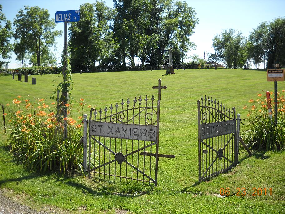
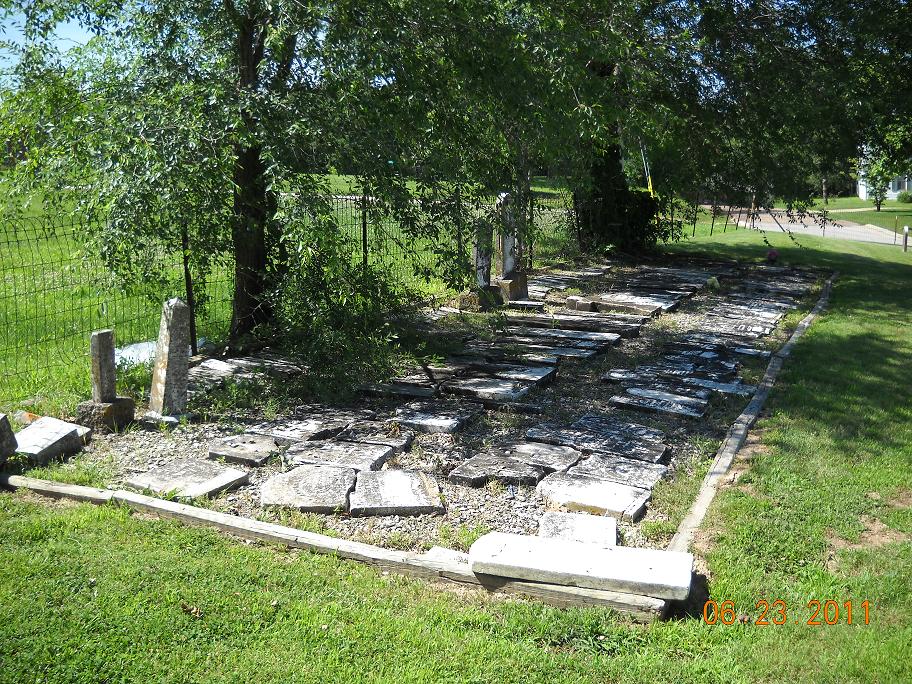
| Description | : | Pre-1900. Most of the stones have been removed to a section at the back of the cemetery where they are all laying in a row. |
frequently asked questions (FAQ):
-
Where is Old Saint Xaviers Catholic Church Cemetery?
Old Saint Xaviers Catholic Church Cemetery is located at Hwy M & 5000 S. Helias Dr Taos, Cole County ,Missouri , 65101USA.
-
Old Saint Xaviers Catholic Church Cemetery cemetery's updated grave count on graveviews.com?
0 memorials
-
Where are the coordinates of the Old Saint Xaviers Catholic Church Cemetery?
Latitude: 38.5059390
Longitude: -92.0715080
Nearby Cemetories:
1. New Saint Xaviers Catholic Church Cemetery
Taos, Cole County, USA
Coordinate: 38.5052986, -92.0802994
2. Saint John's Lutheran Church Cemetery
Schubert, Cole County, USA
Coordinate: 38.5181999, -92.0476990
3. Forest Hill Cemetery
Osage City, Cole County, USA
Coordinate: 38.5374985, -92.0563965
4. Walther Cemetery
Jefferson City, Cole County, USA
Coordinate: 38.5527820, -92.0844109
5. Wolfrum Cemetery
Cole County, USA
Coordinate: 38.5368996, -92.1213989
6. August Henry Family Cemetery
Jefferson City, Cole County, USA
Coordinate: 38.5414510, -92.1174150
7. Mayberry Cemetery
Osage City, Cole County, USA
Coordinate: 38.5594910, -92.0361690
8. Rice-Sone Cemetery
Jefferson City, Cole County, USA
Coordinate: 38.5115900, -92.1658000
9. Ward Burial Grounds
Wardsville, Cole County, USA
Coordinate: 38.4912500, -92.1656900
10. Cadet Creek Cemetery
Loose Creek, Osage County, USA
Coordinate: 38.5367012, -91.9828033
11. Saint Stanislaus Catholic Church Cemetery
Wardsville, Cole County, USA
Coordinate: 38.4863450, -92.1756730
12. Mount Pleasant Cemetery
Callaway County, USA
Coordinate: 38.5877800, -92.0427800
13. Saint Anthony of Padua Cemetery
Folk, Osage County, USA
Coordinate: 38.4214320, -92.0990120
14. Enloe Cemetery
Wardsville, Cole County, USA
Coordinate: 38.4780360, -92.1772050
15. St. Joseph's Catholic Cemetery New
Westphalia, Osage County, USA
Coordinate: 38.4390496, -91.9922341
16. Saint Josephs Catholic Cemetery Old
Westphalia, Osage County, USA
Coordinate: 38.4388070, -91.9923360
17. Jefferson City National Cemetery
Jefferson City, Cole County, USA
Coordinate: 38.5660477, -92.1621857
18. Immaculate Conception Cemetery
Loose Creek, Osage County, USA
Coordinate: 38.5189018, -91.9533005
19. Woodland-Old City Cemetery
Jefferson City, Cole County, USA
Coordinate: 38.5674200, -92.1621070
20. Old Immaculate Conception Catholic Cemetery
Loose Creek, Osage County, USA
Coordinate: 38.5100520, -91.9497730
21. Ott Burial Ground
Wardsville, Cole County, USA
Coordinate: 38.4955560, -92.1930280
22. Missouri State Penitentiary Cemetery (Defunct)
Jefferson City, Cole County, USA
Coordinate: 38.5719130, -92.1612510
23. Lamkin Family Cemetery
Wardsville, Cole County, USA
Coordinate: 38.5318985, -92.1903000
24. Epperson Cemetery
Callaway County, USA
Coordinate: 38.6048400, -92.0790900


