| Memorials | : | 0 |
| Location | : | Velma, Stephens County, USA |
| Coordinate | : | 34.4653400, -97.6395200 |
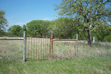
| Description | : | This cemetery is known locally as both "Old Jackson" and "Old Scott" cemetery. Directions to the cemetery: From Velma School, ub the City of Velma, go 2 miles east on old Oklahoma Highway 7 to Sosobee Road and urn north. Follow the road to the point where it turns back east (approxomately 1 mile). At this point to the west you will see a pasture gate. Follow the pasture road west, travelling between an existing fence and a row of old trees that mark where an old road once ran. Follow the pasture road for 5/10 mile to the cemetery. The... Read More |
frequently asked questions (FAQ):
-
Where is Old Jackson Cemetery?
Old Jackson Cemetery is located at Velma, Stephens County ,Oklahoma ,USA.
-
Old Jackson Cemetery cemetery's updated grave count on graveviews.com?
0 memorials
-
Where are the coordinates of the Old Jackson Cemetery?
Latitude: 34.4653400
Longitude: -97.6395200
Nearby Cemetories:
1. New Velma Cemetery
Velma, Stephens County, USA
Coordinate: 34.4624500, -97.6572700
2. Velma Cemetery
Velma, Stephens County, USA
Coordinate: 34.4624500, -97.6730800
3. Alma Cemetery
Alma, Stephens County, USA
Coordinate: 34.4328003, -97.6130981
4. Passmore Cemetery
Velma, Stephens County, USA
Coordinate: 34.4693985, -97.6892014
5. Nancy Tipps Gravesite
Stephens County, USA
Coordinate: 34.5088936, -97.6312400
6. Claud Cemetery
Stephens County, USA
Coordinate: 34.4972000, -97.6018982
7. Stewart Family Cemetery
Velma, Stephens County, USA
Coordinate: 34.4519000, -97.7151000
8. Tussy Cemetery
Tussy, Garvin County, USA
Coordinate: 34.5073000, -97.5475600
9. Ratliff City Cemetery
Ratliff City, Carter County, USA
Coordinate: 34.4544870, -97.5130550
10. Parks Cemetery
Stephens County, USA
Coordinate: 34.3950005, -97.7382965
11. Mountain Grove Cemetery
Loco, Stephens County, USA
Coordinate: 34.3582993, -97.6607971
12. Dripping Springs Cemetery
Pernell, Garvin County, USA
Coordinate: 34.5161018, -97.5177994
13. Monk Cemetery
Ratliff City, Carter County, USA
Coordinate: 34.4580994, -97.4925003
14. Robberson Cemetery
Garvin County, USA
Coordinate: 34.5477982, -97.5302963
15. Sandy Bear Cemetery
Stephens County, USA
Coordinate: 34.5710983, -97.5631027
16. Owens Prairie Cemetery
Stephens County, USA
Coordinate: 34.5797005, -97.7161026
17. Tatums Cemetery
Tatums, Carter County, USA
Coordinate: 34.4674988, -97.4738998
18. Loco Cemetery
Loco, Stephens County, USA
Coordinate: 34.3274994, -97.6682968
19. Cruce Cemetery
Stephens County, USA
Coordinate: 34.5311110, -97.7938880
20. Weaver Chapel Cemetery
Comanche, Stephens County, USA
Coordinate: 34.3905983, -97.8067017
21. Wyatt Chapel Cemetery
Foster, Garvin County, USA
Coordinate: 34.5699043, -97.4765396
22. Colbert Cemetery
Duncan, Stephens County, USA
Coordinate: 34.5654400, -97.8075000
23. Bear Creek Cemetery
Stephens County, USA
Coordinate: 34.6279200, -97.7087300
24. Center Point Cemetery
Ringling, Jefferson County, USA
Coordinate: 34.2900200, -97.6060900

