
| Memorials | : | 0 |
| Location | : | Harper, St. Clair County, USA |
| Coordinate | : | 38.1141900, -93.5168700 |
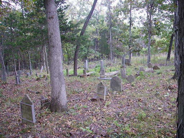
| Description | : | This cemetery is in a field near Harper and Iconium. At one time there was a Liberty church and school at this location also. These buildings were moved long ago and used at their new locations. The church was moved to Iconium. |
frequently asked questions (FAQ):
-
Where is Old Liberty Cemetery?
Old Liberty Cemetery is located at Harper, St. Clair County ,Missouri ,USA.
-
Old Liberty Cemetery cemetery's updated grave count on graveviews.com?
0 memorials
-
Where are the coordinates of the Old Liberty Cemetery?
Latitude: 38.1141900
Longitude: -93.5168700
Nearby Cemetories:
1. Suiter Cemetery
Fristoe, Benton County, USA
Coordinate: 38.1239900, -93.5010800
2. Iconium Cemetery
Iconium, St. Clair County, USA
Coordinate: 38.1032982, -93.5436020
3. Duke Farm Graves
Wisdom, Benton County, USA
Coordinate: 38.1341520, -93.4771840
4. Shiloh Cemetery
Warsaw, Benton County, USA
Coordinate: 38.1021270, -93.4717660
5. Freedom Missionary Baptist Church Cemetery
Warsaw, Benton County, USA
Coordinate: 38.1123200, -93.4664600
6. Hopewell Baptist Church Cemetery
Bentonville, Benton County, USA
Coordinate: 38.0822792, -93.4863586
7. Akin Cemetery
Warsaw, Benton County, USA
Coordinate: 38.1530991, -93.5000000
8. Bird Cemetery
Hickory County, USA
Coordinate: 38.0717010, -93.4819031
9. Cobb Cemetery
Benton County, USA
Coordinate: 38.0875015, -93.4552994
10. Harper Cemetery
Hickory County, USA
Coordinate: 38.0607986, -93.4981003
11. Wisdom Cemetery (Defunct)
Benton County, USA
Coordinate: 38.1775017, -93.4796982
12. Eversole Cemetery
Henry County, USA
Coordinate: 38.1791992, -93.5518723
13. Harris Bend Cemetery
St. Clair County, USA
Coordinate: 38.1794014, -93.5552979
14. L P Union Cemetery
Benton County, USA
Coordinate: 38.0958460, -93.4279700
15. Cunningham Farm Cemetery
Bentonville, Benton County, USA
Coordinate: 38.1425200, -93.4293700
16. Bernard Chapel Cemetery
Quincy, Hickory County, USA
Coordinate: 38.0479317, -93.4709091
17. Sheldon-Logan Cemetery
Osceola, St. Clair County, USA
Coordinate: 38.0624530, -93.5904260
18. Hogles Creek (defunct)
Warsaw, Benton County, USA
Coordinate: 38.1805200, -93.4554000
19. Garrison Cemetery
Osceola, St. Clair County, USA
Coordinate: 38.0601300, -93.5982600
20. Bear Creek Cemetery
Osceola, St. Clair County, USA
Coordinate: 38.0633011, -93.6053009
21. Blackwell Cemetery
Benton County, USA
Coordinate: 38.0703011, -93.4210968
22. Wisner Farm Cemetery #01
Osceola, St. Clair County, USA
Coordinate: 38.0745140, -93.6182790
23. Mount Zion Cemetery
Quincy, Hickory County, USA
Coordinate: 38.0280991, -93.4710999
24. Wisner Farm Cemetery #02
Osceola, St. Clair County, USA
Coordinate: 38.0587610, -93.6130430