
| Memorials | : | 1 |
| Location | : | Greensboro, Caroline County, USA |
| Coordinate | : | 38.9761000, -75.8045500 |
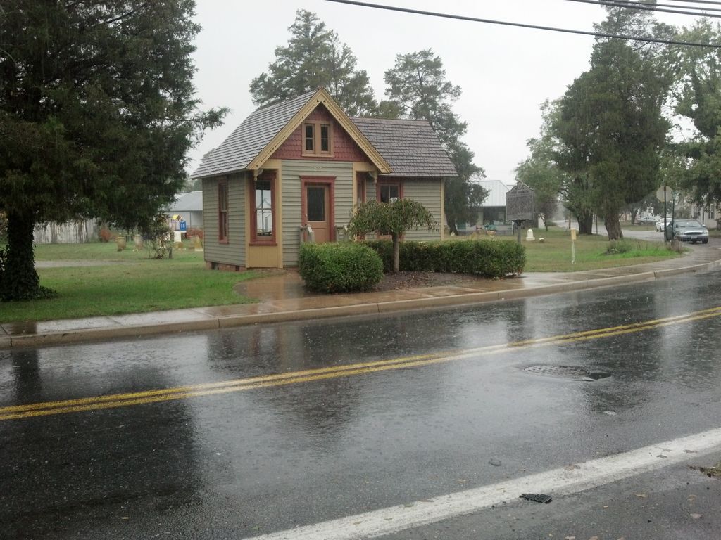
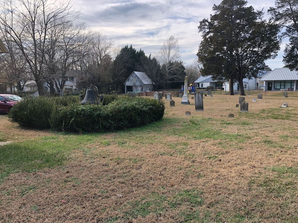
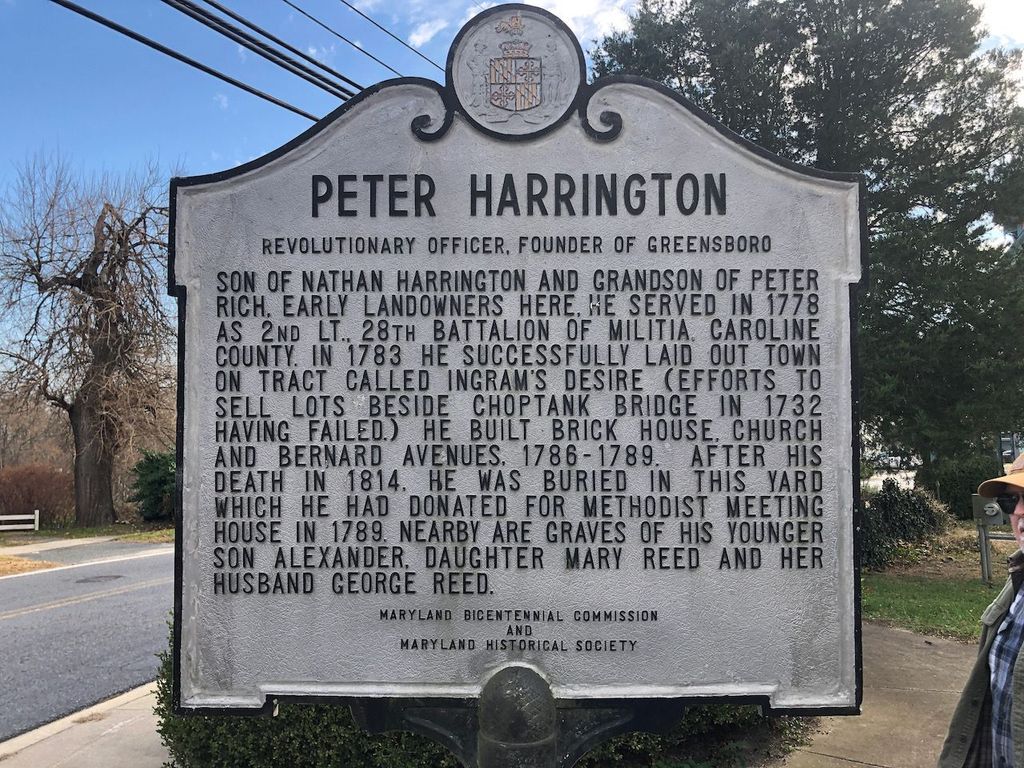
| Description | : | The Methodist Episcopal Church and cemetery: As early as 1775 the Society of Methodists was formed in Greensboro, or Choptank Bridge as it was then known. The meetings of this Society were held in the homes of the different members until ca 1789 when they purchased this land from Peter Harrington for five shillings, built a church upon it and established the adjacent cemetery. It was in the old church building that was erected on this site, located on the bank of the Choptank river, where many people had the opportunity to listen to Francis Asbury and Freeborn Garrettson, who... Read More |
frequently asked questions (FAQ):
-
Where is Old Methodist Church Cemetery?
Old Methodist Church Cemetery is located at 209 N. Main Street Greensboro, Caroline County ,Maryland , 21639USA.
-
Old Methodist Church Cemetery cemetery's updated grave count on graveviews.com?
1 memorials
-
Where are the coordinates of the Old Methodist Church Cemetery?
Latitude: 38.9761000
Longitude: -75.8045500
Nearby Cemetories:
1. Greensboro Cemetery
Greensboro, Caroline County, USA
Coordinate: 38.9707985, -75.8110962
2. Cokers Cemetery
Greensboro, Caroline County, USA
Coordinate: 38.9556890, -75.7966160
3. Charlie Miller Farm Graveyard
Greensboro, Caroline County, USA
Coordinate: 38.9886200, -75.7705300
4. Boon Cemetery
Greensboro, Caroline County, USA
Coordinate: 38.9699000, -75.8455000
5. Holy Cross Cemetery
Greensboro, Caroline County, USA
Coordinate: 38.9324989, -75.8193970
6. Hardcastle Family Cemetery at Castlebury
Ridgely, Caroline County, USA
Coordinate: 38.9395430, -75.8412780
7. Jarrell Family Cemetery
Bridgetown, Caroline County, USA
Coordinate: 39.0161900, -75.8351600
8. Jarman-Seward-Tucker Cemetery
Goldsboro, Caroline County, USA
Coordinate: 39.0237500, -75.8215700
9. Betsy Baynard Farm Cemetery
Goldsboro, Caroline County, USA
Coordinate: 39.0159200, -75.7596900
10. Union Memorial Cemetery
Goldsboro, Caroline County, USA
Coordinate: 39.0311012, -75.8210983
11. Massey Cemetery
Ridgely, Caroline County, USA
Coordinate: 38.9792700, -75.8839600
12. Cedar Grove Cemetery
Felton, Kent County, USA
Coordinate: 38.9806000, -75.7248000
13. Piney Branch Methodist Protestant Church Cemetery
Denton, Caroline County, USA
Coordinate: 38.9142804, -75.8174338
14. Lockerman ME Church Cemetery
Bridgetown, Caroline County, USA
Coordinate: 39.0145200, -75.8684200
15. Philemon Dill Family Plot
Felton, Kent County, USA
Coordinate: 38.9778410, -75.7230090
16. Whiteley Family Cemetery
Whiteleysburg, Kent County, USA
Coordinate: 38.9483060, -75.7310200
17. Peter Dill Family Plot
Edwardsville, Kent County, USA
Coordinate: 38.9803960, -75.7223590
18. Ridgely Cemetery
Ridgely, Caroline County, USA
Coordinate: 38.9439011, -75.8764038
19. Saint Gertrudes Cemetery
Ridgely, Caroline County, USA
Coordinate: 39.0036000, -75.8852800
20. Edwards Family Cemetery
Edwardsville, Kent County, USA
Coordinate: 38.9953500, -75.7097500
21. Castle Hall Cemetery
Goldsboro, Caroline County, USA
Coordinate: 39.0524520, -75.7854550
22. Collison Family Cemetery
Caroline County, USA
Coordinate: 38.8977430, -75.7841230
23. Hughes Family Plot
Whiteleysburg, Kent County, USA
Coordinate: 38.9725900, -75.6963300
24. Bridgetown M.E. Church Cemetery
Queen Anne's County, USA
Coordinate: 39.0331001, -75.8858032