| Memorials | : | 8 |
| Location | : | Welsh, Montgomery County, USA |
| Coordinate | : | 34.3618011, -93.4505005 |
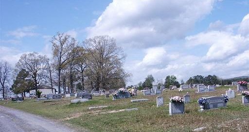
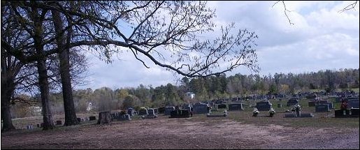
| Description | : | Old Mount Tabor Community Center/Church and Cemetery is on the east side of Old Mount Tabor Road, about 100 yards south of highway US-70. This maintained cemetery is in Montgomery County, Arkansas, has a zip code of 71943, has at least 2,000 existing interments, and is active. Old Mount Tabor road runs south (only) from US-70, only 0.3 mile west of the US-70/AR-182 intersection (road to Amity). Traveling east on US-70, it is 6 miles east of Glenwood (a town in Pike County) and 3.2 miles east of the Pike County/ Montgomery County line. Traveling west on US-70 from Hot... Read More |
frequently asked questions (FAQ):
-
Where is Old Mount Tabor Cemetery?
Old Mount Tabor Cemetery is located at Welsh, Montgomery County ,Arkansas , 71943USA.
-
Old Mount Tabor Cemetery cemetery's updated grave count on graveviews.com?
8 memorials
-
Where are the coordinates of the Old Mount Tabor Cemetery?
Latitude: 34.3618011
Longitude: -93.4505005
Nearby Cemetories:
1. Newcomb Cemetery
Montgomery County, USA
Coordinate: 34.3588982, -93.4625015
2. Adams-Woodall Cemetery
Montgomery County, USA
Coordinate: 34.3764000, -93.4344025
3. Ewing Cemetery
Montgomery County, USA
Coordinate: 34.3518982, -93.4080963
4. Franklin Cemetery
Clark County, USA
Coordinate: 34.3241420, -93.4317040
5. Seventh Day Adventist Cemetery
Bonnerdale, Hot Spring County, USA
Coordinate: 34.3617830, -93.3954750
6. Grants Chapel Cemetery
Bonnerdale, Hot Spring County, USA
Coordinate: 34.3867912, -93.3996887
7. Dillard Cemetery
Clark County, USA
Coordinate: 34.3211000, -93.4112490
8. Thompson Chapel Cemetery
Amity, Clark County, USA
Coordinate: 34.3058014, -93.4540024
9. Dillard Cemetery
Hot Spring County, USA
Coordinate: 34.3424988, -93.3846970
10. Bethel Cemetery
Glenwood, Pike County, USA
Coordinate: 34.3240500, -93.5059100
11. Shiloh Cemetery
Amity, Clark County, USA
Coordinate: 34.3272018, -93.3910980
12. Nelson Cemetery
Hickory Station, Montgomery County, USA
Coordinate: 34.3852997, -93.5192032
13. Caney Cemetery
Montgomery County, USA
Coordinate: 34.4143982, -93.4938965
14. Nicholson Cemetery
Montgomery County, USA
Coordinate: 34.3816986, -93.5278015
15. Diggs Cemetery
Caddo Gap, Montgomery County, USA
Coordinate: 34.3814430, -93.5283770
16. Howerton Cemetery
Montgomery County, USA
Coordinate: 34.4303017, -93.4516983
17. Mountain Home Cemetery
Hickory Station, Montgomery County, USA
Coordinate: 34.4016991, -93.5216980
18. Wacaster Cemetery
Montgomery County, USA
Coordinate: 34.4310989, -93.4096985
19. County Line Cemetery
Montgomery County, USA
Coordinate: 34.3507996, -93.5485992
20. Glenwood Cemetery
Glenwood, Pike County, USA
Coordinate: 34.3223400, -93.5431000
21. Sweet Home Cemetery
Amity, Clark County, USA
Coordinate: 34.2932170, -93.3797460
22. Coker Cemetery
Rosboro, Pike County, USA
Coordinate: 34.2806015, -93.4991989
23. Howton Cemetery
Montgomery County, USA
Coordinate: 34.4550018, -93.4439011
24. Amity Methodist Cemetery
Amity, Clark County, USA
Coordinate: 34.2653008, -93.4645996


