
| Memorials | : | 749 |
| Location | : | Springdale, Hamilton County, USA |
| Coordinate | : | 39.2805176, -84.4852905 |
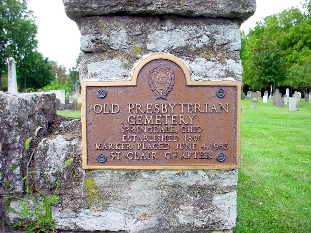
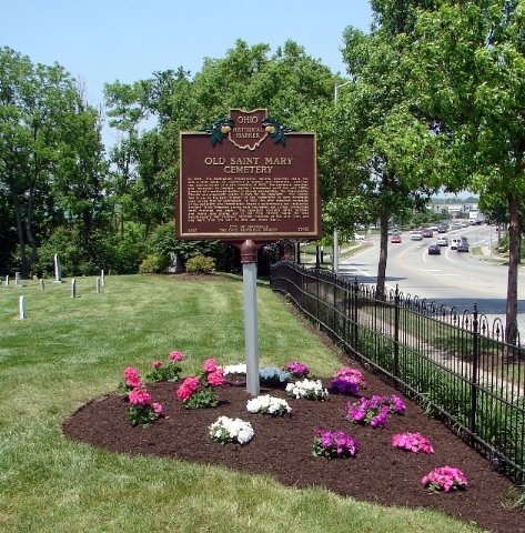
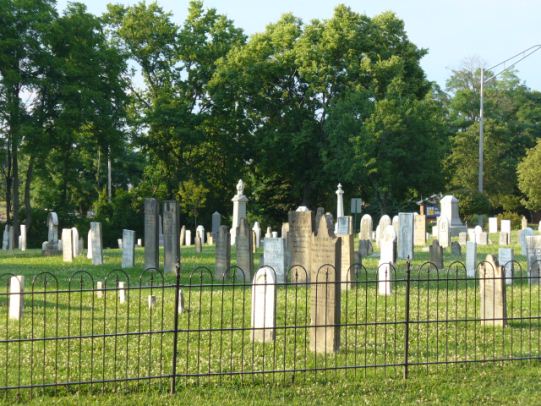
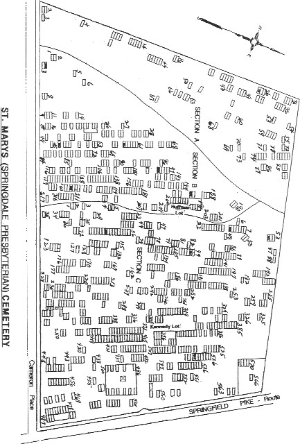
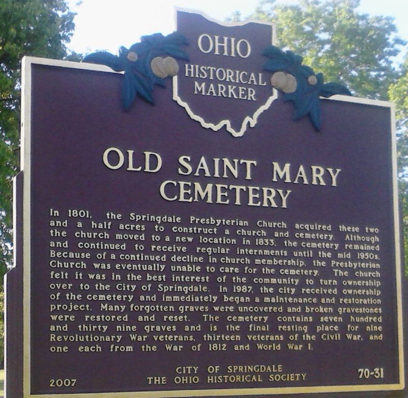
| Description | : | The Springdale Presbyterian Church acquired 2 ½ acres in 1801 at the current intersection of Route 4 and Cameron Rd. The purpose of the purchase was to construct a church and cemetery. In 1833, although the church moved to a different location, the cemetery remained at this location. In 1987, the Springdale Presbyterian Church transferred the ownership of the property to the City of Springdale. The cemetery had fallen into disrepair and neglect, since the church did not have the funds to properly maintain it. The city began a long restoration process, often bringing in Scouts to... Read More |
frequently asked questions (FAQ):
-
Where is Old Saint Marys Cemetery?
Old Saint Marys Cemetery is located at Springfield Pike (Ohio State Route 4) and Cameron Road Springdale, Hamilton County ,Ohio , 45246USA.
-
Old Saint Marys Cemetery cemetery's updated grave count on graveviews.com?
749 memorials
-
Where are the coordinates of the Old Saint Marys Cemetery?
Latitude: 39.2805176
Longitude: -84.4852905
Nearby Cemetories:
1. Glenmary Mission Seminary Cemetery (Defunct)
Springdale, Hamilton County, USA
Coordinate: 39.2828320, -84.4706510
2. Holy Rood Catholic Cemetery
Glendale, Hamilton County, USA
Coordinate: 39.2760380, -84.4696950
3. Christ Church Glendale Chapel Columbarium
Glendale, Hamilton County, USA
Coordinate: 39.2721430, -84.4660500
4. Oak Hill Cemetery
Glendale, Hamilton County, USA
Coordinate: 39.2797012, -84.4625015
5. Bethany Episcopal Day School Chapel Crypt
Glendale, Hamilton County, USA
Coordinate: 39.2657260, -84.4539850
6. Skillman Family Cemetery
Woodlawn, Hamilton County, USA
Coordinate: 39.2588654, -84.4576950
7. Mill Creek Presbyterian Churchyard
Glendale, Hamilton County, USA
Coordinate: 39.2636604, -84.4506836
8. Tucker Station Cemetery
Glendale, Hamilton County, USA
Coordinate: 39.2621500, -84.4506080
9. Cameron-Haines Family Cemetery
Forest Park, Hamilton County, USA
Coordinate: 39.2814407, -84.5322952
10. Landmark Memorial Gardens
Glendale, Hamilton County, USA
Coordinate: 39.2607300, -84.4442300
11. Stockton Cemetery
Fairfield, Butler County, USA
Coordinate: 39.3174720, -84.4955850
12. James Moore Family Cemetery
Wildbrook Acres, Hamilton County, USA
Coordinate: 39.2442741, -84.5157166
13. Beech Grove Cemetery
Springfield Township, Hamilton County, USA
Coordinate: 39.2364006, -84.4916992
14. LaRue-Gardner Family Cemetery
Wyoming Meadows, Hamilton County, USA
Coordinate: 39.2347603, -84.5071411
15. Smiley Cemetery
Pleasant Run, Hamilton County, USA
Coordinate: 39.3056300, -84.5423490
16. New Burlington Cemetery
Springfield Township, Hamilton County, USA
Coordinate: 39.2625008, -84.5468979
17. Sharonville Cemetery
Sharonville, Hamilton County, USA
Coordinate: 39.2683520, -84.4147250
18. Voorhees Family Burying Ground
Lockland, Hamilton County, USA
Coordinate: 39.2296982, -84.4480972
19. Saint Clare Convent Cemetery
Mount Healthy, Hamilton County, USA
Coordinate: 39.2206750, -84.4782390
20. Reading Cemetery
Reading, Hamilton County, USA
Coordinate: 39.2296982, -84.4419022
21. Whallon Burial Ground (Defunct)
Gano, Butler County, USA
Coordinate: 39.2983610, -84.4096920
22. Coleman Cemetery
Sharonville, Hamilton County, USA
Coordinate: 39.2705879, -84.4042892
23. Saints Peter And Paul Cemetery
Reading, Hamilton County, USA
Coordinate: 39.2308006, -84.4313965
24. Saint Marys Cemetery
Mount Healthy, Hamilton County, USA
Coordinate: 39.2329900, -84.5427000