
| Memorials | : | 0 |
| Location | : | Tompkinsville, Monroe County, USA |
| Coordinate | : | 36.7725840, -85.6538860 |
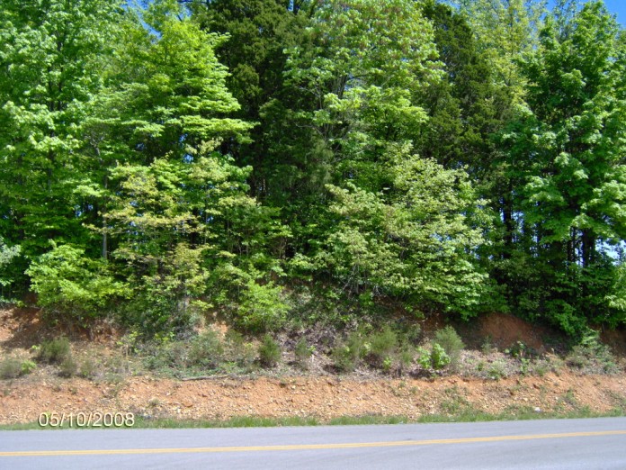
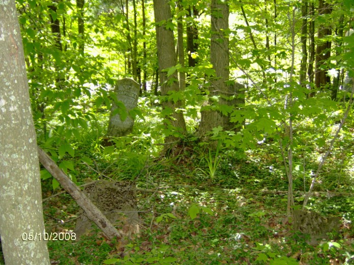
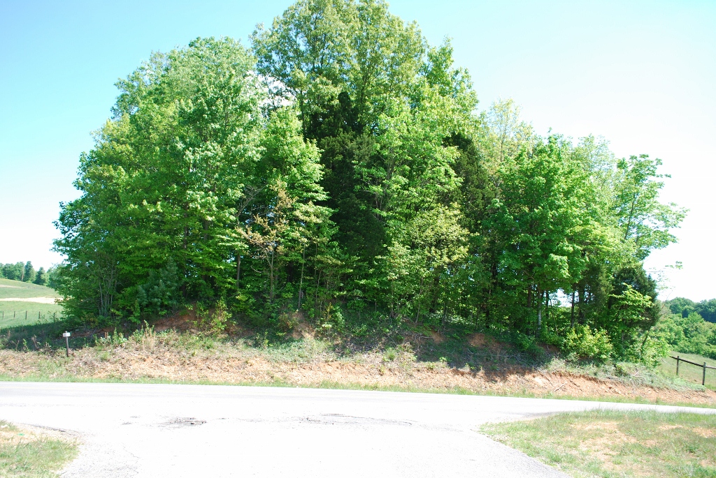
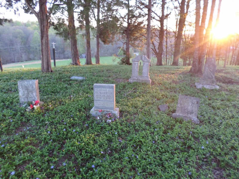
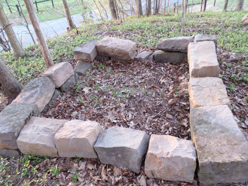
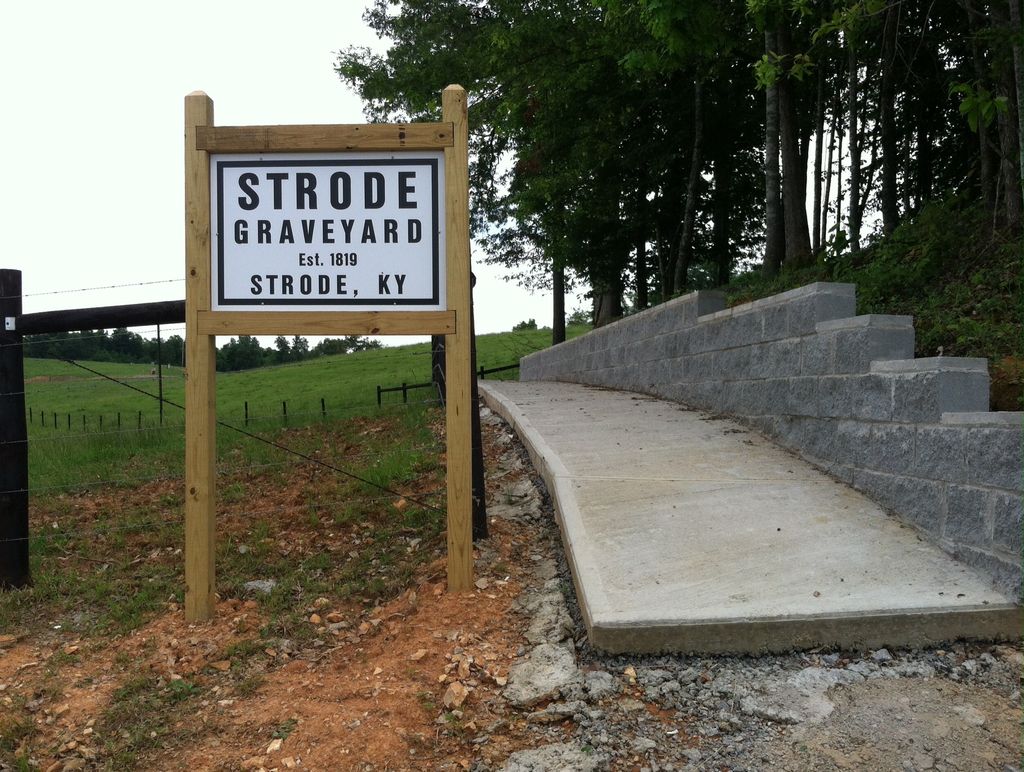
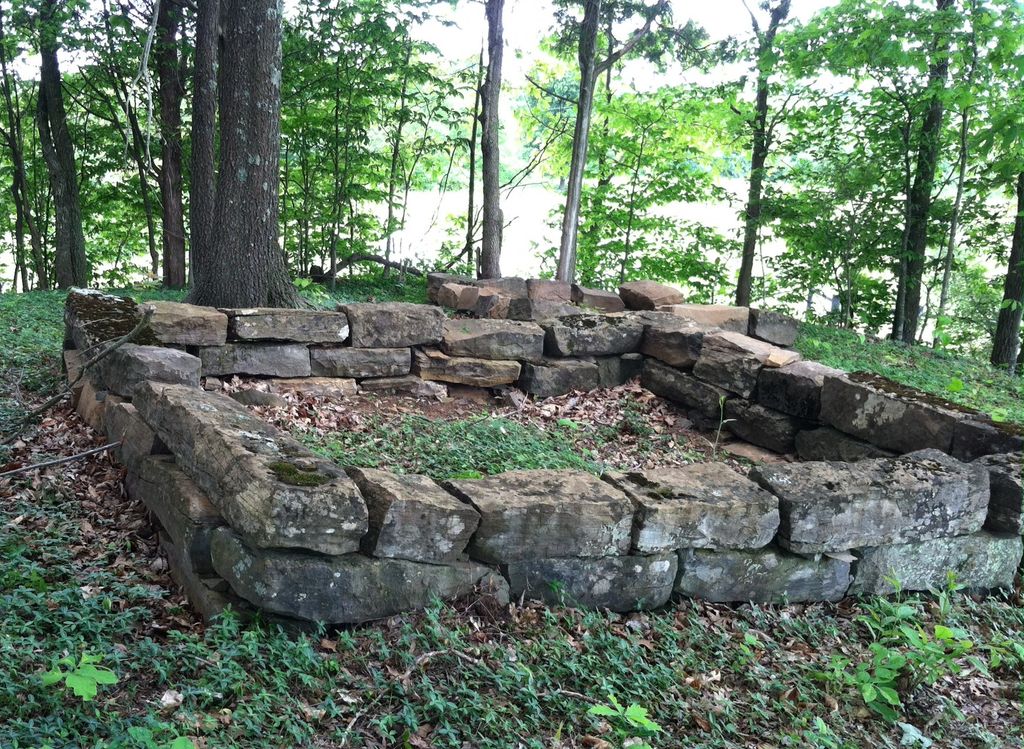
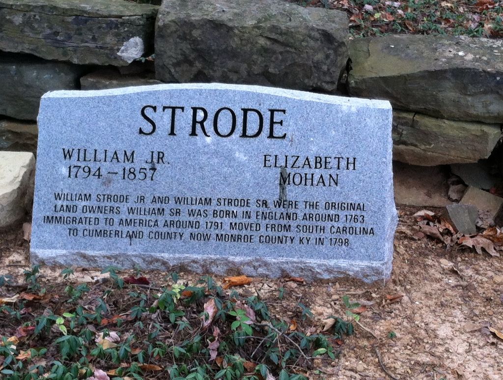
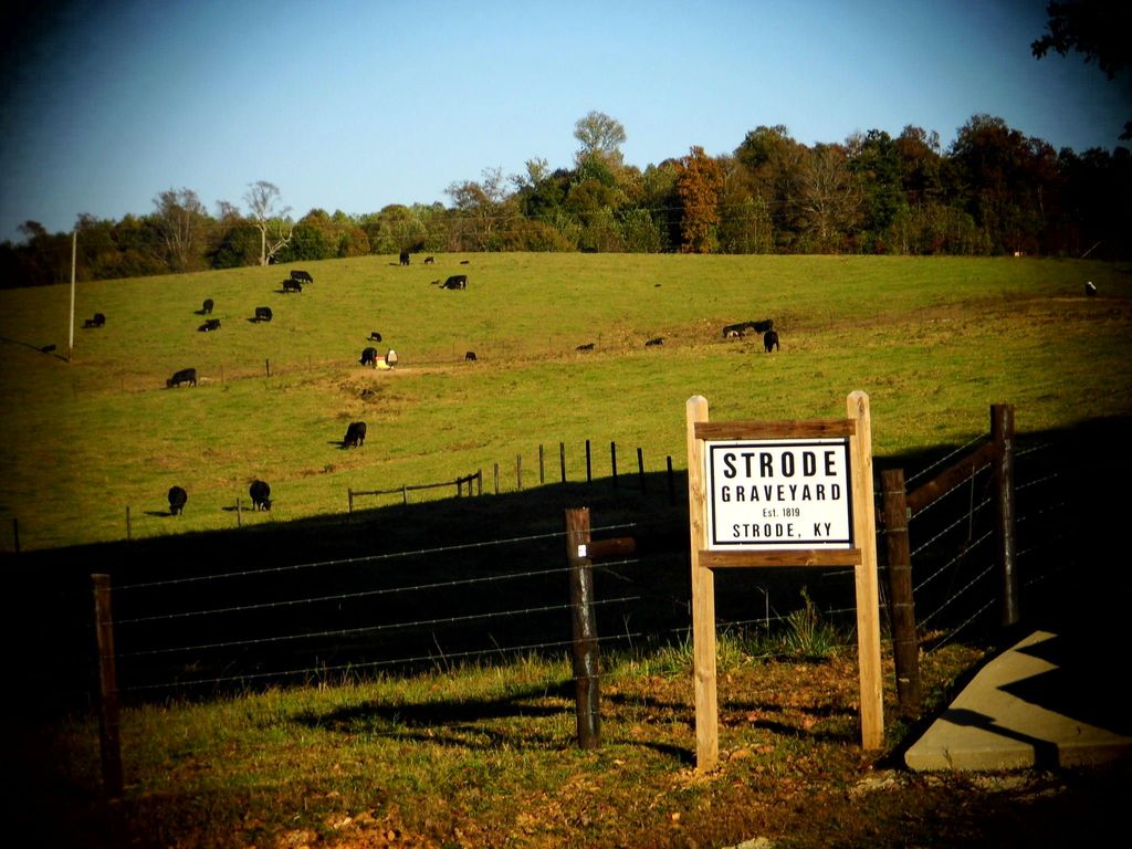
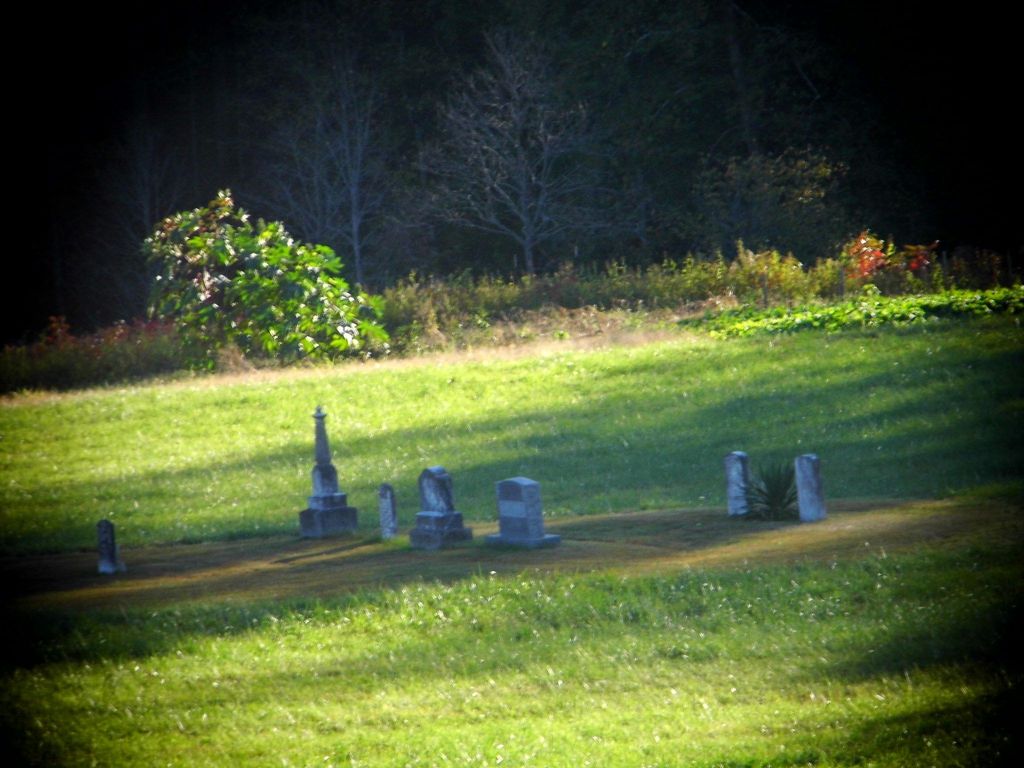
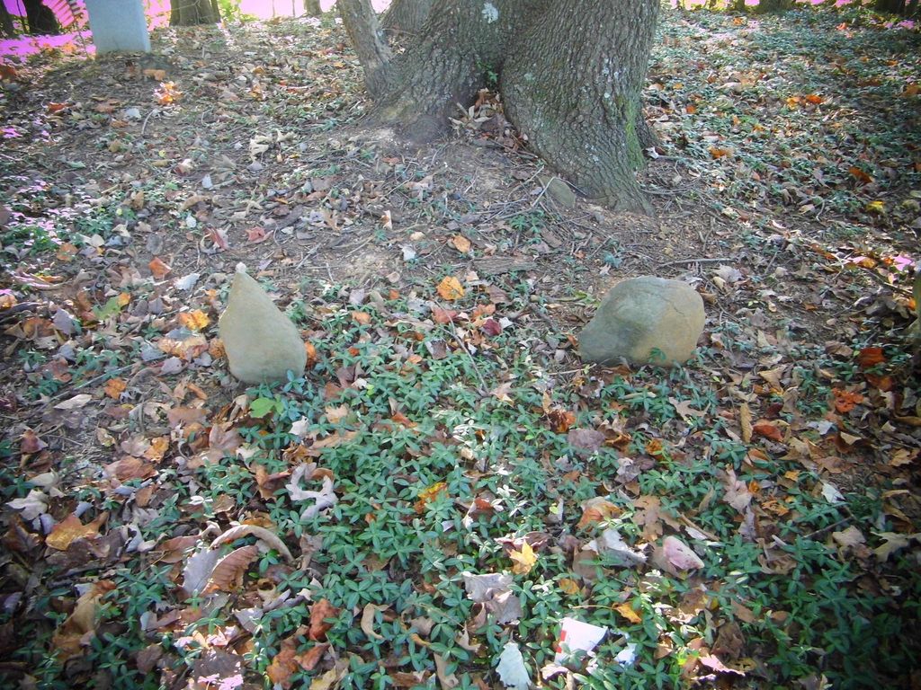
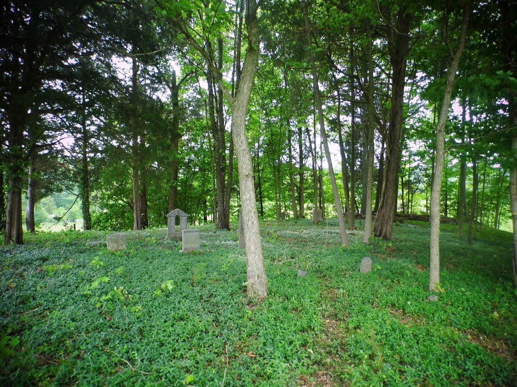
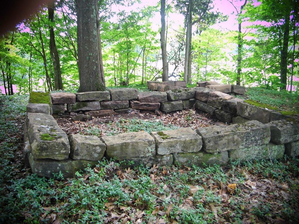
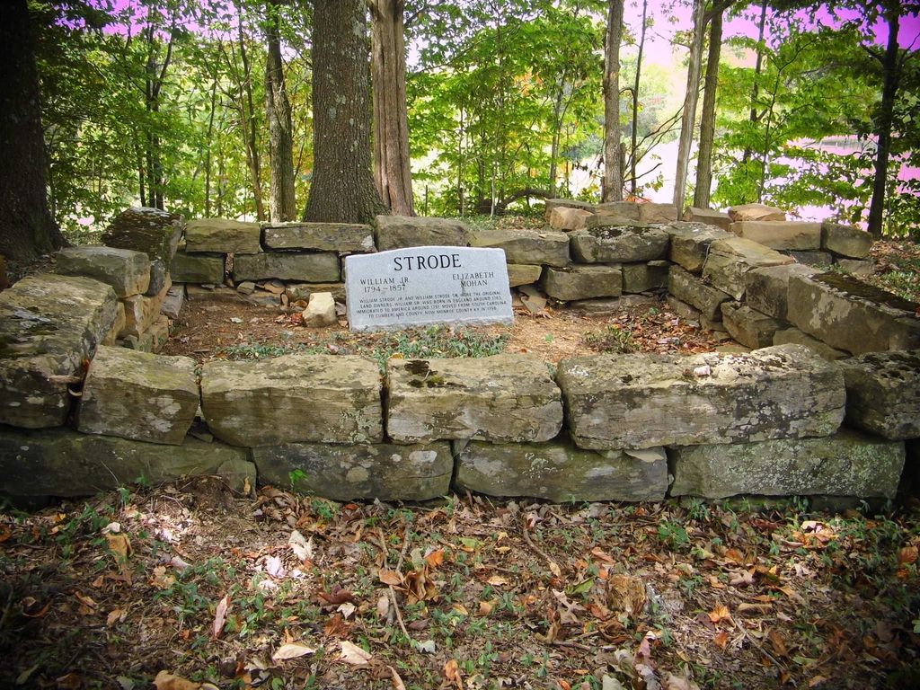
| Description | : | William Strode, Jr. and his wife Elizabeth owned the land where this cemetery is located. It's first burial was in the late 1700s or early 1800s and its most recent burial was sometime in the 1940s. If looking on death certificates and you see "Old Strode Burying Ground" or "Old Strode Graveyard", this the cemetery it is referring to. There is not a cemetery in Monroe County, Kentucky named "Page-Biggers." Captain Page and Sgt. Biggers were Strode sons-in-law and a researcher misnamed it sometime in the mid 20th Century. |
frequently asked questions (FAQ):
-
Where is Old Strode Cemetery?
Old Strode Cemetery is located at Tompkinsville, Monroe County ,Kentucky ,USA.
-
Old Strode Cemetery cemetery's updated grave count on graveviews.com?
0 memorials
-
Where are the coordinates of the Old Strode Cemetery?
Latitude: 36.7725840
Longitude: -85.6538860
Nearby Cemetories:
1. Strode Garden Cemetery
Rockbridge, Monroe County, USA
Coordinate: 36.7720930, -85.6546460
2. Pleasant Hill Church Cemetery
Persimmon, Monroe County, USA
Coordinate: 36.7878000, -85.6424000
3. Miller Farm Cemetery
Tompkinsville, Monroe County, USA
Coordinate: 36.7665201, -85.6764727
4. Norman Cemetery
Monroe County, USA
Coordinate: 36.7753210, -85.6855300
5. Old Mount Herman Cemetery
Tompkinsville, Monroe County, USA
Coordinate: 36.7448230, -85.6400490
6. Scott's Pleasant Acre Cemetery
Tompkinsville, Monroe County, USA
Coordinate: 36.7427145, -85.6456353
7. Skaggs Creek Cemetery
Rockbridge, Monroe County, USA
Coordinate: 36.7933000, -85.6834890
8. Monroe County Memorial Lawn
Tompkinsville, Monroe County, USA
Coordinate: 36.7400000, -85.6904000
9. Page Cemetery
Persimmon, Monroe County, USA
Coordinate: 36.8068680, -85.6182730
10. Mount Gilead Church of Christ Cemetery
Tompkinsville, Monroe County, USA
Coordinate: 36.7469000, -85.6994000
11. Tooley Cemetery
Monroe County, USA
Coordinate: 36.7511950, -85.6043100
12. Mount Zion Cemetery
Tompkinsville, Monroe County, USA
Coordinate: 36.7229940, -85.6785750
13. Old Hammer Graveyard
Meshack, Monroe County, USA
Coordinate: 36.7598360, -85.5876570
14. Old Temple Hill Cemetery
Monroe County, USA
Coordinate: 36.7601013, -85.5875320
15. Copass Cemetery
Tompkinsville, Monroe County, USA
Coordinate: 36.7154340, -85.6518170
16. Basil Cemetery
Meshack, Monroe County, USA
Coordinate: 36.7585300, -85.5834400
17. Clover Hill Cemetery
Persimmon, Monroe County, USA
Coordinate: 36.7568190, -85.5833720
18. Yokley Cemetery
Tompkinsville, Monroe County, USA
Coordinate: 36.7123290, -85.6779590
19. Harvey-White Cemetery
Willow Shade, Metcalfe County, USA
Coordinate: 36.8352680, -85.6138650
20. Brown Cemetery
Monroe County, USA
Coordinate: 36.7132710, -85.6011710
21. Smith Cemetery
Monroe County, USA
Coordinate: 36.7421989, -85.5650024
22. Harvey Cemetery
Summer Shade, Metcalfe County, USA
Coordinate: 36.8430140, -85.6129760
23. Brown Cemetery
Tompkinsville, Monroe County, USA
Coordinate: 36.7257996, -85.7313995
24. White Cemetery
Sulphur Lick, Monroe County, USA
Coordinate: 36.8096000, -85.7396000