
| Memorials | : | 0 |
| Location | : | Ootmarsum, Dinkelland Municipality, Netherlands |
| Coordinate | : | 52.4035800, 6.8970400 |
frequently asked questions (FAQ):
-
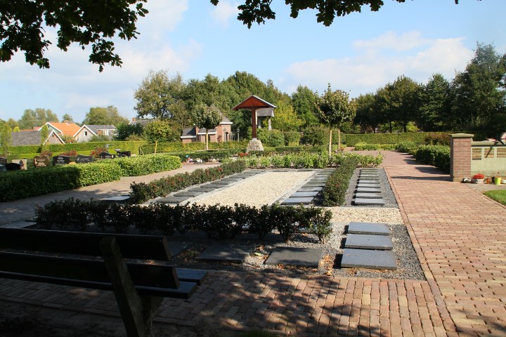
Where is Ootmarsum Roman Catholic Cemetery?
Ootmarsum Roman Catholic Cemetery is located at Ootmarsum, Dinkelland Municipality ,Overijssel ,Netherlands.
-
Ootmarsum Roman Catholic Cemetery cemetery's updated grave count on graveviews.com?
0 memorials
-
Where are the coordinates of the Ootmarsum Roman Catholic Cemetery?
Latitude: 52.4035800
Longitude: 6.8970400
Nearby Cemetories:
1. Ootmarsum Protestant Cemetery
Ootmarsum, Dinkelland Municipality, Netherlands
Coordinate: 52.4101700, 6.8951200
2. Joodse Begraafplaats
Ootmarsum, Dinkelland Municipality, Netherlands
Coordinate: 52.4065500, 6.8837900
3. Reutum Roman Catholic Cemetery
Reutum, Tubbergen Municipality, Netherlands
Coordinate: 52.3907800, 6.8451400
4. Rossum Roman Catholic Cemetery
Rossum, Dinkelland Municipality, Netherlands
Coordinate: 52.3519900, 6.9217100
5. Weerselo Roman Catholic Cemetery
Weerselo, Dinkelland Municipality, Netherlands
Coordinate: 52.3513300, 6.8576100
6. Oude Joodse Begraafplaats
Denekamp, Dinkelland Municipality, Netherlands
Coordinate: 52.3861400, 6.9962700
7. Joodse Begraafplaats
Denekamp, Dinkelland Municipality, Netherlands
Coordinate: 52.3841300, 7.0002100
8. Tubbergen Roman Catholic Cemetery
Tubbergen, Tubbergen Municipality, Netherlands
Coordinate: 52.4082500, 6.7828100
9. Albergen Roman Catholic Cemetery
Albergen, Tubbergen Municipality, Netherlands
Coordinate: 52.3727900, 6.7640500
10. Saasveld Roman Catholic Cemetery
Saasveld, Dinkelland Municipality, Netherlands
Coordinate: 52.3302400, 6.8095800
11. Nieuwe Algemene Begraafplaats
Oldenzaal, Oldenzaal Municipality, Netherlands
Coordinate: 52.3119200, 6.8932200
12. Oldenzaal Roman Catholic Cemetery
Oldenzaal, Oldenzaal Municipality, Netherlands
Coordinate: 52.3081500, 6.9165900
13. Südfriedhof Nordhorn
Nordhorn, Landkreis Grafschaft Bentheim, Germany
Coordinate: 52.4146088, 7.0562279
14. Joodse Begraafplaats
Oldenzaal, Oldenzaal Municipality, Netherlands
Coordinate: 52.3061840, 6.9264470
15. Friedhof Kirchengemeinde Neuenhaus
Neuenhaus, Landkreis Grafschaft Bentheim, Germany
Coordinate: 52.4968700, 6.9586360
16. Katholischer Friedhof Neuenhaus
Neuenhaus, Landkreis Grafschaft Bentheim, Germany
Coordinate: 52.4948860, 6.9756140
17. De Lutte Roman Catholic Churchyard
De Lutte, Losser Municipality, Netherlands
Coordinate: 52.3149300, 6.9866600
18. Deurningen Roman Catholic Cemetery
Deurningen, Dinkelland Municipality, Netherlands
Coordinate: 52.3009700, 6.8383400
19. Jüdischer Friedhof (Neu)
Nordhorn, Landkreis Grafschaft Bentheim, Germany
Coordinate: 52.4221600, 7.0812600
20. Neuer Friedhof Veldhausen
Veldhausen, Landkreis Grafschaft Bentheim, Germany
Coordinate: 52.5144480, 6.9966660
21. Tubbergen-Langeveen Cemetery
Langeveen, Tubbergen Municipality, Netherlands
Coordinate: 52.4702076, 6.7130924
22. Roman Catholic cemetery
Zenderen, Borne Municipality, Netherlands
Coordinate: 52.3237300, 6.7251900
23. Borne General cemetery
Borne, Borne Municipality, Netherlands
Coordinate: 52.3037400, 6.7525900
24. Hengelo Roman Catholic Cemetery
Hengelo, Hengelo Municipality, Netherlands
Coordinate: 52.2797300, 6.8103900