
| Memorials | : | 0 |
| Location | : | Rossum, Dinkelland Municipality, Netherlands |
| Coordinate | : | 52.3519900, 6.9217100 |
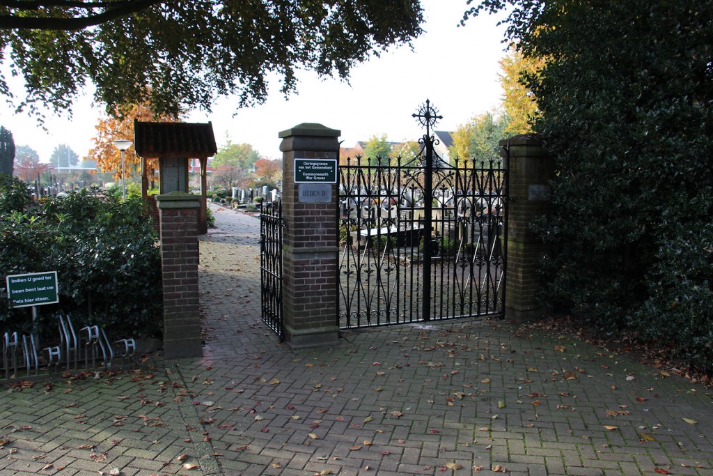
| Description | : | Rossum is a small village 6 kilometres east of Weerselo, and 5 kilometres north of Oldenzaal. It lies 3 kilometres north-west of the main road to Germany. The Catholic church is in the centre of the village, with the churchyard immediately to the south. |
frequently asked questions (FAQ):
-
Where is Rossum Roman Catholic Cemetery?
Rossum Roman Catholic Cemetery is located at Rossum, Dinkelland Municipality ,Overijssel ,Netherlands.
-
Rossum Roman Catholic Cemetery cemetery's updated grave count on graveviews.com?
0 memorials
-
Where are the coordinates of the Rossum Roman Catholic Cemetery?
Latitude: 52.3519900
Longitude: 6.9217100

Nearby Cemetories:
1. Weerselo Roman Catholic Cemetery
Weerselo, Dinkelland Municipality, Netherlands
Coordinate: 52.3513300, 6.8576100
2. Nieuwe Algemene Begraafplaats
Oldenzaal, Oldenzaal Municipality, Netherlands
Coordinate: 52.3119200, 6.8932200
3. Oldenzaal Roman Catholic Cemetery
Oldenzaal, Oldenzaal Municipality, Netherlands
Coordinate: 52.3081500, 6.9165900
4. Joodse Begraafplaats
Oldenzaal, Oldenzaal Municipality, Netherlands
Coordinate: 52.3061840, 6.9264470
5. Ootmarsum Roman Catholic Cemetery
Ootmarsum, Dinkelland Municipality, Netherlands
Coordinate: 52.4035800, 6.8970400
6. De Lutte Roman Catholic Churchyard
De Lutte, Losser Municipality, Netherlands
Coordinate: 52.3149300, 6.9866600
7. Oude Joodse Begraafplaats
Denekamp, Dinkelland Municipality, Netherlands
Coordinate: 52.3861400, 6.9962700
8. Joodse Begraafplaats
Denekamp, Dinkelland Municipality, Netherlands
Coordinate: 52.3841300, 7.0002100
9. Joodse Begraafplaats
Ootmarsum, Dinkelland Municipality, Netherlands
Coordinate: 52.4065500, 6.8837900
10. Ootmarsum Protestant Cemetery
Ootmarsum, Dinkelland Municipality, Netherlands
Coordinate: 52.4101700, 6.8951200
11. Reutum Roman Catholic Cemetery
Reutum, Tubbergen Municipality, Netherlands
Coordinate: 52.3907800, 6.8451400
12. Saasveld Roman Catholic Cemetery
Saasveld, Dinkelland Municipality, Netherlands
Coordinate: 52.3302400, 6.8095800
13. Deurningen Roman Catholic Cemetery
Deurningen, Dinkelland Municipality, Netherlands
Coordinate: 52.3009700, 6.8383400
14. Albergen Roman Catholic Cemetery
Albergen, Tubbergen Municipality, Netherlands
Coordinate: 52.3727900, 6.7640500
15. Hengelo Roman Catholic Cemetery
Hengelo, Hengelo Municipality, Netherlands
Coordinate: 52.2797300, 6.8103900
16. Tubbergen Roman Catholic Cemetery
Tubbergen, Tubbergen Municipality, Netherlands
Coordinate: 52.4082500, 6.7828100
17. Lonneker Roman Catholic Churchyard
Lonneker, Enschede Municipality, Netherlands
Coordinate: 52.2499800, 6.9121700
18. Losser Roman Catholic Churchyard
Losser, Losser Municipality, Netherlands
Coordinate: 52.2628700, 7.0034500
19. Südfriedhof Nordhorn
Nordhorn, Landkreis Grafschaft Bentheim, Germany
Coordinate: 52.4146088, 7.0562279
20. Losser General Cemetery
Losser, Losser Municipality, Netherlands
Coordinate: 52.2625100, 7.0105100
21. Hengelo Overijssel General Cemetery
Hengelo, Hengelo Municipality, Netherlands
Coordinate: 52.2719200, 6.8099900
22. Joodse begraafplaats
Hengelo, Hengelo Municipality, Netherlands
Coordinate: 52.2695700, 6.7939800
23. Borne General cemetery
Borne, Borne Municipality, Netherlands
Coordinate: 52.3037400, 6.7525900
24. Joodse Begraafplaats
Borne, Borne Municipality, Netherlands
Coordinate: 52.2992800, 6.7461900