
| Memorials | : | 0 |
| Location | : | Greene County, USA |
| Coordinate | : | 36.2020620, -82.7419000 |
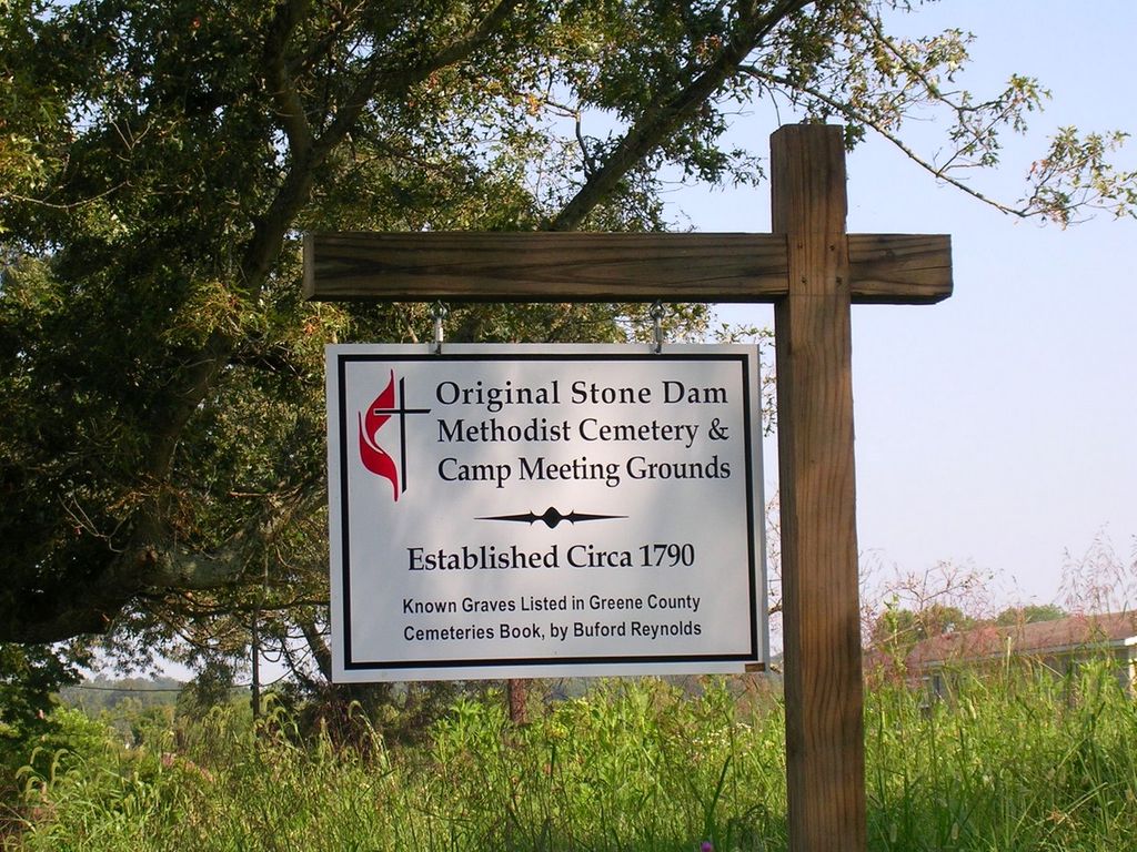
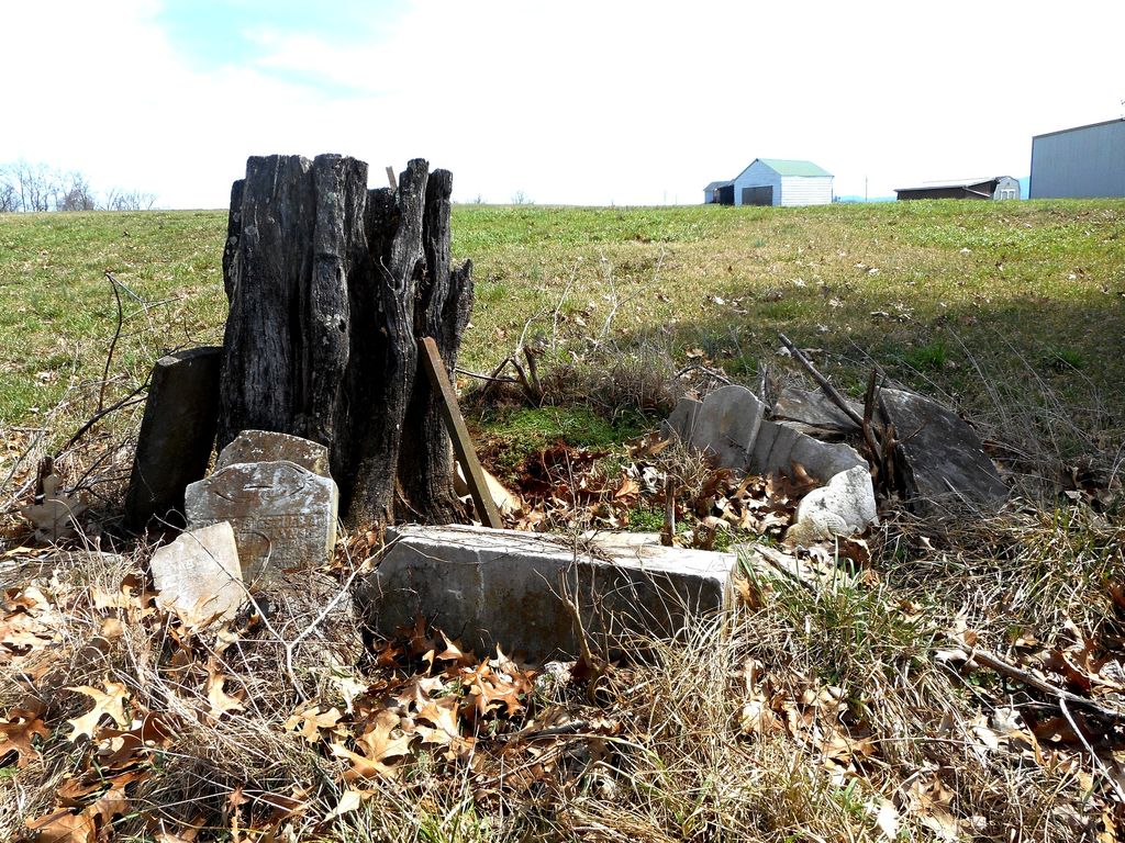
| Description | : | The Old Stone Dam Cemetery is located one mile north of Afton on the Afton Road. This is a very old Cemetery, neglected and abandoned. The family living nearest the cemetery have lived there twenty-six years, and say there has not been a burial in this cemetery in that time. There are a great many unmarked graves. |
frequently asked questions (FAQ):
-
Where is Original Stone Dam Methodist Cemetery?
Original Stone Dam Methodist Cemetery is located at Greene County ,Tennessee ,USA.
-
Original Stone Dam Methodist Cemetery cemetery's updated grave count on graveviews.com?
0 memorials
-
Where are the coordinates of the Original Stone Dam Methodist Cemetery?
Latitude: 36.2020620
Longitude: -82.7419000
Nearby Cemetories:
1. Stone Dam Methodist Church Cemetery
Chuckey, Greene County, USA
Coordinate: 36.1995860, -82.7279730
2. Oakland Presbyterian Cemetery
Greeneville, Greene County, USA
Coordinate: 36.1925740, -82.7596430
3. Graceland Memorial Gardens
Afton, Greene County, USA
Coordinate: 36.1963350, -82.7218150
4. Gauntt Family Cemetery
Afton, Greene County, USA
Coordinate: 36.2203850, -82.7464970
5. Fairview Cumberland Presbyterian Church Cemetery
Afton, Greene County, USA
Coordinate: 36.2210200, -82.7621300
6. Mount Zion United Methodist Church Cemetery
Afton, Greene County, USA
Coordinate: 36.2352470, -82.7482650
7. Ragsdale Family Cemetery
Rheatown, Greene County, USA
Coordinate: 36.2330120, -82.7118290
8. Ebenezer Methodist Church Cemetery
Chuckey, Greene County, USA
Coordinate: 36.1900900, -82.6933000
9. Quaker Knob Cemetery
Rheatown, Greene County, USA
Coordinate: 36.2361100, -82.7083300
10. Chuckey Community Cemetery
Chuckey, Greene County, USA
Coordinate: 36.2141500, -82.6861070
11. Fox Cemetery
Chuckey, Greene County, USA
Coordinate: 36.1768990, -82.6931000
12. Fortner-Moore Cemetery
Greeneville, Greene County, USA
Coordinate: 36.2026770, -82.8001320
13. Horse Creek Church of God Cemetery
Horse Creek, Greene County, USA
Coordinate: 36.1605500, -82.7058430
14. Bradburn Hill UMC Cemetery
Greeneville, Greene County, USA
Coordinate: 36.1923360, -82.8051980
15. Greene County Mennonite Church Cemetery
Chuckey, Greene County, USA
Coordinate: 36.1797900, -82.6817660
16. Rheatown Cemetery
Rheatown, Greene County, USA
Coordinate: 36.2345060, -82.6872060
17. Grizzle Family Cemetery
Afton, Greene County, USA
Coordinate: 36.2349030, -82.6868110
18. Hermon United Methodist Church Cemetery
Greene County, USA
Coordinate: 36.1455220, -82.7280540
19. Broyles Family Cemetery
Horse Creek, Greene County, USA
Coordinate: 36.1622940, -82.6886170
20. McCurry Cemetery
Baileyton, Greene County, USA
Coordinate: 36.2000008, -82.8217010
21. Pleasant Vale Cumberland Presbyterian Cemetery
Chuckey, Greene County, USA
Coordinate: 36.2560600, -82.6971100
22. Mount Bethel Cemetery
Greeneville, Greene County, USA
Coordinate: 36.1707993, -82.8139038
23. Fortner-Gass Cemetery
Greene County, USA
Coordinate: 36.2242012, -82.8193970
24. Cedar Grove United Methodist Church Cemetery
Chuckey, Greene County, USA
Coordinate: 36.1583250, -82.6779360