| Memorials | : | 0 |
| Location | : | Burgin, Mercer County, USA |
| Coordinate | : | 37.7969670, -84.7185370 |
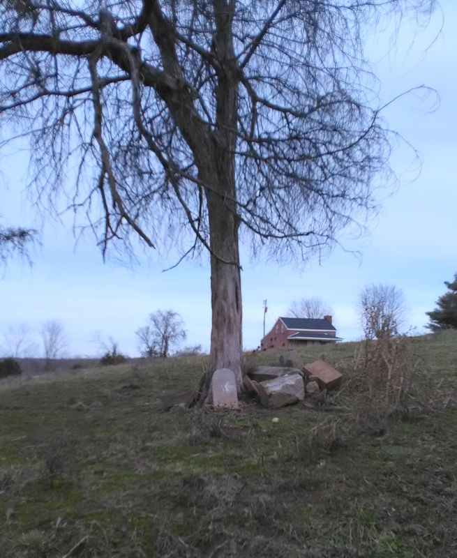
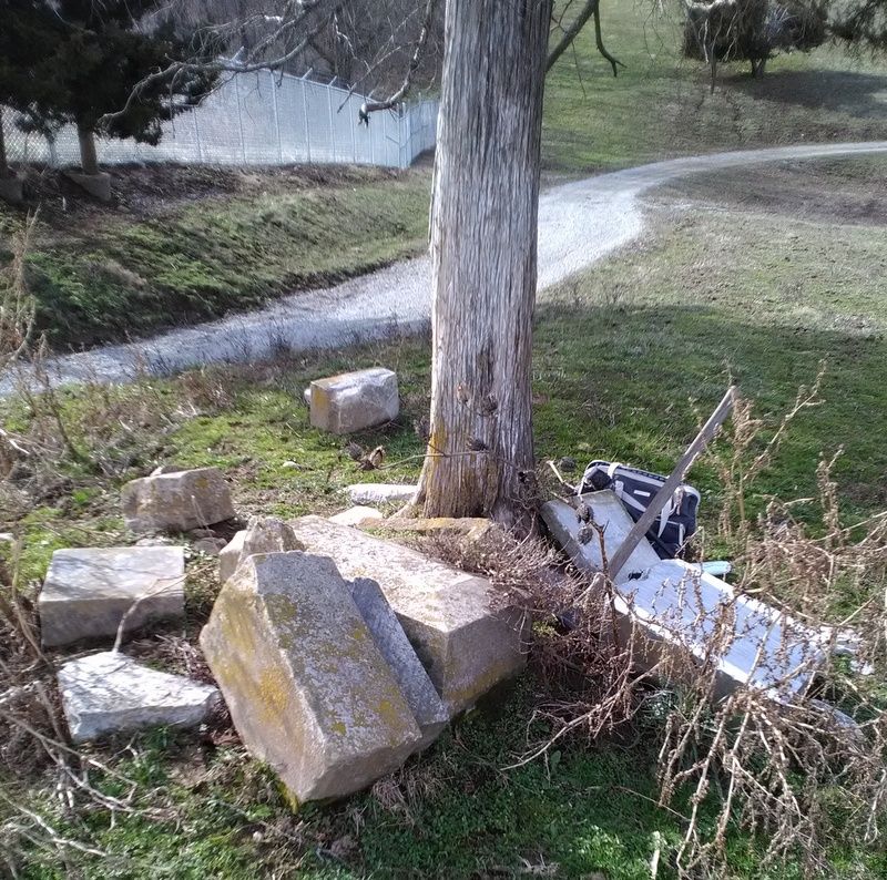
| Description | : | Directions to farm: From Rt. 33 in Burgin, turn onto Curdsville Rd. At the bend in the road near the power plant, take the slight right (still called Curdsville Rd.). Turn right onto Webb Lane. Go back the road until you see a tree on your left with stones stacked around it. This is the site. Cattle had scattered the stones, but Webb family members stacked what they could under the tree, which is the original burial site. Most of the stones are face-down to preserve them (and they are VERY well preserved). |
frequently asked questions (FAQ):
-
Where is Orland Webb Farm Cemetery?
Orland Webb Farm Cemetery is located at Burgin, Mercer County ,Kentucky ,USA.
-
Orland Webb Farm Cemetery cemetery's updated grave count on graveviews.com?
0 memorials
-
Where are the coordinates of the Orland Webb Farm Cemetery?
Latitude: 37.7969670
Longitude: -84.7185370
Nearby Cemetories:
1. Dodds and King Family Graveyard
Burgin, Mercer County, USA
Coordinate: 37.7960534, -84.7384000
2. Long Family Graveyard
Shakertown, Mercer County, USA
Coordinate: 37.8151319, -84.7245494
3. Joseph Curd Family Cemetery
Mercer County, USA
Coordinate: 37.7803600, -84.7331500
4. John Dickerson Cemetery
Lancaster, Garrard County, USA
Coordinate: 37.8136980, -84.7017050
5. Jennings Cemetery
Garrard County, USA
Coordinate: 37.7888080, -84.6898160
6. Dickerson Cemetery
Garrard County, USA
Coordinate: 37.8019380, -84.6880530
7. Ison Cemetery
Lancaster, Garrard County, USA
Coordinate: 37.7728020, -84.7051840
8. Majors Cemetery
Bryantsville, Garrard County, USA
Coordinate: 37.7708080, -84.7055450
9. Shaker Cemetery
Mercer County, USA
Coordinate: 37.8188890, -84.7445640
10. Shawnee Run Baptist Church Cemetery
Harrodsburg, Mercer County, USA
Coordinate: 37.7851100, -84.7560740
11. Bowman Graveyard
Lancaster, Garrard County, USA
Coordinate: 37.8167940, -84.6836140
12. Taylor Family Graveyard
Harrodsburg, Mercer County, USA
Coordinate: 37.8112528, -84.7640157
13. Curd Cemetery
High Bridge, Jessamine County, USA
Coordinate: 37.8081000, -84.6630100
14. Terrill Cemetery
Bryantsville, Garrard County, USA
Coordinate: 37.7763850, -84.6658310
15. Smock Family Graveyard
Burgin, Mercer County, USA
Coordinate: 37.7787160, -84.7746010
16. Saint James Cemetery
Buena Vista, Garrard County, USA
Coordinate: 37.7493400, -84.7020100
17. Furguson Graveyard
Mercer County, USA
Coordinate: 37.8466200, -84.7153200
18. Spillman Family Graveyard
Buena Vista, Garrard County, USA
Coordinate: 37.7546430, -84.6853340
19. Canaan Farm Cemetery
Harrodsburg, Mercer County, USA
Coordinate: 37.8444770, -84.7397120
20. Crow Cemetery
Buena Vista, Garrard County, USA
Coordinate: 37.7626770, -84.6709210
21. Cog Hill Cemetery
Mercer County, USA
Coordinate: 37.8471985, -84.7058029
22. James Crow Cemetery
Buena Vista, Garrard County, USA
Coordinate: 37.7616650, -84.6713850
23. Bishop Family Graveyard
Shakertown, Mercer County, USA
Coordinate: 37.8497470, -84.7081950
24. Bonta Family Graveyard
Burgin, Mercer County, USA
Coordinate: 37.7418900, -84.7044400


