
| Memorials | : | 1 |
| Location | : | Burgin, Mercer County, USA |
| Coordinate | : | 37.7418900, -84.7044400 |
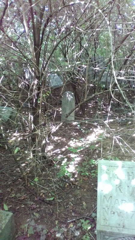
| Description | : | AKA: England & Bonta Graveyard. This graveyard is located on the Ralph Proctor farm (1967), Kennedy Bridge Pike Rd, Mercer Co, KY. This list was copied in October 1967 by the Harrodsburg Historical Soc. volunteers, namely Mrs. Ison to compile her cemetery books. **Even though it says on Kennedy Bridge Rd, it is actually on Herrington Woods up above Pandora Cove. |
frequently asked questions (FAQ):
-
Where is Bonta Family Graveyard?
Bonta Family Graveyard is located at Burgin, Mercer County ,Kentucky ,USA.
-
Bonta Family Graveyard cemetery's updated grave count on graveviews.com?
1 memorials
-
Where are the coordinates of the Bonta Family Graveyard?
Latitude: 37.7418900
Longitude: -84.7044400
Nearby Cemetories:
1. Saint James Cemetery
Buena Vista, Garrard County, USA
Coordinate: 37.7493400, -84.7020100
2. Proctor Cemetery
Mercer County, USA
Coordinate: 37.7372017, -84.7185974
3. Bonta and Sallee Family Graveyard
Burgin, Mercer County, USA
Coordinate: 37.7293500, -84.7098000
4. Mayes Cemetery
Burgin, Mercer County, USA
Coordinate: 37.7270770, -84.6964360
5. Spillman Family Graveyard
Buena Vista, Garrard County, USA
Coordinate: 37.7546430, -84.6853340
6. Majors Cemetery
Bryantsville, Garrard County, USA
Coordinate: 37.7708080, -84.7055450
7. Ison Cemetery
Lancaster, Garrard County, USA
Coordinate: 37.7728020, -84.7051840
8. Harmony Presbyterian Church Cemetery
Buena Vista, Garrard County, USA
Coordinate: 37.7515200, -84.6664600
9. Robinson Road Cemetery
Mercer County, USA
Coordinate: 37.7374992, -84.7444000
10. Carry Nation - Moore Family Cemetery
Bryantsville, Garrard County, USA
Coordinate: 37.7095870, -84.7033810
11. James Crow Cemetery
Buena Vista, Garrard County, USA
Coordinate: 37.7616650, -84.6713850
12. Crow Cemetery
Buena Vista, Garrard County, USA
Coordinate: 37.7626770, -84.6709210
13. Smith Cemetery
Lancaster, Garrard County, USA
Coordinate: 37.7199940, -84.6675000
14. Kays Farm Cemetery
Bryantsville, Garrard County, USA
Coordinate: 37.7237500, -84.6639060
15. Swope Cemetery
Bryantsville, Garrard County, USA
Coordinate: 37.7094460, -84.6777770
16. Mount Olivet Methodist Cemetery
White Oak, Garrard County, USA
Coordinate: 37.7461580, -84.6522530
17. Day's Cemetery
Garrard County, USA
Coordinate: 37.7629610, -84.6578590
18. Joseph Curd Family Cemetery
Mercer County, USA
Coordinate: 37.7803600, -84.7331500
19. Darnell Hospital Cemetery
Boyle County, USA
Coordinate: 37.7101021, -84.7448883
20. White Oak Cemetery
Garrard County, USA
Coordinate: 37.7381410, -84.6464610
21. Terrill Cemetery
Bryantsville, Garrard County, USA
Coordinate: 37.7763850, -84.6658310
22. Walker-Simpson Af-Am Cemetery
White Oak, Garrard County, USA
Coordinate: 37.7390500, -84.6437300
23. Jennings Cemetery
Garrard County, USA
Coordinate: 37.7888080, -84.6898160
24. Burnt Tavern Cemetery
Garrard County, USA
Coordinate: 37.7119470, -84.6527790