
| Memorials | : | 1 |
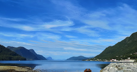
| Location | : | Ørskog kommune, Norway |
| Coordinate | : | 62.4789930, 6.8135780 |
| Description | : | Ørskog Church (Norwegian: Ørskog kyrkje) is a parish church in Ørskog Municipality in Møre og Romsdal county, Norway. It is located in the village of Sjøholt. The church is part of the Ørskog parish in the Austre Sunnmøre deanery in the Diocese of Møre. The white wooden church was built in 1873 by the architect Jacob Wilhelm Nordan. |
frequently asked questions (FAQ):
-
Where is Orskog Church Cemetery?
Orskog Church Cemetery is located at Ørskog kommune ,Møre og Romsdal fylke ,Norway.
-
Orskog Church Cemetery cemetery's updated grave count on graveviews.com?
1 memorials
-
Where are the coordinates of the Orskog Church Cemetery?
Latitude: 62.4789930
Longitude: 6.8135780
Nearby Cemetories:
1. Skodje Cemetery
Skodje, Skodje kommune, Norway
Coordinate: 62.5060180, 6.6966760
2. Vatne
Vatne, Haram kommune, Norway
Coordinate: 62.5548723, 6.6081402
3. Stordal Nye Kirke
Stordal, Stordal kommune, Norway
Coordinate: 62.3826000, 7.0008000
4. Stordal Gamle Kirke
Stordal, Stordal kommune, Norway
Coordinate: 62.3839700, 7.0143400
5. Sykkylven
Sykkylven kommune, Norway
Coordinate: 62.3942400, 6.5821620
6. Ødegård
Stranda kommune, Norway
Coordinate: 62.3166064, 6.9346576
7. Ødegaard Cemetery
Stranda, Stranda kommune, Norway
Coordinate: 62.3162170, 6.9345400
8. Vestnes Church Cemetery
Vestnes, Vestnes kommune, Norway
Coordinate: 62.6277670, 7.0842080
9. Ringstad Cemetery
Brattvag, Haram kommune, Norway
Coordinate: 62.5932008, 6.4663320
10. Hatlehol Cemetery
Spjelkavik, Ålesund kommune, Norway
Coordinate: 62.4355200, 6.3925400
11. Brattvaag Cemetery
Haram, Haram kommune, Norway
Coordinate: 62.6021880, 6.4397580
12. Brattvåg
Brattvag, Haram kommune, Norway
Coordinate: 62.6021964, 6.4393782
13. Otrøy Cemetery
Midsund, Midsund kommune, Norway
Coordinate: 62.6993844, 6.7079435
14. Indre Sula Cemetery
Fiskarstranda, Sula kommune, Norway
Coordinate: 62.4284000, 6.3010000
15. Slotsvika Cemetery
Ålesund kommune, Norway
Coordinate: 62.4920809, 6.2702817
16. Hildre Cemetery
Haram, Haram kommune, Norway
Coordinate: 62.6067800, 6.3306820
17. Hamnsund Cemetery
Grytastranda, Haram kommune, Norway
Coordinate: 62.5314215, 6.2672767
18. Borgund Cemetery Norway
Norvasundet, Ålesund kommune, Norway
Coordinate: 62.4664926, 6.2340662
19. Aalesund Nedre Cemetery
Alesund, Ålesund kommune, Norway
Coordinate: 62.4741020, 6.2321350
20. Øvre Gravlund
Norvasundet, Ålesund kommune, Norway
Coordinate: 62.4757460, 6.2318810
21. Aalesund Øvre Cemetery
Alesund, Ålesund kommune, Norway
Coordinate: 62.4758950, 6.2318370
22. Nedre gravlund
Alesund, Ålesund kommune, Norway
Coordinate: 62.4720375, 6.2295902
23. Nørve kirkegaard
Alesund, Ålesund kommune, Norway
Coordinate: 62.4726200, 6.2282850
24. Langevaag Cemetery
Langevag, Sula kommune, Norway
Coordinate: 62.4387950, 6.2051120