
| Memorials | : | 196 |
| Location | : | Osawatomie, Miami County, USA |
| Coordinate | : | 38.5128600, -94.9326300 |
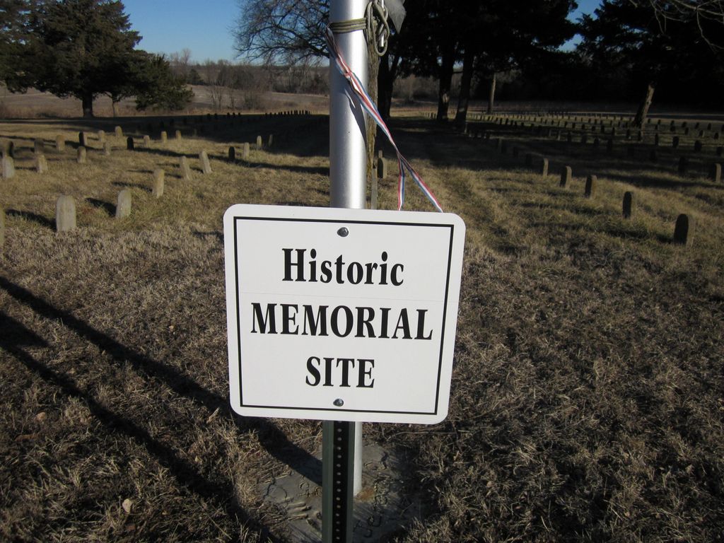
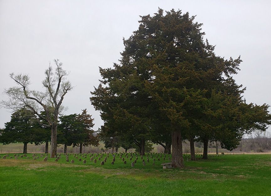
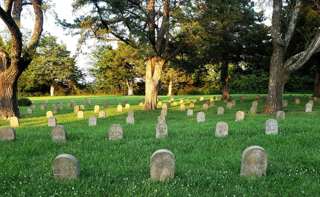
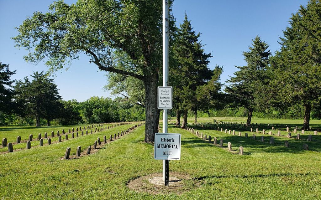
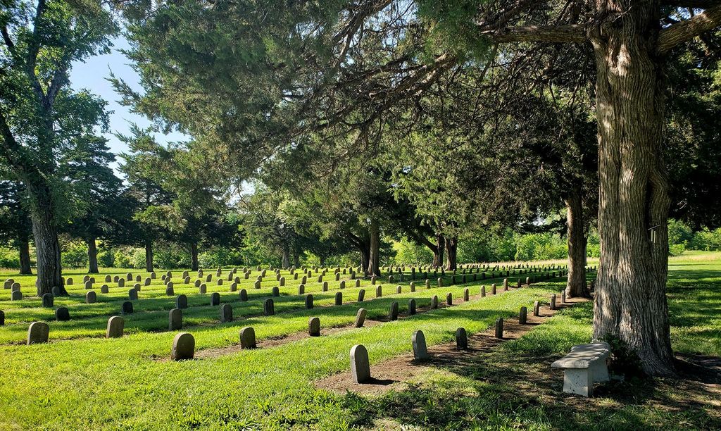
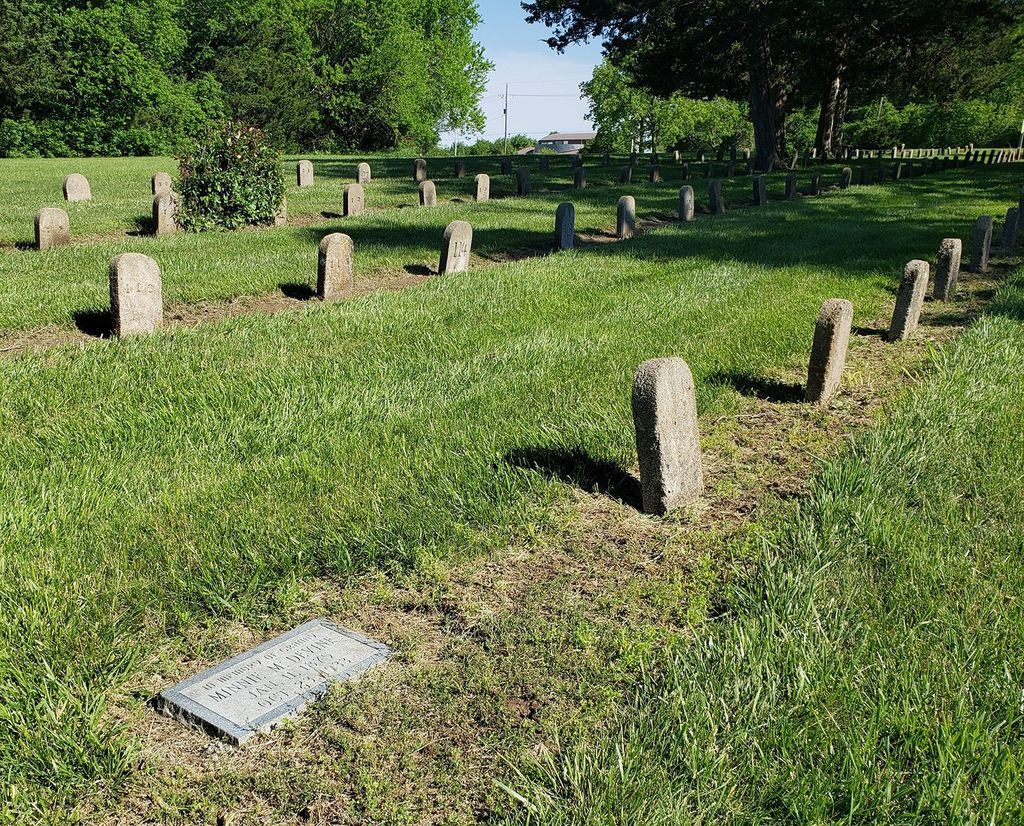
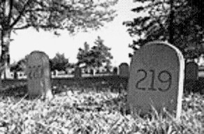
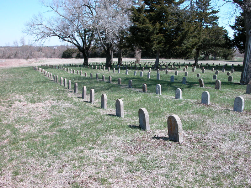
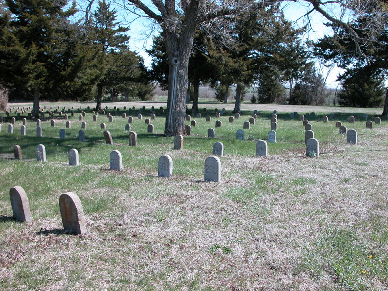
| Description | : | The Osawatomie State Hospital Burial Grounds are located north of the city of Osawatomie, Kansas, and approximately 1/2 mile east of the State Hospital. It is a small cemetery consisting of 346 markers identifying people, mostly patients, who had no families that would claim them. Burials were discontinued during the early 1950's. All 346 markers are only identified with a number, with the exception of a couple stones which have been replaced with identifying named markers. The entire cemetery was photographed in 2019, and photos for each numbered stone were matched with the associated named record in Find-A-Grave. Markers 1-343... Read More |
frequently asked questions (FAQ):
-
Where is Osawatomie State Hospital Burial Ground?
Osawatomie State Hospital Burial Ground is located at Osawatomie, Miami County ,Kansas ,USA.
-
Osawatomie State Hospital Burial Ground cemetery's updated grave count on graveviews.com?
196 memorials
-
Where are the coordinates of the Osawatomie State Hospital Burial Ground?
Latitude: 38.5128600
Longitude: -94.9326300
Nearby Cemetories:
1. Elmdale Cemetery
Osawatomie, Miami County, USA
Coordinate: 38.5017014, -94.9381027
2. Oakwood Cemetery
Osawatomie, Miami County, USA
Coordinate: 38.5024300, -94.9510300
3. Miami Memorial Gardens
Paola, Miami County, USA
Coordinate: 38.5337100, -94.9221400
4. Osawatomie Cemetery
Osawatomie, Miami County, USA
Coordinate: 38.5355988, -94.9377975
5. Brown Cemetery
Osawatomie, Miami County, USA
Coordinate: 38.4980300, -94.9566500
6. Indianapolis Cemetery
Osawatomie, Miami County, USA
Coordinate: 38.5046997, -94.9931030
7. Whiteford Cemetery
Osawatomie, Miami County, USA
Coordinate: 38.4618988, -94.8992004
8. Mount Nebo Family Cemetery
Osawatomie Township, Miami County, USA
Coordinate: 38.4540400, -94.9208400
9. Paola Cemetery
Paola, Miami County, USA
Coordinate: 38.5704000, -94.8873000
10. Crescent Hill Cemetery
Osawatomie, Miami County, USA
Coordinate: 38.4513700, -94.9705800
11. Ursuline Cemetery
Paola, Miami County, USA
Coordinate: 38.5678500, -94.8676400
12. Debrick Cemetery
Miami County, USA
Coordinate: 38.4757996, -94.8432999
13. Miami County Poor Farm Cemetery
Paola, Miami County, USA
Coordinate: 38.5943420, -94.9193018
14. Holy Cross Cemetery
Paola, Miami County, USA
Coordinate: 38.5628014, -94.8482971
15. Mannen Cemetery
Stanton, Miami County, USA
Coordinate: 38.5731010, -95.0113983
16. Beagle Cemetery
Beagle, Miami County, USA
Coordinate: 38.4178300, -94.9493400
17. Spring Grove Quaker Cemetery
Miami County, USA
Coordinate: 38.4409600, -95.0185100
18. Block Trinity Lutheran Cemetery
Block, Miami County, USA
Coordinate: 38.4944400, -94.8086900
19. Green Valley Cemetery
Miami County, USA
Coordinate: 38.4700012, -95.0472031
20. Frank Cemetery
Block, Miami County, USA
Coordinate: 38.5270400, -94.8033500
21. Stanton Cemetery
Stanton, Miami County, USA
Coordinate: 38.5426000, -95.0596100
22. Fontana Cemetery
Fontana, Miami County, USA
Coordinate: 38.4312515, -94.8441925
23. Lockhart Cemetery
Beagle, Miami County, USA
Coordinate: 38.4112400, -94.9828500
24. Shively Cemetery
Rantoul, Franklin County, USA
Coordinate: 38.5159500, -95.0747400