
| Memorials | : | 0 |
| Location | : | Eichstätt, Landkreis Eichstätt, Germany |
| Coordinate | : | 48.8912600, 11.1896300 |
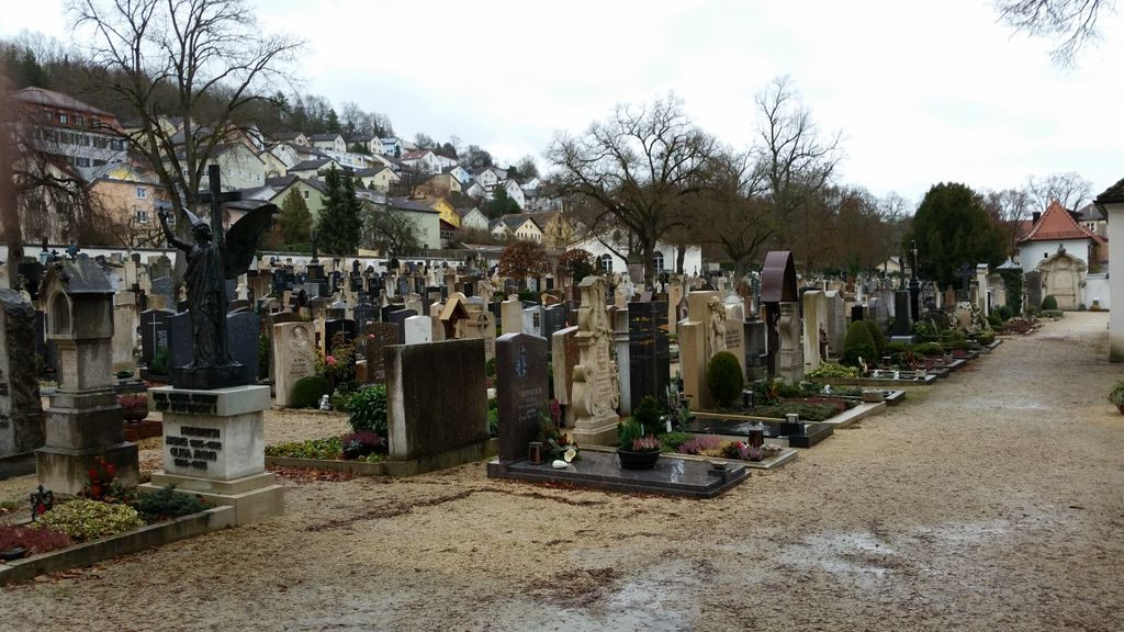
| Description | : | The cemetery was founded in 1535. In the same year the Allerheiligen-Chappel was build. other cemeteries in the county of Eichstätt (Landkreis Eichstätt CScnty=4846): ► Cemeteries in Eichstätt County |
frequently asked questions (FAQ):
-
Where is Ostenfriedhof Eichstätt?
Ostenfriedhof Eichstätt is located at Gottesackergasse Eichstätt, Landkreis Eichstätt ,Bavaria (Bayern) , 85072Germany.
-
Ostenfriedhof Eichstätt cemetery's updated grave count on graveviews.com?
0 memorials
-
Where are the coordinates of the Ostenfriedhof Eichstätt?
Latitude: 48.8912600
Longitude: 11.1896300

Nearby Cemetories:
1. Dom St. Salvator
Eichstätt, Landkreis Eichstätt, Germany
Coordinate: 48.8918610, 11.1835560
2. Friedof Oblaten des heiligen Franz von Sales
Eichstätt, Landkreis Eichstätt, Germany
Coordinate: 48.8791000, 11.1944800
3. Friedhof Sappenfeld
Sappenfeld, Landkreis Eichstätt, Germany
Coordinate: 48.9213170, 11.1295570
4. Sornhüll
Pollenfeld, Landkreis Eichstätt, Germany
Coordinate: 48.9458702, 11.2743813
5. St. Johannes der Täufer
Pfahldorf, Landkreis Eichstätt, Germany
Coordinate: 48.9600022, 11.3322031
6. Arnsberg Friedhof Kirche St. Sebastian
Arnsberg, Landkreis Eichstätt, Germany
Coordinate: 48.9268138, 11.3774009
7. Alter Friedhof Enkering
Enkering, Landkreis Eichstätt, Germany
Coordinate: 48.9913051, 11.3648874
8. Neuer Friedhof Enkering
Enkering, Landkreis Eichstätt, Germany
Coordinate: 48.9971671, 11.3587933
9. Hofkirche Neuburg
Neuburg an der Donau, Landkreis Neuburg-Schrobenhausen, Germany
Coordinate: 48.7374490, 11.1794260
10. Alter Friedhof
Neuburg an der Donau, Landkreis Neuburg-Schrobenhausen, Germany
Coordinate: 48.7325100, 11.1791790
11. Gruftkapelle auf dem Antoniberg
Rennertshofen, Landkreis Neuburg-Schrobenhausen, Germany
Coordinate: 48.7385880, 11.0756670
12. Saint Martin's Church
Oberhochstatt, Landkreis Weißenburg-Gunzenhausen, Germany
Coordinate: 49.0330600, 11.0422900
13. Friedhof Wülzburg
Weissenburg in Bayern, Landkreis Weißenburg-Gunzenhausen, Germany
Coordinate: 49.0243480, 11.0103290
14. Denkendorf
Denkendorf, Landkreis Eichstätt, Germany
Coordinate: 48.9301700, 11.4540200
15. Denkendorf St. Laurentius
Denkendorf, Landkreis Eichstätt, Germany
Coordinate: 48.9282500, 11.4560100
16. Friedhof Rennertshofen
Rennertshofen, Landkreis Neuburg-Schrobenhausen, Germany
Coordinate: 48.7450300, 11.0175900
17. Friedhof Greding
Greding, Landkreis Roth, Germany
Coordinate: 49.0478900, 11.3518400
18. Ingolstadt Westfriedhof
Ingolstadt, Stadtkreis Ingolstadt, Germany
Coordinate: 48.7650400, 11.4093980
19. Friedhof St. Michael
Thalmassing, Landkreis Roth, Germany
Coordinate: 49.0845630, 11.2118376
20. Münster Zur Schönen Unserer Lieben Frau
Ingolstadt, Stadtkreis Ingolstadt, Germany
Coordinate: 48.7642510, 11.4205030
21. Laurentiuskirche
Rehlingen, Landkreis Weißenburg-Gunzenhausen, Germany
Coordinate: 48.9150610, 10.8879280
22. Weißenburg Alter Friedhof
Weissenburg in Bayern, Landkreis Weißenburg-Gunzenhausen, Germany
Coordinate: 49.0280340, 10.9671340
23. Weißenburg Neuer Friedhof
Weissenburg in Bayern, Landkreis Weißenburg-Gunzenhausen, Germany
Coordinate: 49.0360600, 10.9577470
24. Ingolstadt-Sudfriedhof
Spitalhof, Stadtkreis Ingolstadt, Germany
Coordinate: 48.7364400, 11.4213700