
| Memorials | : | 0 |
| Location | : | Oberhochstatt, Landkreis Weißenburg-Gunzenhausen, Germany |
| Coordinate | : | 49.0330600, 11.0422900 |
frequently asked questions (FAQ):
-
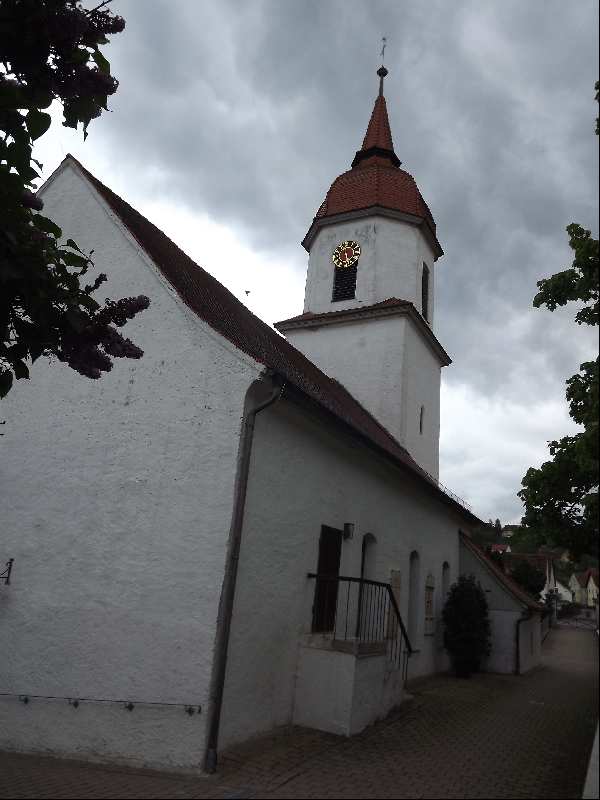
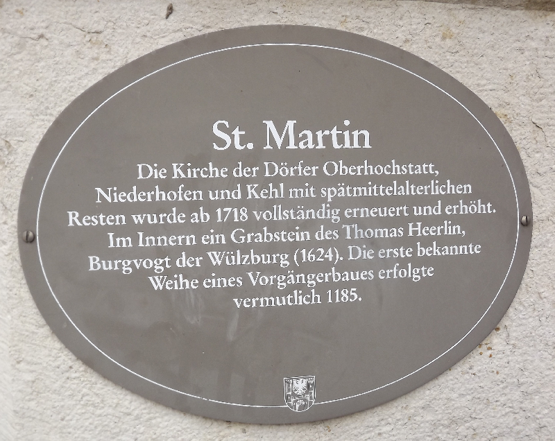
Where is Saint Martin's Church?
Saint Martin's Church is located at Oberhochstatt, Landkreis Weißenburg-Gunzenhausen ,Bavaria (Bayern) ,Germany.
-
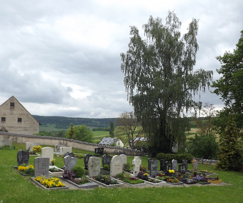
Saint Martin's Church cemetery's updated grave count on graveviews.com?
0 memorials
-
Where are the coordinates of the Saint Martin's Church?
Latitude: 49.0330600
Longitude: 11.0422900
Nearby Cemetories:
1. Friedhof Wülzburg
Weissenburg in Bayern, Landkreis Weißenburg-Gunzenhausen, Germany
Coordinate: 49.0243480, 11.0103290
2. Weißenburg Alter Friedhof
Weissenburg in Bayern, Landkreis Weißenburg-Gunzenhausen, Germany
Coordinate: 49.0280340, 10.9671340
3. Friedhof Ellingen
Ellingen, Landkreis Weißenburg-Gunzenhausen, Germany
Coordinate: 49.0576130, 10.9691650
4. Weißenburg Neuer Friedhof
Weissenburg in Bayern, Landkreis Weißenburg-Gunzenhausen, Germany
Coordinate: 49.0360600, 10.9577470
5. Friedhofskirche St. Ulrich
Röttenbach, Landkreis Roth, Germany
Coordinate: 49.1516760, 11.0354160
6. Friedhof St. Michael
Thalmassing, Landkreis Roth, Germany
Coordinate: 49.0845630, 11.2118376
7. Friedhof Sappenfeld
Sappenfeld, Landkreis Eichstätt, Germany
Coordinate: 48.9213170, 11.1295570
8. Laurentiuskirche
Rehlingen, Landkreis Weißenburg-Gunzenhausen, Germany
Coordinate: 48.9150610, 10.8879280
9. Dornhausen Cemetery
Dornhausen, Landkreis Weißenburg-Gunzenhausen, Germany
Coordinate: 49.0879050, 10.8199320
10. Friedhof Georgensgmünd
Georgensgmund, Landkreis Roth, Germany
Coordinate: 49.1878500, 11.0113370
11. Friedhof Spalt
Spalt, Landkreis Roth, Germany
Coordinate: 49.1791817, 10.9256435
12. Dom St. Salvator
Eichstätt, Landkreis Eichstätt, Germany
Coordinate: 48.8918610, 11.1835560
13. Ostenfriedhof Eichstätt
Eichstätt, Landkreis Eichstätt, Germany
Coordinate: 48.8912600, 11.1896300
14. Sornhüll
Pollenfeld, Landkreis Eichstätt, Germany
Coordinate: 48.9458702, 11.2743813
15. Friedof Oblaten des heiligen Franz von Sales
Eichstätt, Landkreis Eichstätt, Germany
Coordinate: 48.8791000, 11.1944800
16. Friedhof Hilpoltstein
Hilpoltstein, Landkreis Roth, Germany
Coordinate: 49.1923294, 11.1879009
17. Benediktinerkloster in Markt Heidenheim
Heidenheim, Landkreis Weißenburg-Gunzenhausen, Germany
Coordinate: 49.0167000, 10.7500000
18. Friedhof Gräfensteinberg
Grafensteinberg, Landkreis Weißenburg-Gunzenhausen, Germany
Coordinate: 49.1511578, 10.8102554
19. Jewish Cemetery of Gunzenhausen
Gunzenhausen, Landkreis Weißenburg-Gunzenhausen, Germany
Coordinate: 49.1140213, 10.7653408
20. Sindersdorf
Sindersdorf, Landkreis Roth, Germany
Coordinate: 49.1634500, 11.2733700
21. Friedhof Aha
Aha, Landkreis Weißenburg-Gunzenhausen, Germany
Coordinate: 49.0974246, 10.7514500
22. Friedhof Greding
Greding, Landkreis Roth, Germany
Coordinate: 49.0478900, 11.3518400
23. St. Johannes der Täufer
Pfahldorf, Landkreis Eichstätt, Germany
Coordinate: 48.9600022, 11.3322031
24. Pflaumfeld
Gunzenhausen, Landkreis Weißenburg-Gunzenhausen, Germany
Coordinate: 49.0771900, 10.7386290