
| Memorials | : | 363 |
| Location | : | Ōtāhūhū, Auckland Council, New Zealand |
| Website | : | www.aucklandcity.govt.nz/dbtw-wpd/cemeteries/cemetery.html |
| Coordinate | : | -36.9377500, 174.8432390 |
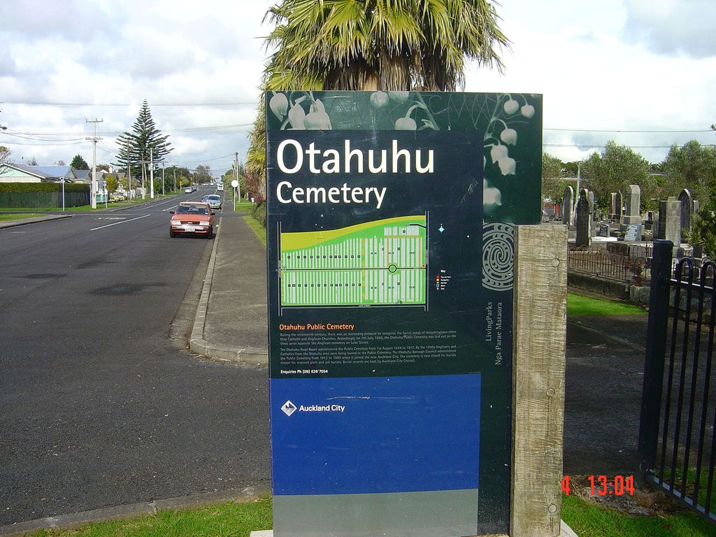
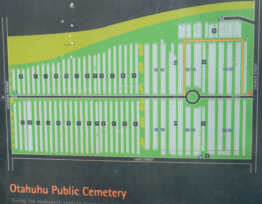
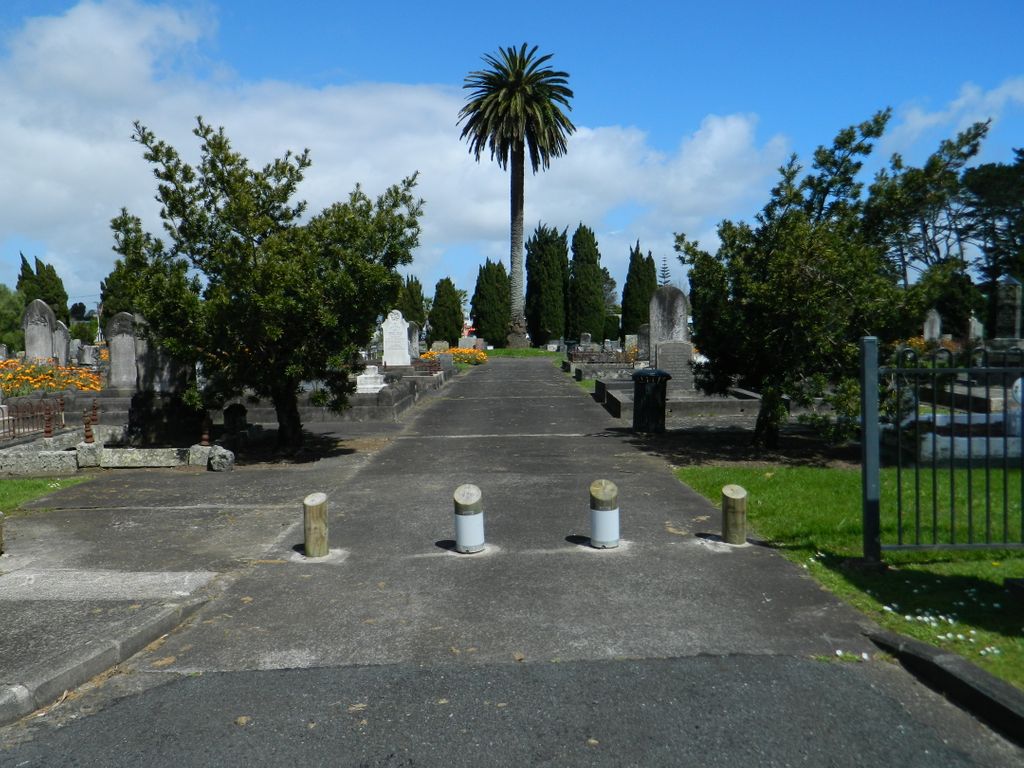
| Description | : | During the nineteenth century, there was an increasing pressure to recognise the burial needs of denominations other than Catholic and Anglican Churches, which each had their own cemeteries. Accordingly, on 7th July 1880, the Ōtāhuhu Public Cemetery was laid out on the three acres opposite the Anglican cemetery in Luke Street. The Ōtāhuhu Road Board administered the Public Cemetery from 1st August 1894 to 1912. By the 1890's Anglicans and Catholics from the Ōtāhuhu area were being buried in the Public Cemetery. The Ōtāhuhu Borough Council administered the Public Cemetery from 1912 to 1989, when it joined the new Auckland... Read More |
frequently asked questions (FAQ):
-
Where is Otahuhu Public Cemetery?
Otahuhu Public Cemetery is located at Atkinson Avenue and Luke Street Ōtāhūhū, Auckland Council ,Auckland ,New Zealand.
-
Otahuhu Public Cemetery cemetery's updated grave count on graveviews.com?
346 memorials
-
Where are the coordinates of the Otahuhu Public Cemetery?
Latitude: -36.9377500
Longitude: 174.8432390
Nearby Cemetories:
1. Holy Trinity Memorial Park
Ōtāhūhū, Auckland Council, New Zealand
Coordinate: -36.9374510, 174.8448580
2. St. Joseph and St. Joachim Catholic Cemetery
Ōtāhūhū, Auckland Council, New Zealand
Coordinate: -36.9436100, 174.8490100
3. Nixon Memorial
Ōtāhūhū, Auckland Council, New Zealand
Coordinate: -36.9499366, 174.8449909
4. St. John's Presbyterian Church Cemetery
Papatoetoe, Auckland Council, New Zealand
Coordinate: -36.9674185, 174.8598178
5. St Matthias Churchyard
Panmure, Auckland Council, New Zealand
Coordinate: -36.9053300, 174.8577200
6. St. Patrick's Roman Catholic Church Cemetery
Panmure, Auckland Council, New Zealand
Coordinate: -36.9029680, 174.8564960
7. Waikaraka Cemetery
Ōnehunga, Auckland Council, New Zealand
Coordinate: -36.9297140, 174.7967170
8. St. John's Church Cemetery
East Tamaki, Auckland Council, New Zealand
Coordinate: -36.9522250, 174.8964540
9. Onehunga Catholic Cemetery
Ōnehunga, Auckland Council, New Zealand
Coordinate: -36.9224360, 174.7884560
10. Our Lady of the Assumption Catholic Church
Ōnehunga, Auckland Council, New Zealand
Coordinate: -36.9223690, 174.7884530
11. Mangere Piriti Urupā St. James Churchyard
Mangere, Auckland Council, New Zealand
Coordinate: -36.9418970, 174.7835260
12. St. Peter's Anglican Cemetery
Ōnehunga, Auckland Council, New Zealand
Coordinate: -36.9227113, 174.7847550
13. Pakuranga Methodist Cemetery
Pakuranga, Auckland Council, New Zealand
Coordinate: -36.9054000, 174.8914900
14. Papatoetoe Cemetery
Papatoetoe, Auckland Council, New Zealand
Coordinate: -36.9893110, 174.8373530
15. Mangere Lawn Cemetery
Mangere, Auckland Council, New Zealand
Coordinate: -36.9626150, 174.7857000
16. Mangere Presbyterian Cemetery
Mangere, Auckland Council, New Zealand
Coordinate: -36.9750197, 174.7924783
17. Flat Bush Cemetery
East Tamaki, Auckland Council, New Zealand
Coordinate: -36.9563500, 174.9097100
18. Howick Historical Village
Pakuranga, Auckland Council, New Zealand
Coordinate: -36.9067680, 174.9027080
19. Manukau Memorial Gardens
Manukau, Auckland Council, New Zealand
Coordinate: -36.9944380, 174.8397300
20. Point England Presbyterian Cemetery
Point England, Auckland Council, New Zealand
Coordinate: -36.8823420, 174.8601550
21. St. Paul's Anglican Cemetery
East Tamaki, Auckland Council, New Zealand
Coordinate: -36.9615200, 174.9082000
22. St. John’s College Graveyard
Saint Johns, Auckland Council, New Zealand
Coordinate: -36.8738169, 174.8416826
23. Woodside Methodist Cemetery
Manukau, Auckland Council, New Zealand
Coordinate: -36.9929680, 174.8837860
24. St. Thomas Churchyard
Tamaki, Auckland Council, New Zealand
Coordinate: -36.8675590, 174.8460560