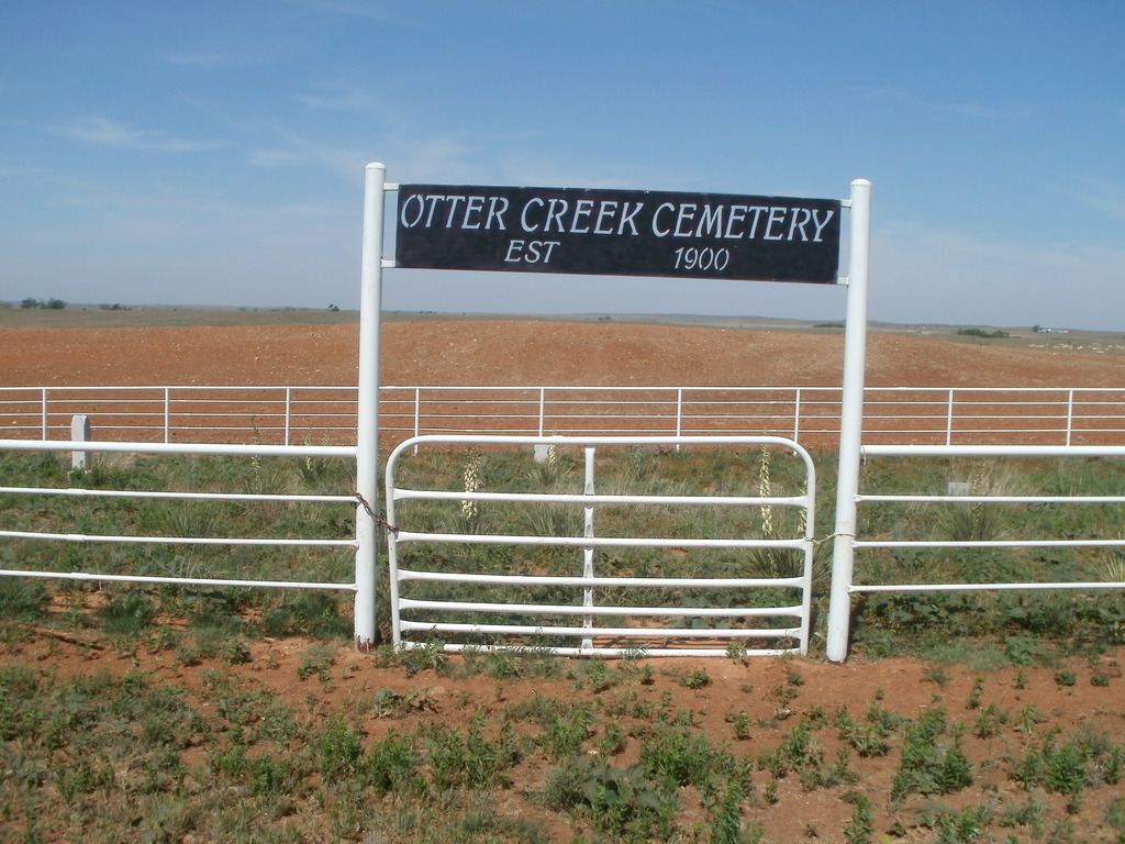
| Memorials | : | 0 |
| Location | : | Buffalo, Harper County, USA |
| Coordinate | : | 36.8781100, -99.6581200 |
| Description | : | Otter Creek Cemetery aka Pikes Peak Cemetery. It is on a dusty gravel road 3 miles north 2 miles west, and 1/2 miles north of Buffalo, Oklahoma. It is about 1/2 to 3/4 mile off this dusty gravel road in a middle of a pasture. There is a gate (no marking) and the area that is the cemetery is surrounded by barb wire. You have to drive to it through the bumpy pasture. There is no Cemetery Name at the entrance of this cemetery. This is a map of Harper County, Oklahoma showing existing citys, towns, villages... Read More |
frequently asked questions (FAQ):
-
Where is Otter Creek Cemetery?
Otter Creek Cemetery is located at Buffalo, Harper County ,Oklahoma ,USA.
-
Otter Creek Cemetery cemetery's updated grave count on graveviews.com?
0 memorials
-
Where are the coordinates of the Otter Creek Cemetery?
Latitude: 36.8781100
Longitude: -99.6581200
Nearby Cemetories:
1. High Point Cemetery
Buffalo, Harper County, USA
Coordinate: 36.8278008, -99.6014023
2. Willard Cemetery
Willard, Harper County, USA
Coordinate: 36.9585991, -99.7197037
3. Doby Springs Cemetery
Harper County, USA
Coordinate: 36.8381004, -99.7817001
4. Willow Creek Cemetery
Buffalo, Harper County, USA
Coordinate: 36.9688988, -99.5749969
5. Hopewell Cemetery
Harper County, USA
Coordinate: 36.8708000, -99.5164032
6. Snake Creek Ranch Cemetery
Ashland, Clark County, USA
Coordinate: 37.0017700, -99.6458200
7. Evergreen Cemetery
Buffalo, Harper County, USA
Coordinate: 36.7544400, -99.6918000
8. Goldenrod Cemetery
Buffalo, Harper County, USA
Coordinate: 36.8555493, -99.5002693
9. Pleasant Valley Cemetery
Buffalo, Harper County, USA
Coordinate: 36.9136009, -99.8178024
10. Zion Lutheran Cemetery
Buffalo, Harper County, USA
Coordinate: 36.8999500, -99.4850900
11. Rose Hill Cemetery
Laverne, Harper County, USA
Coordinate: 36.7905998, -99.8169022
12. Kibby Cemetery
Harper County, USA
Coordinate: 36.7242012, -99.5543976
13. Pleasant Ridge Cemetery
Rosston, Harper County, USA
Coordinate: 36.8711014, -99.8910980
14. Spring Valley Cemetery
Harper County, USA
Coordinate: 36.8292007, -99.3666992
15. Wolf Farm Cemetery
Rosston, Harper County, USA
Coordinate: 36.8407516, -99.9551544
16. Laverne Memorial Cemetery
Laverne, Harper County, USA
Coordinate: 36.6800003, -99.8839035
17. Protection Mennonite Cemetery
Protection, Comanche County, USA
Coordinate: 37.1188640, -99.4790610
18. Gate Cemetery
Gate, Beaver County, USA
Coordinate: 36.8814011, -100.0286026
19. Cline Cemetery
Beaver County, USA
Coordinate: 36.7756004, -100.0072021
20. Coy Cemetery
Freedom, Woods County, USA
Coordinate: 36.9721700, -99.3029700
21. Fern - Mount Olive Cemetery
Harper County, USA
Coordinate: 36.6671982, -99.3758011
22. Smoot Cemetery
Laverne, Harper County, USA
Coordinate: 36.6569400, -99.9280500
23. Lookout Cemetery
Freedom, Woods County, USA
Coordinate: 36.9002991, -99.2722015
24. Fort Supply Hospital Cemetery
Fort Supply, Woodward County, USA
Coordinate: 36.5722780, -99.5624050

