
| Memorials | : | 1 |
| Location | : | Ouddorp, Goeree-Overflakkee Municipality, Netherlands |
| Coordinate | : | 51.8071900, 3.9290700 |
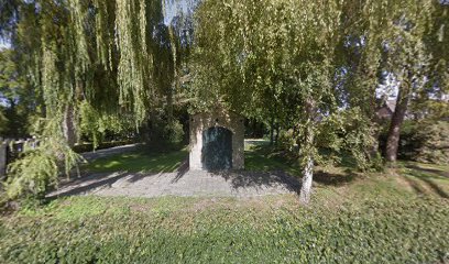
| Description | : | Ouddorp is in the north-western part of the island of Goeree-Overflakkee, and is about 63 kilometres west-south-west of Rotterdam and 75 kilometres west of Dordrecht. The cemetery stands opposite a prominent windmill on the south-western outskirts of the village. There is now one 1914-1918, and over 10 1939-1945 war casualties commemorated in this site. Over half of these, including the 1914-1918 casualty are unidentified |
frequently asked questions (FAQ):
-
Where is Ouddorp General Cemetery?
Ouddorp General Cemetery is located at Ouddorp, Goeree-Overflakkee Municipality ,Zuid-Holland ,Netherlands.
-
Ouddorp General Cemetery cemetery's updated grave count on graveviews.com?
1 memorials
-
Where are the coordinates of the Ouddorp General Cemetery?
Latitude: 51.8071900
Longitude: 3.9290700
Nearby Cemetories:
1. Goedereede General Cemetery
Goedereede, Goeree-Overflakkee Municipality, Netherlands
Coordinate: 51.8166200, 3.9764300
2. Grote-of St.Nicolaaskerk
Brouwershaven, Schouwen-Duiveland Municipality, Netherlands
Coordinate: 51.7258151, 3.9100450
3. Begraafplaats Brouwershaven
Brouwershaven, Schouwen-Duiveland Municipality, Netherlands
Coordinate: 51.7233104, 3.9164335
4. Begraafplaats Looperkapelle
Looperskapelle, Schouwen-Duiveland Municipality, Netherlands
Coordinate: 51.7331339, 3.8583546
5. Oude begraafplaats Looperskapelle
Looperskapelle, Schouwen-Duiveland Municipality, Netherlands
Coordinate: 51.7269754, 3.8642181
6. Algemene Begraafplaats
Scharendijke, Schouwen-Duiveland Municipality, Netherlands
Coordinate: 51.7327000, 3.8430200
7. Zonnemaire Cemetery
Zonnemaire, Schouwen-Duiveland Municipality, Netherlands
Coordinate: 51.7125300, 3.9472700
8. Begraafplaats Ellemeet
Ellemeet, Schouwen-Duiveland Municipality, Netherlands
Coordinate: 51.7237848, 3.8179093
9. Zeeweg General Cemetery
Rockanje, Westvoorne Municipality, Netherlands
Coordinate: 51.8747900, 4.0674300
10. Oude Begraafplaats Ellemeet
Ellemeet, Schouwen-Duiveland Municipality, Netherlands
Coordinate: 51.7137581, 3.8294904
11. Driekoningenkerk
Noordgouwe, Schouwen-Duiveland Municipality, Netherlands
Coordinate: 51.6937781, 3.9387569
12. Begraafplaats Noordgouwe
Noordgouwe, Schouwen-Duiveland Municipality, Netherlands
Coordinate: 51.6930516, 3.9357464
13. Begraafplaats Noordwelle
Noordwelle, Schouwen-Duiveland Municipality, Netherlands
Coordinate: 51.7203933, 3.7925697
14. Joodse Begraafplaats
Dirksland, Goeree-Overflakkee Municipality, Netherlands
Coordinate: 51.7509730, 4.1045730
15. Renesse General Cemetery
Renesse, Schouwen-Duiveland Municipality, Netherlands
Coordinate: 51.7331500, 3.7718100
16. Begraafplaats Kerkwerve
Kerkwerve, Schouwen-Duiveland Municipality, Netherlands
Coordinate: 51.6860290, 3.9019918
17. Corneliuskerk
Noordwelle, Schouwen-Duiveland Municipality, Netherlands
Coordinate: 51.7184012, 3.7927052
18. Adriaanskerk
Dreischor, Schouwen-Duiveland Municipality, Netherlands
Coordinate: 51.6893221, 3.9834029
19. Dirksland Oude Begraafplaats
Dirksland, Goeree-Overflakkee Municipality, Netherlands
Coordinate: 51.7461100, 4.1021200
20. Dreischor Cemetery
Dreischor, Schouwen-Duiveland Municipality, Netherlands
Coordinate: 51.6871930, 3.9815400
21. Nieuw-Helvoet General Cemetery
Nieuw-Helvoet, Hellevoetsluis Municipality, Netherlands
Coordinate: 51.8400400, 4.1244610
22. Begraafplaats Serooskerke
Serooskerke, Schouwen-Duiveland Municipality, Netherlands
Coordinate: 51.7004759, 3.8157287
23. Herkingen General Cemetery
Herkingen, Goeree-Overflakkee Municipality, Netherlands
Coordinate: 51.7118100, 4.0919500
24. Sommelsdijk Old Churchyard
Sommelsdijk, Goeree-Overflakkee Municipality, Netherlands
Coordinate: 51.7589805, 4.1516930