
| Memorials | : | 0 |
| Location | : | Guadalupe, Santa Barbara County, USA |
| Coordinate | : | 34.9284800, -120.5911300 |
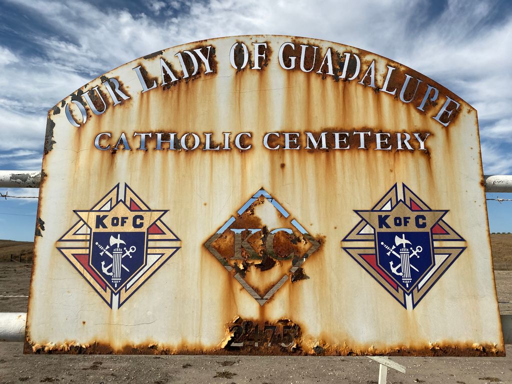
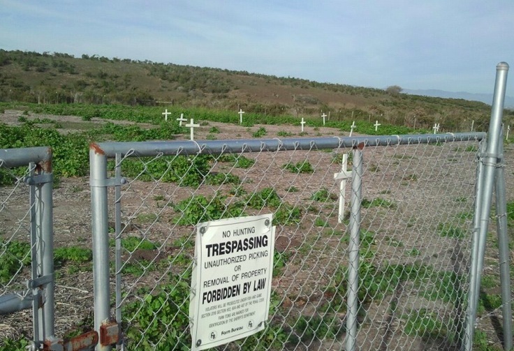
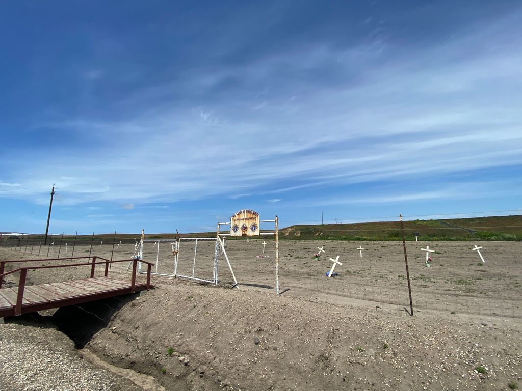
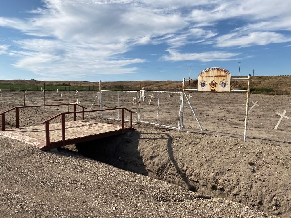
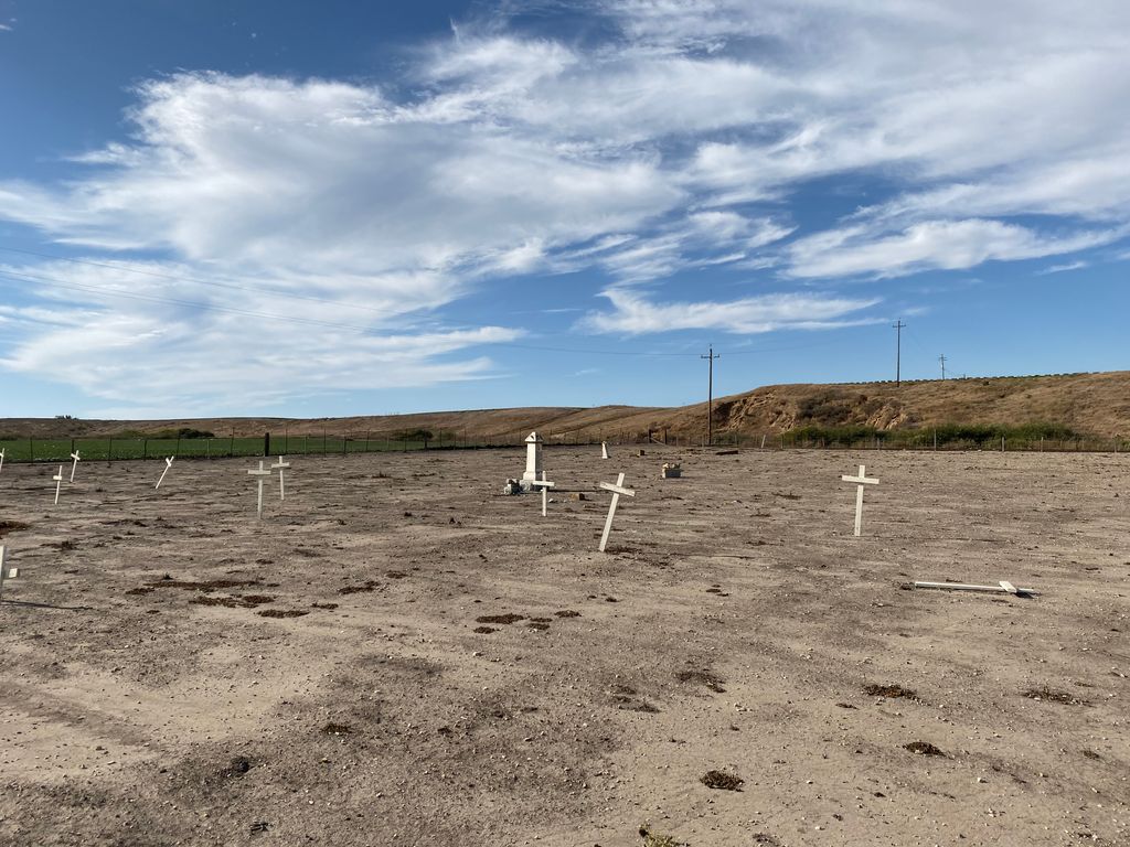
| Description | : | Location: 1/4 mile from Highway 1 (State Rt. 135) on Brown Road, Guadalupe, California, just south of Route 166 in Guadalupe. On the road to Point Sal, 1/4 mile from Highway 1, 1/4 mile south of Guadalupe Cemetery. This cemetery is described on page 25 in Americans West as the "Old Abandoned Cemetery on Point Sal Road". Our Lady of Guadalupe Catholic Cemetery, also known as the Old Catholic Cemetery in Guadalupe, California, contains the graves of some of the first settlers, early ranchers, in Guadalupe. Most of those buried are still there, although there are only a few gravestones left.... Read More |
frequently asked questions (FAQ):
-
Where is Our Lady of Guadalupe Catholic Cemetery?
Our Lady of Guadalupe Catholic Cemetery is located at On Road to Point Sal, 1/4 mile from Highway 1, 1/4 mile south of Guadalupe Cemetery Guadalupe, Santa Barbara County ,California ,USA.
-
Our Lady of Guadalupe Catholic Cemetery cemetery's updated grave count on graveviews.com?
0 memorials
-
Where are the coordinates of the Our Lady of Guadalupe Catholic Cemetery?
Latitude: 34.9284800
Longitude: -120.5911300
Nearby Cemetories:
1. Guadalupe Cemetery
Guadalupe, Santa Barbara County, USA
Coordinate: 34.9582863, -120.5741501
2. Bethel Lutheran Church Resurrection Garden
Santa Maria, Santa Barbara County, USA
Coordinate: 34.9415700, -120.4279900
3. Santa Maria Cemetery District
Santa Maria, Santa Barbara County, USA
Coordinate: 34.9369011, -120.4253006
4. Dudley-Hoffman Memory Gardens Columbarium
Santa Maria, Santa Barbara County, USA
Coordinate: 34.9388480, -120.4215260
5. Saint Joseph of Cupertino Province Cemetery
San Luis Obispo County, USA
Coordinate: 35.0718803, -120.5263519
6. Pine Grove Cemetery
Santa Barbara County, USA
Coordinate: 34.8550430, -120.4185950
7. Saint John's Lutheran Church Columbarium
Arroyo Grande, San Luis Obispo County, USA
Coordinate: 35.1032070, -120.5808630
8. Halcyon Cemetery
Halcyon, San Luis Obispo County, USA
Coordinate: 35.1062000, -120.5994990
9. Saint Barnabas Memorial Garden
Arroyo Grande, San Luis Obispo County, USA
Coordinate: 35.1179910, -120.5706380
10. Arroyo Grande Cemetery
Arroyo Grande, San Luis Obispo County, USA
Coordinate: 35.1230011, -120.5930634
11. Saint Patrick's Cemetery
Arroyo Grande, San Luis Obispo County, USA
Coordinate: 35.1292740, -120.6002950
12. Guillermo Eduardo de la Guerra Burial Site
Los Alamos, Santa Barbara County, USA
Coordinate: 34.7500000, -120.3500000
13. Saint Mary's Episcopal Memory Garden
Lompoc, Santa Barbara County, USA
Coordinate: 34.6807100, -120.4533500
14. Mission La Purisima Concepcion Cemetery
Lompoc, Santa Barbara County, USA
Coordinate: 34.6716652, -120.4216690
15. Ontiveros Cemetery
Los Alamos, Santa Barbara County, USA
Coordinate: 34.8897000, -120.2334900
16. San Ramon Chapel Cemetery
Santa Barbara County, USA
Coordinate: 34.8478012, -120.2394028
17. Lompoc Evergreen Cemetery
Lompoc, Santa Barbara County, USA
Coordinate: 34.6296997, -120.4477997
18. Los Alamos Cemetery
Los Alamos, Santa Barbara County, USA
Coordinate: 34.7327995, -120.2807999
19. San Luis Cemetery
San Luis Obispo, San Luis Obispo County, USA
Coordinate: 35.2644192, -120.6712830
20. Old Mission Cemetery
San Luis Obispo, San Luis Obispo County, USA
Coordinate: 35.2670660, -120.6692150
21. Mission San Luis Obispo Cemetery
San Luis Obispo, San Luis Obispo County, USA
Coordinate: 35.2806600, -120.6645200
22. Los Osos Valley Memorial Park
Los Osos, San Luis Obispo County, USA
Coordinate: 35.3053017, -120.8011017
23. Carroll-McGovern Cemetery
Pozo, San Luis Obispo County, USA
Coordinate: 35.3069100, -120.3598100
24. Canet Cemetery
San Luis Obispo County, USA
Coordinate: 35.3522840, -120.7901660