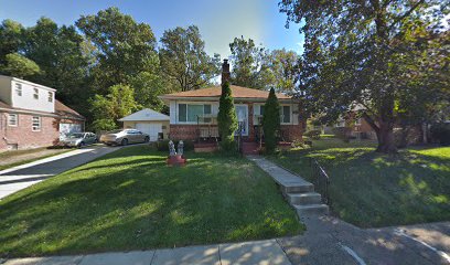
| Memorials | : | 0 |
| Location | : | Yeadon, Delaware County, USA |
| Coordinate | : | 39.9375610, -75.2409470 |
| Description | : | The Owen and Palmer burial ground was established on land owned by J. L. Palmer in the 19th century, prior to the establishment of Mount Moriah cemetery. The small family cemetery was enclosed by a stone wall and was situated near Charles Palmer's planned suburb of "Palermo," near Fernwood station on the West Chester and Philadelphia Railroad. After the Palmer family sold their land to Mount Moriah, management of the small family plot was taken over by Mount Moriah, which established the Naval Plot adjacent to it. Today this small family cemetery is overgrown. |
frequently asked questions (FAQ):
-
Where is Owen and Palmer Burial Ground?
Owen and Palmer Burial Ground is located at North of Mount Moriah Cemetery, West of Cobbs Creek Yeadon, Delaware County ,Pennsylvania , 19050USA.
-
Owen and Palmer Burial Ground cemetery's updated grave count on graveviews.com?
0 memorials
-
Where are the coordinates of the Owen and Palmer Burial Ground?
Latitude: 39.9375610
Longitude: -75.2409470
Nearby Cemetories:
1. Mount Moriah Cemetery
Philadelphia, Philadelphia County, USA
Coordinate: 39.9336014, -75.2382965
2. Graceland Cemetery
Yeadon, Delaware County, USA
Coordinate: 39.9387474, -75.2473373
3. Hebrew Mutual Burial Ground
Philadelphia, Philadelphia County, USA
Coordinate: 39.9291946, -75.2390474
4. Fernwood Cemetery
Lansdowne, Delaware County, USA
Coordinate: 39.9443800, -75.2525100
5. Holy Cross Cemetery
Yeadon, Delaware County, USA
Coordinate: 39.9308014, -75.2556000
6. Hanover Street Burial Grounds (Defunct)
Philadelphia, Philadelphia County, USA
Coordinate: 39.9498920, -75.2306800
7. Saint Cyril of Alexandria Roman Catholic Church Grounds (Defunct)
East Lansdowne, Delaware County, USA
Coordinate: 39.9447978, -75.2606365
8. Leech Family Burial Grounds
Philadelphia, Philadelphia County, USA
Coordinate: 39.9405120, -75.2164140
9. Friends Southwestern Burial Ground
Upper Darby, Delaware County, USA
Coordinate: 39.9565010, -75.2522202
10. Bartram's Garden National Historic Landmark
Philadelphia, Philadelphia County, USA
Coordinate: 39.9320831, -75.2135162
11. Darby Friends Cemetery
Darby, Delaware County, USA
Coordinate: 39.9228058, -75.2647400
12. Mikveh Israel Cemetery #03
Philadelphia, Philadelphia County, USA
Coordinate: 39.9612083, -75.2302933
13. Saint Alice Roman Catholic Church Grounds
Bywood, Delaware County, USA
Coordinate: 39.9572201, -75.2616611
14. New Jerusalem Church Cemetery (Defunct)
Lansdowne, Delaware County, USA
Coordinate: 39.9518700, -75.2694000
15. Darby Methodist Meeting Cemetery
Collingdale, Delaware County, USA
Coordinate: 39.9191895, -75.2693100
16. Mount Zion Cemetery
Collingdale, Delaware County, USA
Coordinate: 39.9201622, -75.2706528
17. Collegiate Church of Saint Andrew Churchyard
Philadelphia, Philadelphia County, USA
Coordinate: 39.9532700, -75.2068200
18. Eden Cemetery
Collingdale, Delaware County, USA
Coordinate: 39.9188995, -75.2750015
19. African Friends to Harmony Burial Ground
Philadelphia, Philadelphia County, USA
Coordinate: 39.9562090, -75.2051990
20. Blockley Baptist Church Cemetery (Defunct)
Philadelphia, Philadelphia County, USA
Coordinate: 39.9691760, -75.2265040
21. Blockley Almshouse Cemetery #2
Philadelphia, Philadelphia County, USA
Coordinate: 39.9456510, -75.1976500
22. Walnut Street Associated Presbyterian Church Cemetery
Philadelphia County, USA
Coordinate: 39.9542550, -75.2015500
23. Convent of the Society of the Holy Child Jesus Burial Ground (Defunct)
Sharon Hill, Delaware County, USA
Coordinate: 39.9084985, -75.2670769
24. Haddington Methodist Episcopal Cemetery (Defunct)
Haddington, Philadelphia County, USA
Coordinate: 39.9725430, -75.2532180

