
| Memorials | : | 0 |
| Location | : | Oxford, City of Oxford, England |
| Coordinate | : | 51.7521453, -1.2631165 |
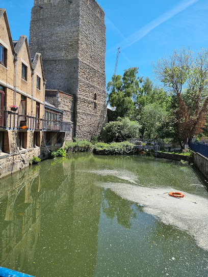
| Description | : | Partly ruined Norman medieval castle on the western side of central Oxford in Oxfordshire, England. Most of the original moated, wooden motte and bailey castle was replaced in stone in the late 12th or early 13th century and the castle played an important role in the conflict of the Anarchy. In the 14th century the military value of the castle diminished and the site became used primarily for county administration and as a prison. After the Civil War, Oxford Castle served primarily as the local prison. As with other prisons at the time, the owners, in this case Christ... Read More |
frequently asked questions (FAQ):
-
Where is Oxford Castle and Prison Cemetery?
Oxford Castle and Prison Cemetery is located at Oxford, City of Oxford, Oxfordshire, England Oxford, City of Oxford ,Oxfordshire ,England.
-
Oxford Castle and Prison Cemetery cemetery's updated grave count on graveviews.com?
0 memorials
-
Where are the coordinates of the Oxford Castle and Prison Cemetery?
Latitude: 51.7521453
Longitude: -1.2631165
Nearby Cemetories:
1. Saint Peter le Bailey Churchyard
Oxford, City of Oxford, England
Coordinate: 51.7516980, -1.2600300
2. St Ebbe Churchyard
Oxford, City of Oxford, England
Coordinate: 51.7504200, -1.2596030
3. Saint Thomas the Martyr Churchyard
Oxford, City of Oxford, England
Coordinate: 51.7512222, -1.2679445
4. St Martin's Church, Carfax (Defunct)
Oxford, City of Oxford, England
Coordinate: 51.7513500, -1.2581700
5. St Thomas the Martyr
Oxford, City of Oxford, England
Coordinate: 51.7518100, -1.2683430
6. St. Michael at the North Gate Church
Oxford, City of Oxford, England
Coordinate: 51.7537210, -1.2583950
7. Rewley Abbey
Oxford, City of Oxford, England
Coordinate: 51.7543810, -1.2675170
8. St. Mary Magdalene's Churchyard
Oxford, City of Oxford, England
Coordinate: 51.7546250, -1.2588340
9. Martyrs' Memorial
Oxford, City of Oxford, England
Coordinate: 51.7550900, -1.2590100
10. Jesus College Chapel
Oxford, City of Oxford, England
Coordinate: 51.7536130, -1.2566180
11. Blackfriars
Oxford, City of Oxford, England
Coordinate: 51.7561210, -1.2602060
12. Balliol College Chapel
Oxford, City of Oxford, England
Coordinate: 51.7547800, -1.2572240
13. University Church of St Mary the Virgin
Oxford, City of Oxford, England
Coordinate: 51.7523990, -1.2556000
14. Exeter College Chapel
Oxford, City of Oxford, England
Coordinate: 51.7539460, -1.2561170
15. St Johns College
Oxford, City of Oxford, England
Coordinate: 51.7560820, -1.2589910
16. All Saints Churchyard
Oxford, City of Oxford, England
Coordinate: 51.7525000, -1.2555560
17. Osney Cemetery
Oxford, City of Oxford, England
Coordinate: 51.7505310, -1.2703040
18. Osney Cathedral
Oxford, City of Oxford, England
Coordinate: 51.7497220, -1.2700000
19. Trinity College Chapel
Oxford, City of Oxford, England
Coordinate: 51.7552360, -1.2569620
20. Christ Church Cathedral
Oxford, City of Oxford, England
Coordinate: 51.7500620, -1.2547160
21. Corpus Christi College Chapel
Oxford, City of Oxford, England
Coordinate: 51.7507010, -1.2534236
22. Oriel College Ante-Chapel
Oxford, City of Oxford, England
Coordinate: 51.7512420, -1.2531940
23. Austin Friars Church
Oxford, City of Oxford, England
Coordinate: 51.7553710, -1.2541550
24. Merton College chapel
Oxford, City of Oxford, England
Coordinate: 51.7510500, -1.2526620