
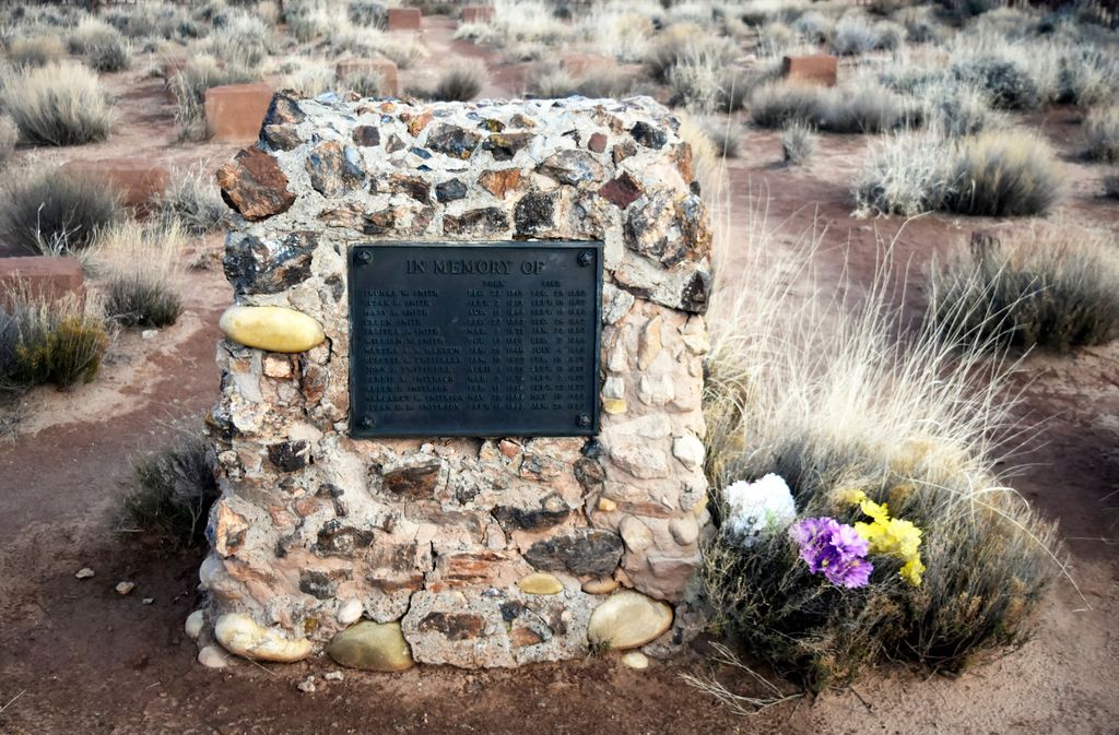
| Memorials | : | 0 |
| Location | : | Kane County, USA |
| Coordinate | : | 37.2430770, -111.9576720 |
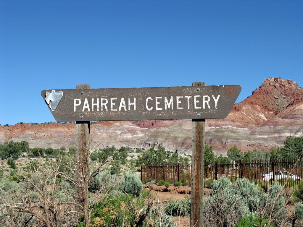
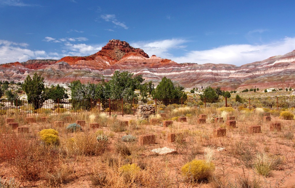
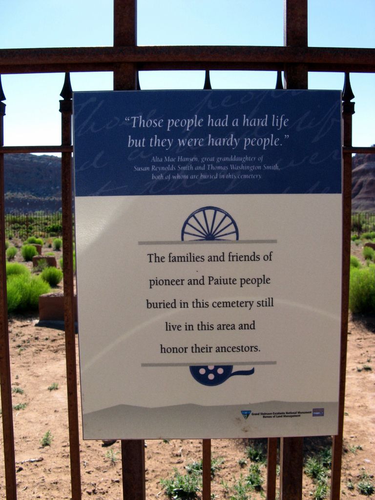
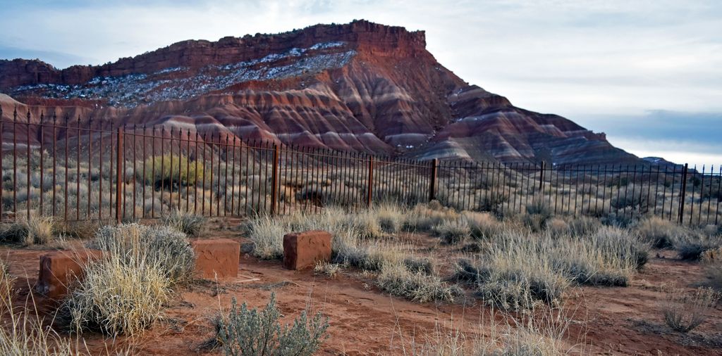
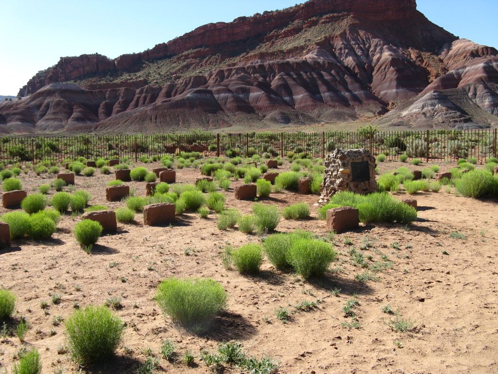
| Description | : | Pahreah, aka Paria was first settled by Mormon farmers in 1870 and thrived until 1920 when 5 years of frequent floods washed away crops and buildings. By 1930 the town was empty and today only the cemetery remains. The movies "The Outlaw Josie Wales" and the "Long Ride Home" were both filmed here. |
frequently asked questions (FAQ):
-
Where is Pahreah Cemetery?
Pahreah Cemetery is located at Kane County ,Utah ,USA.
-
Pahreah Cemetery cemetery's updated grave count on graveviews.com?
0 memorials
-
Where are the coordinates of the Pahreah Cemetery?
Latitude: 37.2430770
Longitude: -111.9576720


Nearby Cemetories:
1. Adairville Cemetery
Paria, Kane County, USA
Coordinate: 37.1181830, -111.9176240
2. Elijah Averett Gravesite
Paria, Kane County, USA
Coordinate: 37.4891380, -112.0818930
3. Georgetown Cemetery
Cannonville, Garfield County, USA
Coordinate: 37.5360985, -112.0543976
4. Henrieville Cemetery
Henrieville, Garfield County, USA
Coordinate: 37.5653000, -112.0033035
5. Crystal Cove Cemetery
Johnson, Kane County, USA
Coordinate: 37.1790241, -112.3840522
6. Cannonville Cemetery
Cannonville, Garfield County, USA
Coordinate: 37.5806007, -112.0658035
7. Johnson Cemetery
Johnson, Kane County, USA
Coordinate: 37.0864363, -112.3751514
8. Loseeville Cemetery
Loseeville, Garfield County, USA
Coordinate: 37.6253000, -112.0466300
9. Tropic Cemetery
Tropic, Garfield County, USA
Coordinate: 37.6293983, -112.0817032
10. Siler Ranch Cemetery
Alton, Kane County, USA
Coordinate: 37.3948200, -112.4799500
11. Roundy-Johnson Cemetery
Alton, Kane County, USA
Coordinate: 37.4569200, -112.4495800
12. Roundy Cemetery
Alton, Kane County, USA
Coordinate: 37.4550300, -112.4553800
13. Honeymoon Trail Gravesites
House Rock Valley, Coconino County, USA
Coordinate: 36.7983100, -112.0592300
14. Bryce Canyon City Cemetery
Bryce Canyon, Garfield County, USA
Coordinate: 37.6719080, -112.1508719
15. Alton Cemetery
Alton, Kane County, USA
Coordinate: 37.4319000, -112.4888992
16. Bryce Woodlands Cemetery
Alton, Kane County, USA
Coordinate: 37.5262831, -112.4201972
17. Lonely Dell Cemetery
Lee's Ferry, Coconino County, USA
Coordinate: 36.8691597, -111.5949249
18. Angels Rest Pet Cemetery
Kanab, Kane County, USA
Coordinate: 37.1489700, -112.5405900
19. Kanab City Cemetery
Kanab, Kane County, USA
Coordinate: 37.0442009, -112.5177994
20. Kanab Pioneer Park Cemetery
Kanab, Kane County, USA
Coordinate: 37.0550452, -112.5251345
21. Glendale City Cemetery
Glendale, Kane County, USA
Coordinate: 37.3185997, -112.5907974
22. Stewart Cemetery
Glendale, Kane County, USA
Coordinate: 37.3138300, -112.5966100
23. Page Cemetery
Page, Coconino County, USA
Coordinate: 36.9064050, -111.4690610
24. House Rock Cemetery
House Rock Valley, Coconino County, USA
Coordinate: 36.7325710, -112.0477316