
| Memorials | : | 0 |
| Location | : | Deaf Smith County, USA |
| Coordinate | : | 35.1167700, -102.2047260 |
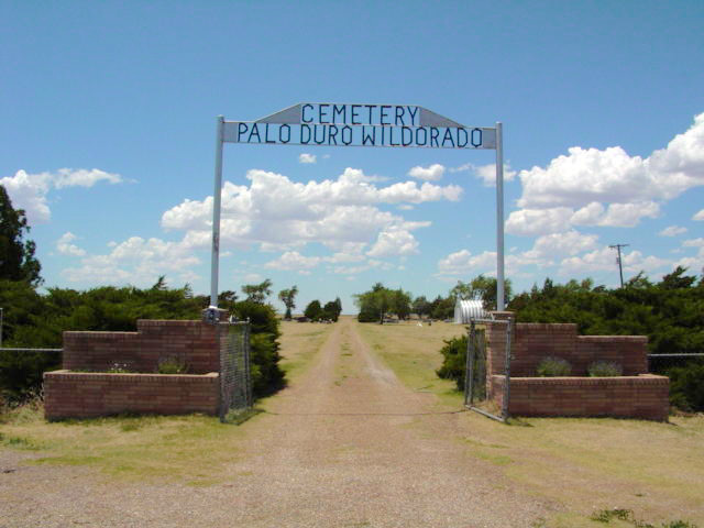
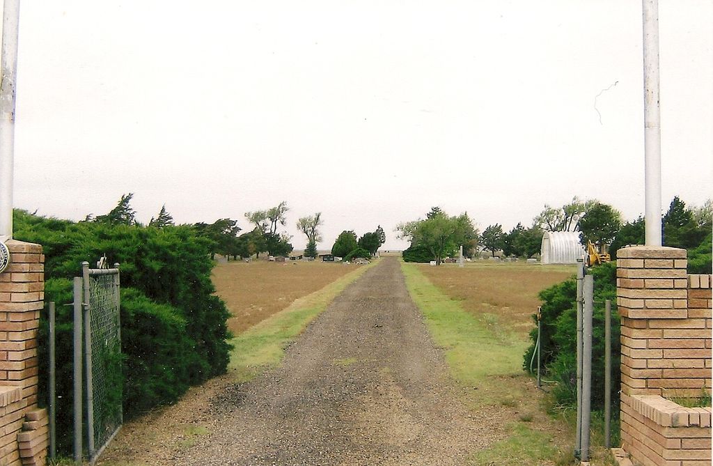
| Description | : | Palo Duro Wildorado Cemetery, actually lies just south of the Oldham County line in Deaf Smith County. Palo Duro Baptist Church is across the road. The assocation with the cemetery is historical not current. Early settlers to this area included the JC Womble family, which came in January 1892. The next year, the community obtained land on which to build a schoolhouse, known as the Union School. In May 1893, George D. Whitfield, a young cowboy, was buried in what was the schoolyard. His is the first marked burial, although two earlier graves were known to exist. In 1901, residents organized the Palo... Read More |
frequently asked questions (FAQ):
-
Where is Palo Duro Wildorado?
Palo Duro Wildorado is located at Hwy 40;Palo Duro Wildorado Deaf Smith County ,Texas ,USA.
-
Palo Duro Wildorado cemetery's updated grave count on graveviews.com?
0 memorials
-
Where are the coordinates of the Palo Duro Wildorado?
Latitude: 35.1167700
Longitude: -102.2047260

Nearby Cemetories:
1. Rest Lawn Cemetery
Hereford, Deaf Smith County, USA
Coordinate: 34.8643990, -102.4049988
2. Saint Anthonys Cemetery
Hereford, Deaf Smith County, USA
Coordinate: 34.8327600, -102.4100700
3. Saint Thomas Episcopal Church Columbarium
Hereford, Deaf Smith County, USA
Coordinate: 34.8217660, -102.4133190
4. West Park Cemetery
Hereford, Deaf Smith County, USA
Coordinate: 34.8210983, -102.4206009
5. Old La Plata Cemetery
Hereford, Deaf Smith County, USA
Coordinate: 34.9695880, -102.5980060
6. Hereford Italian POW Camp Chapel Grounds
Hereford, Deaf Smith County, USA
Coordinate: 34.7458000, -102.4250000
7. Washburn Cemetery
Washburn, Armstrong County, USA
Coordinate: 35.1767006, -101.5419006
8. Liberty Cemetery
Carson County, USA
Coordinate: 35.2806015, -101.5496979
9. Holy Family Cemetery
Nazareth, Castro County, USA
Coordinate: 34.5469017, -102.1025009
10. Westlawn Memorial Park
Dimmitt, Castro County, USA
Coordinate: 34.5380250, -102.3618610
11. Castro Memorial Gardens
Dimmitt, Castro County, USA
Coordinate: 34.5280991, -102.3197021
12. Wayside Cemetery
Wayside, Armstrong County, USA
Coordinate: 34.7919998, -101.5466003
13. Claude Cemetery
Claude, Armstrong County, USA
Coordinate: 35.1324997, -101.3799973
14. Flagg Cemetery
Castro County, USA
Coordinate: 34.4393997, -102.3681030
15. Mount Pleasant Cemetery
Armstrong County, USA
Coordinate: 34.9446983, -101.3608017
16. Panhandle Cemetery
Panhandle, Carson County, USA
Coordinate: 35.3534740, -101.3701260
17. Hart Cemetery
Hart, Castro County, USA
Coordinate: 34.3926010, -102.1346970
18. Endee Cemetery
Quay County, USA
Coordinate: 35.1453018, -103.1247025
19. Mitchell Cemetery
Bellview, Curry County, USA
Coordinate: 34.9150009, -103.0991974
20. Allen Cemetery
Quay County, USA
Coordinate: 35.0120020, -103.1381030
21. Hollene Cemetery
Hollene, Curry County, USA
Coordinate: 34.7774950, -103.0994210
22. Milo Cemetery
Briscoe County, USA
Coordinate: 34.5928710, -101.4524400
23. Bard Cemetery
Bard, Quay County, USA
Coordinate: 35.1209000, -103.2263000
24. Goodnight Cemetery
Goodnight, Armstrong County, USA
Coordinate: 35.0463982, -101.1735992