
| Memorials | : | 10 |
| Location | : | Lyman, Grafton County, USA |
| Coordinate | : | 44.2582400, -71.9458800 |
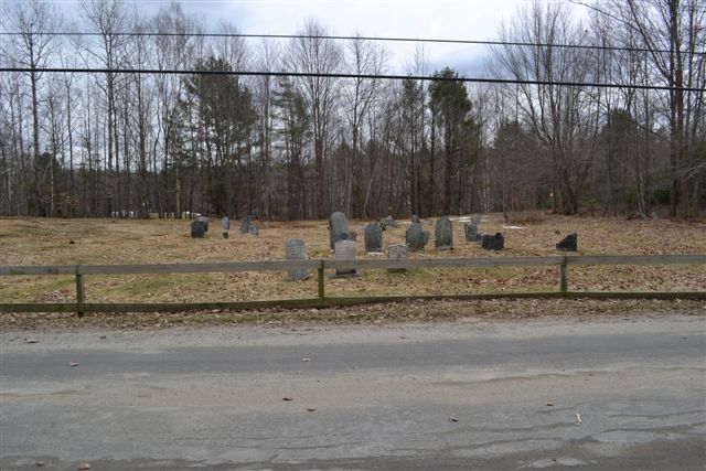
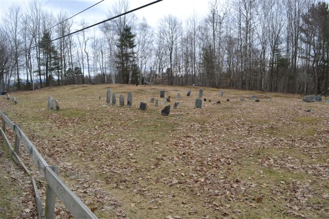
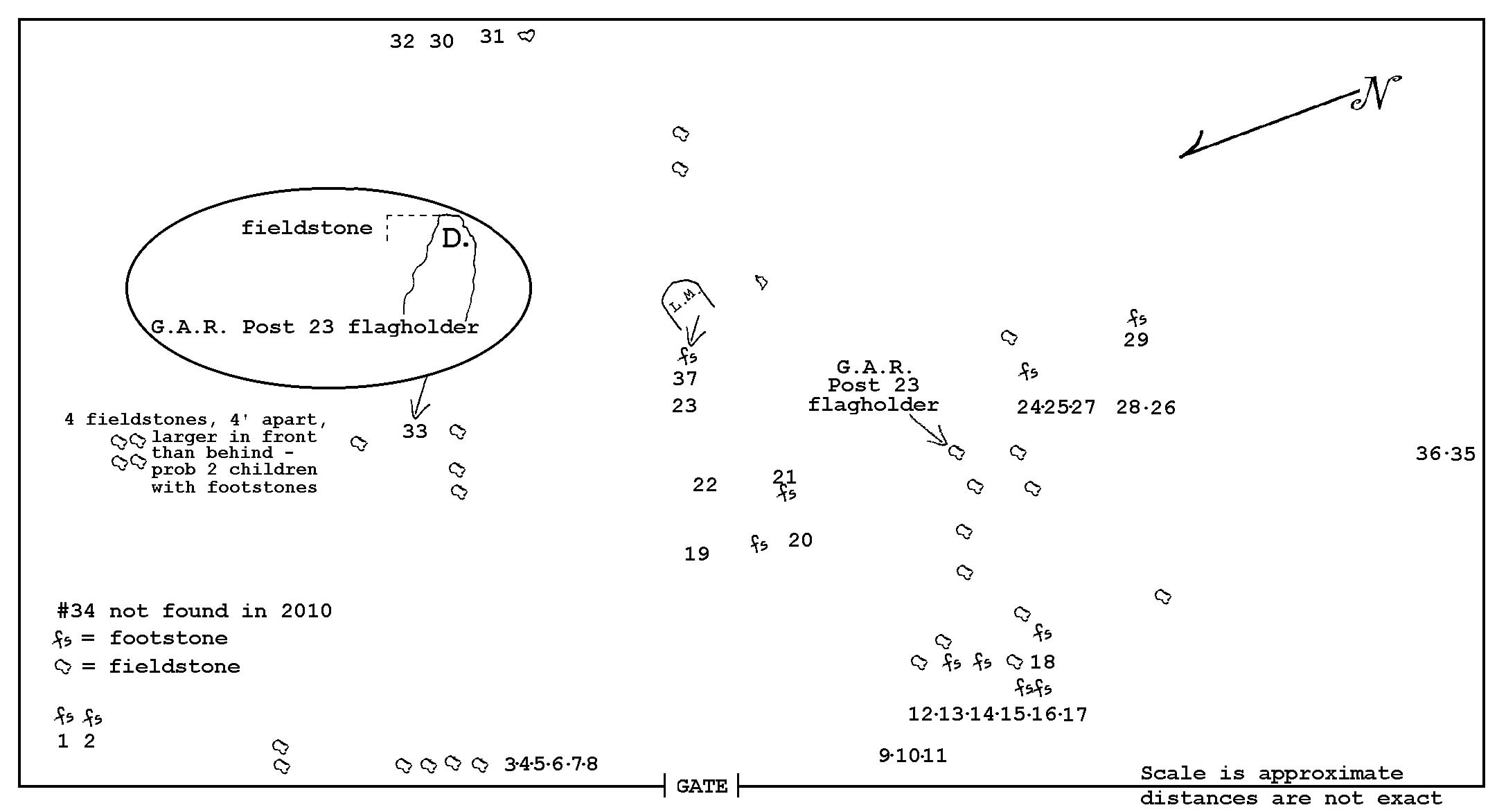
| Description | : | This is a very old cemetery, reputed to be the first one in Lyman. Almost all stones are gone. Mrs Charles Carpenter Goss in her "Colonial Gravestone Inscriptions in the State of New Hampshire" calls this cemetery "Lyman Cemetery near Church". From the forward to Mrs Pickwick's 1950 transcript: It is located at what was at that time the center of the town. Because the land was so rocky, it was abandoned, and a new cemetery started just above the town hall, about 3/4 mile to the north. Some of the bodies were moved at that time. There appear about... Read More |
frequently asked questions (FAQ):
-
Where is Parker Hill Cemetery?
Parker Hill Cemetery is located at Lyman, Grafton County ,New Hampshire ,USA.
-
Parker Hill Cemetery cemetery's updated grave count on graveviews.com?
10 memorials
-
Where are the coordinates of the Parker Hill Cemetery?
Latitude: 44.2582400
Longitude: -71.9458800
Nearby Cemetories:
1. Center Cemetery
Lyman, Grafton County, USA
Coordinate: 44.2672200, -71.9381400
2. Pond Cemetery
Lyman, Grafton County, USA
Coordinate: 44.2671800, -71.9093700
3. Moulton Hill Cemetery
Lyman, Grafton County, USA
Coordinate: 44.2457400, -71.9862900
4. Salmon Hole Cemetery
Lisbon, Grafton County, USA
Coordinate: 44.2359600, -71.8848200
5. Grove Hill Cemetery
Lisbon, Grafton County, USA
Coordinate: 44.2108002, -71.9094009
6. Pettyboro District Cemetery
Pettyboro, Grafton County, USA
Coordinate: 44.2038310, -71.9620880
7. Upper Smith Road Cemetery
Bath, Grafton County, USA
Coordinate: 44.2202780, -72.0075000
8. North Monroe Cemetery
Monroe, Grafton County, USA
Coordinate: 44.3067680, -71.9998780
9. Monroe Village Cemetery
Monroe, Grafton County, USA
Coordinate: 44.2558400, -72.0427900
10. West Littleton Cemetery
Littleton, Grafton County, USA
Coordinate: 44.3319016, -71.9199982
11. Pleasant View Cemetery
Barnet, Caledonia County, USA
Coordinate: 44.2980200, -72.0469500
12. Stevens Cemetery
Barnet, Caledonia County, USA
Coordinate: 44.2976700, -72.0481100
13. Bedel Cemetery
Bath, Grafton County, USA
Coordinate: 44.2075000, -72.0455560
14. West Bath Cemetery
Bath, Grafton County, USA
Coordinate: 44.1750930, -71.9865080
15. Bath Village Cemetery
Bath, Grafton County, USA
Coordinate: 44.1693500, -71.9617800
16. McIndoe Falls Cemetery
Barnet, Caledonia County, USA
Coordinate: 44.2685400, -72.0724900
17. Lower Waterford Cemetery
Waterford, Caledonia County, USA
Coordinate: 44.3474998, -71.9186020
18. Pattenville Cemetery (Defunct)
Littleton, Grafton County, USA
Coordinate: 44.3310320, -71.8624310
19. Landaff Center Cemetery
Landaff, Grafton County, USA
Coordinate: 44.1739860, -71.8847040
20. Riverside Cemetery
Waterford, Caledonia County, USA
Coordinate: 44.3456001, -71.8897018
21. Manchester Family Cemetery
Ryegate, Caledonia County, USA
Coordinate: 44.2153625, -72.0713120
22. West Waterford Cemetery
Waterford, Caledonia County, USA
Coordinate: 44.3604900, -71.9518300
23. Adams-Pfaelzer Cemetery
Littleton, Grafton County, USA
Coordinate: 44.3185210, -71.8283880
24. Carbee District Cemetery
Bath, Grafton County, USA
Coordinate: 44.1881040, -72.0521310