| Memorials | : | 0 |
| Location | : | Blount County, USA |
| Coordinate | : | 35.7401800, -84.1164000 |
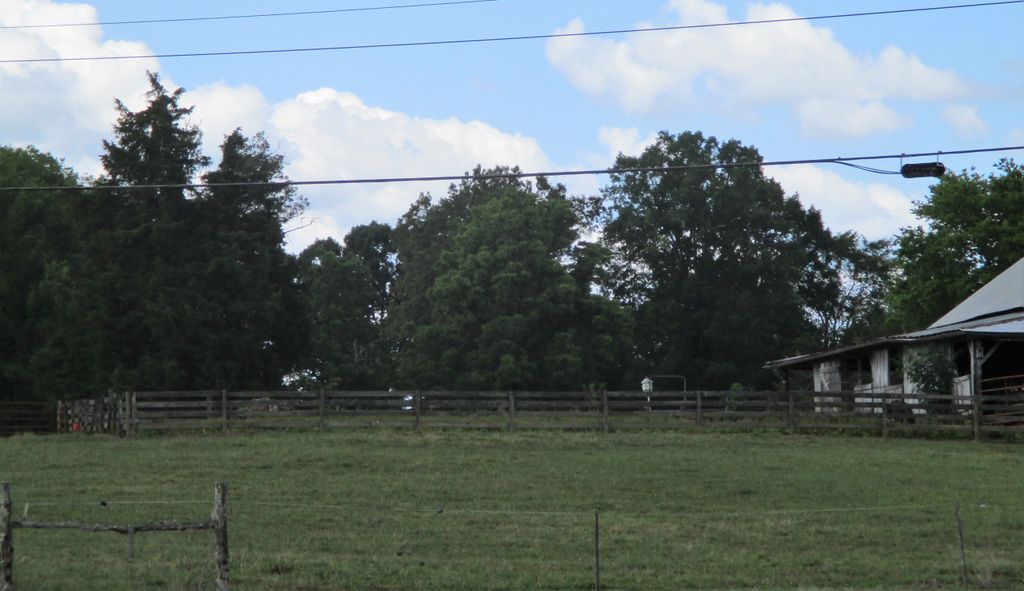
| Description | : | Located on private property. This cemetery is place here based upon information found in the book by Robert McGinnis, "Gone so Soon, the Cemeteries of Blount County, Tennessee," in Vol. 4, page 207. It lists it as being, "located off of Big Springs Road across from the intersection with Marble Hill Road. The cemetery is located behind the 18th Century stone Frazier/Parkins house. The burial site is partial enclosed with in a single rail fence, but there has been some evidence that additional graves may be located outside the enclosure. " |
frequently asked questions (FAQ):
-
Where is Parkins Family Cemetery?
Parkins Family Cemetery is located at Big Springs Rd. and Marble Hill Rd. Blount County ,Tennessee ,USA.
-
Parkins Family Cemetery cemetery's updated grave count on graveviews.com?
0 memorials
-
Where are the coordinates of the Parkins Family Cemetery?
Latitude: 35.7401800
Longitude: -84.1164000
Nearby Cemetories:
1. Big Spring Presbyterian Church Cemetery
Friendsville, Blount County, USA
Coordinate: 35.7271996, -84.1027985
2. Union Grove Methodist Cemetery
Friendsville, Blount County, USA
Coordinate: 35.7531000, -84.0931000
3. Friends Meeting House and Cemetery
Friendsville, Blount County, USA
Coordinate: 35.7612991, -84.1373978
4. Marble Hill Missionary Baptist Church Cemetery
Friendsville, Blount County, USA
Coordinate: 35.7187770, -84.1406850
5. Rescue Baptist Church Cemetery
Friendsville, Blount County, USA
Coordinate: 35.7724200, -84.0962700
6. Shady Grove Cemetery
Miser Station, Blount County, USA
Coordinate: 35.7738991, -84.0858002
7. Salem Baptist Church Cemetery
Blount County, USA
Coordinate: 35.6982994, -84.1014023
8. Unitia Cemetery
Unitia, Loudon County, USA
Coordinate: 35.7491989, -84.1750031
9. Unitia Campground Cemetery
Loudon County, USA
Coordinate: 35.7484741, -84.1787415
10. Clover Hill Cemetery
Blount County, USA
Coordinate: 35.7127991, -84.0607986
11. Leeper Cemetery
Loudon County, USA
Coordinate: 35.7607994, -84.1791992
12. Cloyds Creek Cemetery
Blount County, USA
Coordinate: 35.6981010, -84.1605988
13. Ish Cemetery
Blount County, USA
Coordinate: 35.7921982, -84.1446991
14. Zion Chapel Cemetery
Louisville, Blount County, USA
Coordinate: 35.7963982, -84.1046982
15. Hickory Valley Cemetery
Unitia, Loudon County, USA
Coordinate: 35.7409134, -84.1890564
16. Mount Zion Baptist Church Cemetery
Maryville, Blount County, USA
Coordinate: 35.7698000, -84.0509900
17. Davis Cemetery
Blount County, USA
Coordinate: 35.7943993, -84.0817032
18. Prater Cemetery
Loudon County, USA
Coordinate: 35.7647018, -84.1881027
19. Hopewell Cemetery
Maryville, Blount County, USA
Coordinate: 35.7083015, -84.0475006
20. Laurel Bank Baptist Church Cemetery
Friendsville, Blount County, USA
Coordinate: 35.7439003, -84.0357971
21. Hackney Chapel Cemetery
Unitia, Loudon County, USA
Coordinate: 35.7441406, -84.1980820
22. Dotson Memorial Cemetery
Maryville, Blount County, USA
Coordinate: 35.7283478, -84.0315247
23. Cox Cemetery
Blount County, USA
Coordinate: 35.8074989, -84.0860977
24. Bogle Farm Cemetery
Blount County, USA
Coordinate: 35.6708565, -84.0913239

