
| Memorials | : | 4 |
| Location | : | Cedarville, Gilmer County, USA |
| Coordinate | : | 38.8239470, -80.8418970 |
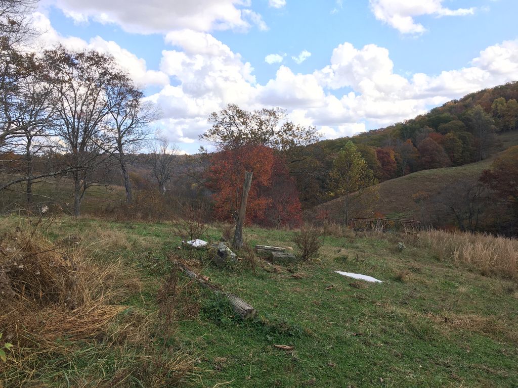
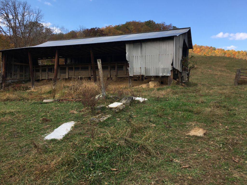
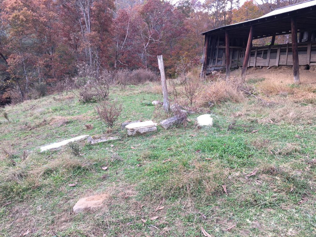
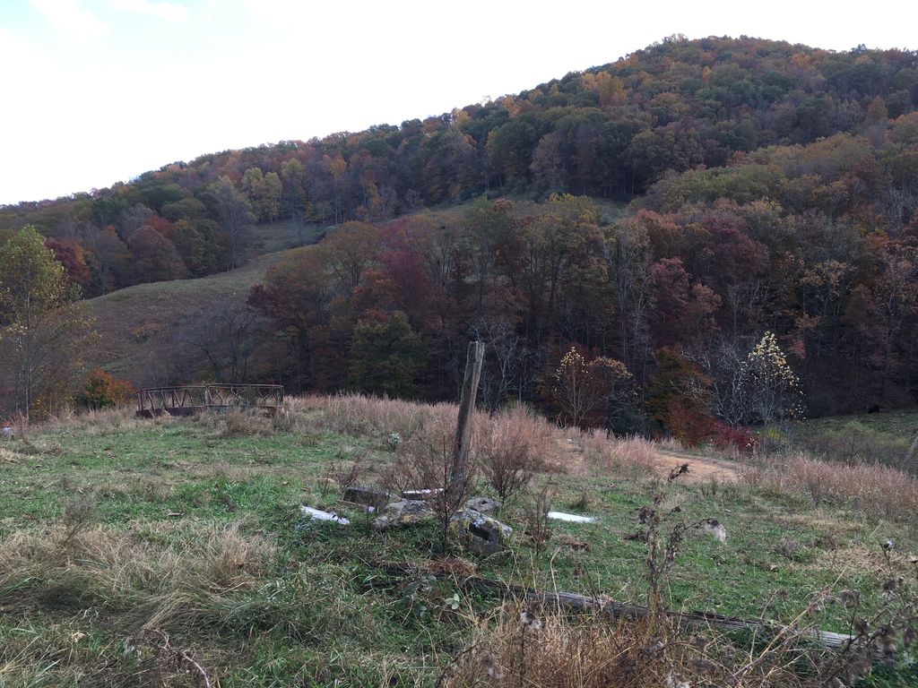
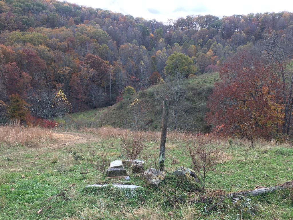
| Description | : | Cemetery is located up a hollow from Lower Level Run Rd on the Sponaugle Farm. It is right at the forks of this hollow in the very head, and the drain on your right (directly south of the cemetery and running from the west) is said to have been referred to the old folks as Graveyard Hollow. The cemetery is near an old barn, and has been partially destroyed, the stones having been removed and piled around a single lone fence post. One grave, the furthest down the hill, appears not to have been disturbed as the headstone base and... Read More |
frequently asked questions (FAQ):
-
Where is Parsons Cemetery?
Parsons Cemetery is located at Lower Level Run Rd Cedarville, Gilmer County ,West Virginia ,USA.
-
Parsons Cemetery cemetery's updated grave count on graveviews.com?
4 memorials
-
Where are the coordinates of the Parsons Cemetery?
Latitude: 38.8239470
Longitude: -80.8418970
Nearby Cemetories:
1. Norman Cemetery
Normantown, Gilmer County, USA
Coordinate: 38.8236111, -80.8516666
2. Clowser Cemetery
Cedarville, Gilmer County, USA
Coordinate: 38.8231110, -80.8284740
3. Whitesel Cemetery
Cedarville, Gilmer County, USA
Coordinate: 38.8048000, -80.8327000
4. Cedarville Cemetery
Cedarville, Gilmer County, USA
Coordinate: 38.8452830, -80.8240100
5. Burk Cemetery
Gilmer County, USA
Coordinate: 38.8426000, -80.8084000
6. Karickhoff Cemetery
Braxton, Braxton County, USA
Coordinate: 38.7922480, -80.8501500
7. Currycomb Cemetery
Braxton County, USA
Coordinate: 38.7919006, -80.8503036
8. Burk Church Cemetery
Cedarville, Gilmer County, USA
Coordinate: 38.8322220, -80.7986110
9. Sumpter Cemetery
Normantown, Gilmer County, USA
Coordinate: 38.8472222, -80.8805556
10. Rutherford Cemetery
Gilmer County, USA
Coordinate: 38.8272018, -80.7930984
11. Mount Carmel Cemetery
Normantown, Gilmer County, USA
Coordinate: 38.8174280, -80.8913720
12. Mount Camel Baptist Church Cemetery
Gassaway, Braxton County, USA
Coordinate: 38.8174450, -80.8914080
13. Jack Family Cemetery
Exchange, Braxton County, USA
Coordinate: 38.8208008, -80.7910995
14. Mowery-Deulley Cemetery
Gilmer County, USA
Coordinate: 38.7982070, -80.8814230
15. Belknap Family-Bender Run Church Cemetery
Braxton County, USA
Coordinate: 38.7831630, -80.8286890
16. Beall Cemetery
Normantown, Gilmer County, USA
Coordinate: 38.8461306, -80.8910306
17. Albert VanHorn Cemetery
Orton, Gilmer County, USA
Coordinate: 38.8178020, -80.8983150
18. Moss Cemetery
Gilmer County, USA
Coordinate: 38.8678017, -80.8311005
19. Frederick Gerwig Memorial Cemetery
Braxton County, USA
Coordinate: 38.7954610, -80.7971710
20. Gerwig Family Cemetery
Braxton County, USA
Coordinate: 38.7954760, -80.7971520
21. George and Juliana Gerwig Cemetery
Braxton County, USA
Coordinate: 38.7813390, -80.8206810
22. Frame Family Cemetery
Gilmer County, USA
Coordinate: 38.7864810, -80.8782790
23. Moore Cemetery
Normantown, Gilmer County, USA
Coordinate: 38.7986160, -80.8970590
24. Marks Cemetery
Cedarville, Gilmer County, USA
Coordinate: 38.8654400, -80.8835200