
| Memorials | : | 9 |
| Location | : | Scotland |
| Coordinate | : | 55.8270580, -3.2193700 |
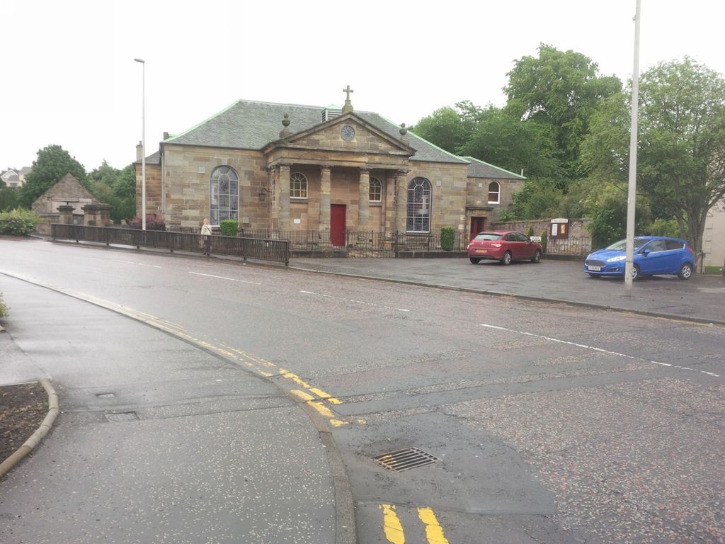
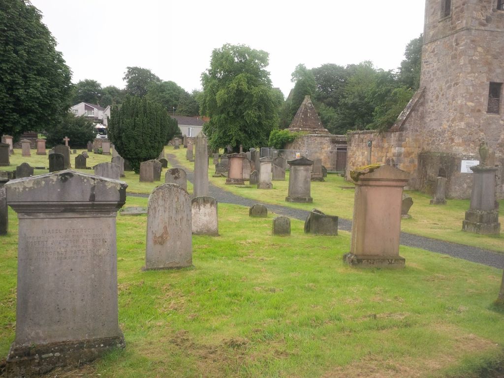
| Description | : | This is at the junction of the High Street and Kirkhill Road. Penicuik is a burgh in Midlothian, Scotland, lying on the west bank of the River North Esk. The town was developed as a planned village in 1770 by Sir James Clerk of Penicuik. The ruined old parish church, in the centre of the graveyard, dates from the late 17th century. |
frequently asked questions (FAQ):
-
Where is Penicuik Old Churchyard?
Penicuik Old Churchyard is located at Kirkhill Road. Midlothian ,Scotland.
-
Penicuik Old Churchyard cemetery's updated grave count on graveviews.com?
9 memorials
-
Where are the coordinates of the Penicuik Old Churchyard?
Latitude: 55.8270580
Longitude: -3.2193700
Nearby Cemetories:
1. Cranstoun Parish Churchyard
Scotland
Coordinate: 55.8792400, -2.9860300
2. Ecclesmachan Cemetery
Scotland
Coordinate: 55.9461400, -3.5096500
3. Muiravonside Church of Scotland
Scotland
Coordinate: 55.9743440, -3.6742900
4. Athelstaneford Parish Church Cemetery
Scotland
Coordinate: 55.9867390, -2.7499130
5. Chapel Knowe and Cockburn's Tombe
Scotland
Coordinate: 55.4942625, -3.2214799
6. St. Serf's Priory
Scotland
Coordinate: 56.1876160, -3.3529760
7. Longformacus Parish Church
Scotland
Coordinate: 55.8080300, -2.4898700
8. Largo Cemetery
Scotland
Coordinate: 56.2230510, -2.9332210
9. New Monkland Cemetery
Scotland
Coordinate: 55.8879340, -3.9972610
10. Cults Cemetery
Scotland
Coordinate: 56.2767906, -3.0565600
11. Tullibody Old Kirkyard
Scotland
Coordinate: 56.1371705, -3.8353321
12. Tullibody Cemetery
Scotland
Coordinate: 56.1375500, -3.8356500
13. Abercrombie Old Chapelyard
Scotland
Coordinate: 56.2210500, -2.7725053
14. Abdie Churchyard
Scotland
Coordinate: 56.3338200, -3.1993100
15. St Cuthbert Churchyard
Carham, Northumberland Unitary Authority, England
Coordinate: 55.6389230, -2.3238090
16. Riddrie Cemetery
Scotland
Coordinate: 55.8750700, -4.1823400
17. Creich Cemetery
Scotland
Coordinate: 56.3798110, -3.0912140
18. St Helen's Churchyard
Cornhill-on-Tweed, Northumberland Unitary Authority, England
Coordinate: 55.6464840, -2.2264990
19. Cathcart Cemetery
Scotland
Coordinate: 55.8098500, -4.2673800
20. Mindrum Churchyard
Mindrum, Northumberland Unitary Authority, England
Coordinate: 55.5937100, -2.2481000
21. Flodden Field Cemetery
Branxton, Northumberland Unitary Authority, England
Coordinate: 55.6287730, -2.1765120
22. St Paul's Churchyard
Branxton, Northumberland Unitary Authority, England
Coordinate: 55.6308820, -2.1726490
23. Chapel of Hermitage
Scotland
Coordinate: 55.2531046, -2.7803227
24. Redgorton Parish Churchyard
Scotland
Coordinate: 56.4385500, -3.4876000